…on such a winter’s day. Today’s high is in the 30’s, so this classic song seems especially appropriate as I pen this post.
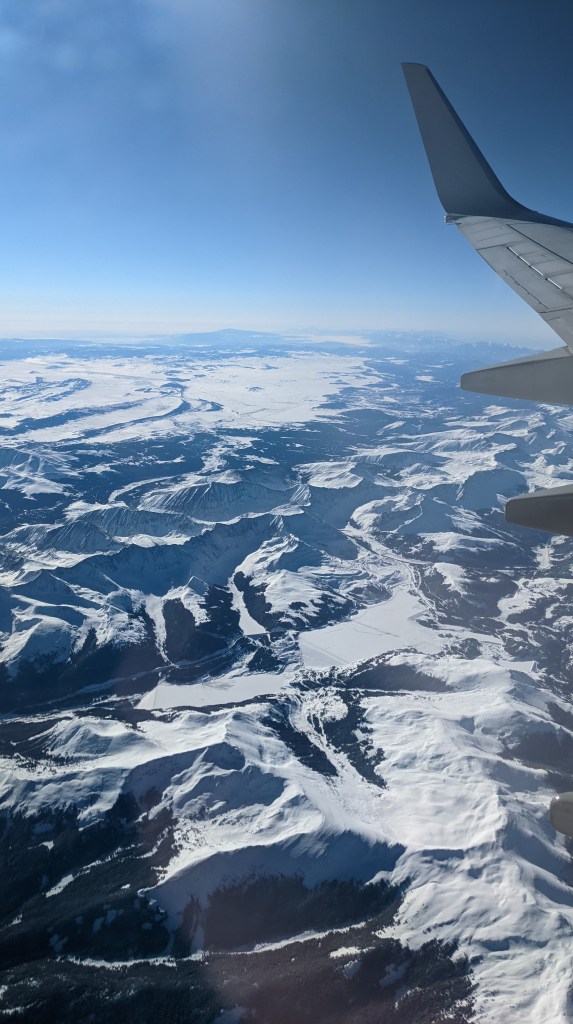
To begin this epic trip to Death Valley, Joshua Tree, and the Channel Islands, I flew into LA early Saturday morning. The flight cruised at pretty low altitude, so I got to see some gorgeous landscapes when I wasn’t asleep.
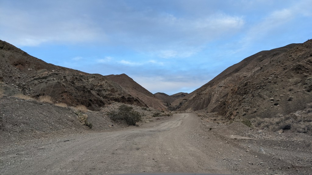
I picked up my rental car, bought groceries, grabbed a shrimp taco from Del Taco, and headed out for Death Valley that afternoon. It was pretty crazy going from the second largest city in the country to a very isolated desert landscape that tested my 4-wheel drive within just a few hours.
I planned to explore the less developed part of the park in the Panamint range (circled in blue below), then make my way over to the valley and hit several main attractions (circled in purple).
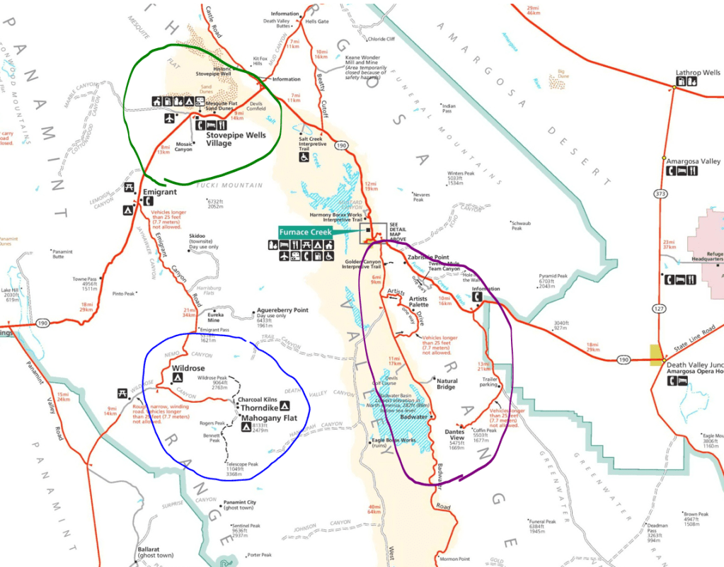
My original plans were to camp at Mahogany Flats Saturday night and hike to Telescope Peak, the highest point in the park, on Sunday, but that idea was dashed when I discovered that the last 1.5 miles of the road to Mahogany Flats was closed. I instead camped at Wildrose Saturday night.
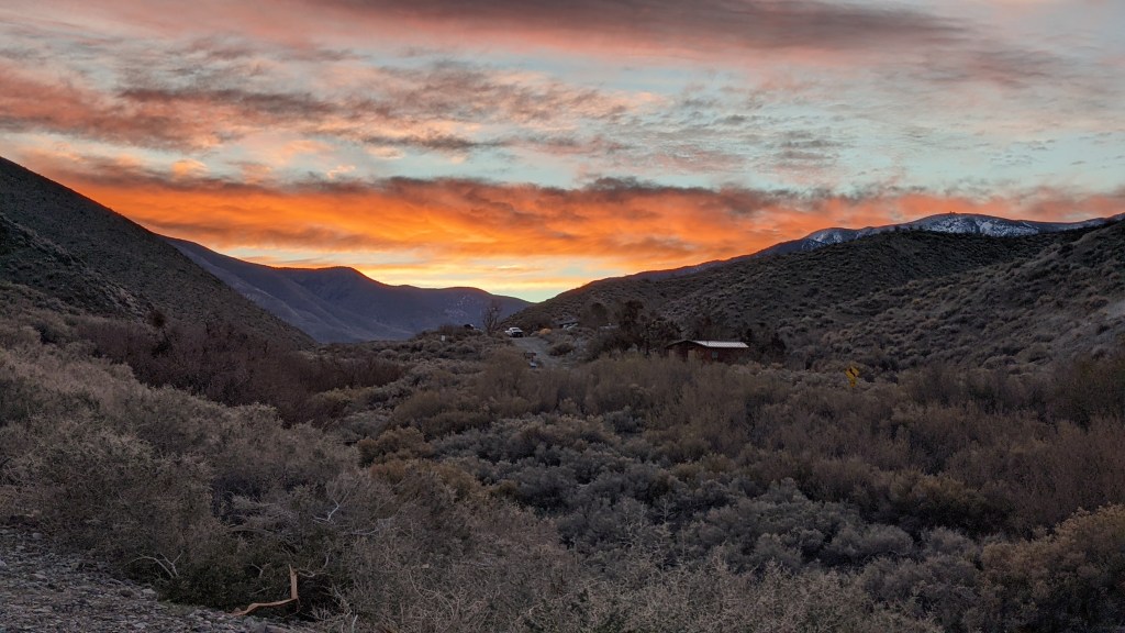
And BRRR, was it chilly! The campground pretty exposed, and since it’s at a higher elevation, it got down in the 30s that night. I’d say it was all worth it, though, for that sunrise view the next morning. Pretty sure I took this from my tent.
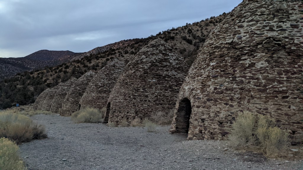
Since the 14 miles to Telescope Peak in the snow sounded daunting before adding the 1.5 miles of closed road each way, I ultimately settled for the less intimidating 8.4 mile RT hike to Wildrose Peak. The trailhead is by the Charcoal Kilns, where miners used to burn piñon pines to turn into charcoal.
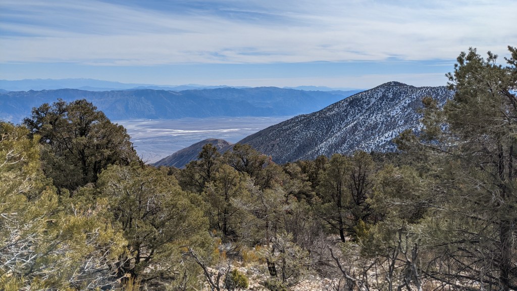
One of the best parts, however, was the lack of people. I counted fewer than ten people the entire hike, which would prove a stark contrast to the rest of my Death Valley experience.
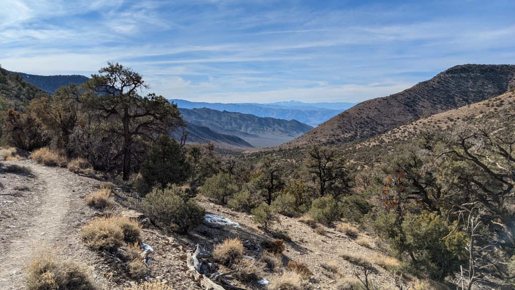
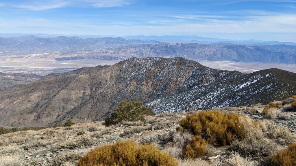
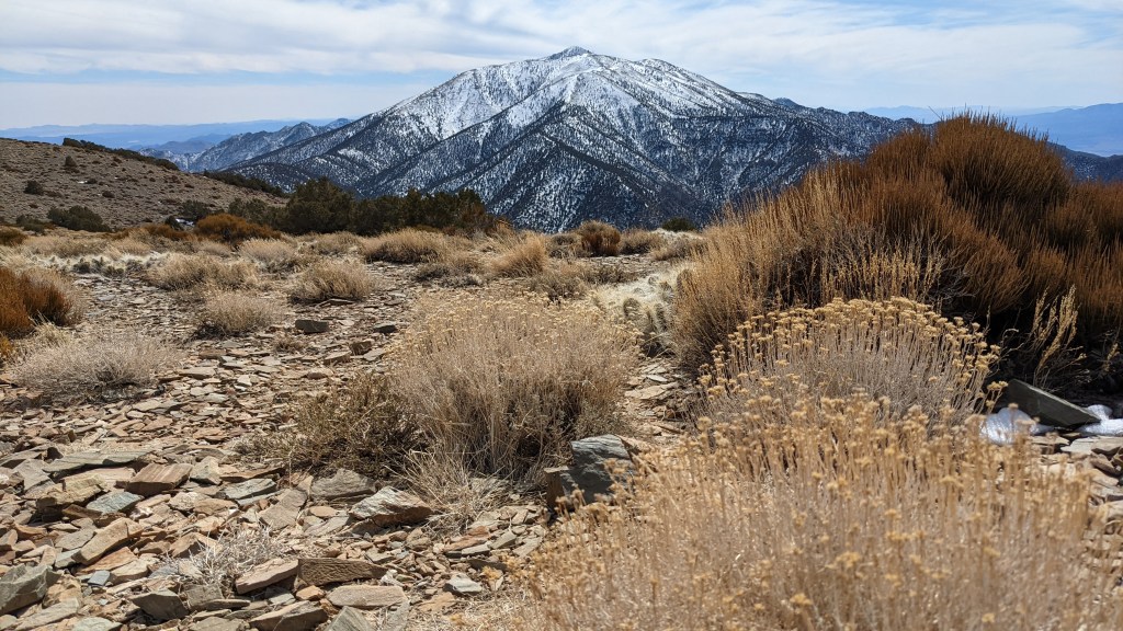
I did end up meeting an awesome couple near the summit and spent some time with them up there just soaking in the views. You can see Telescope Peak in the bottom photograph.
After lunch, my new friends settled in for a brief nap in the warm sun, but I decided I’d better get going again, so we bid farewell.
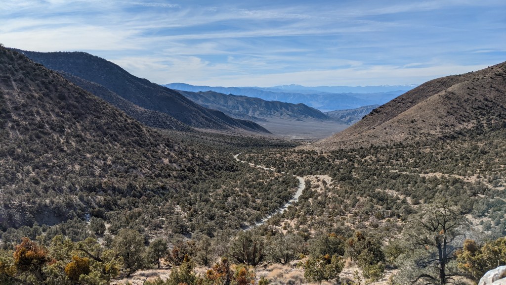
I made it back to the trailhead in a little less than 2.5 hours and started towards the main part of the park. That drive was just gorgeous.
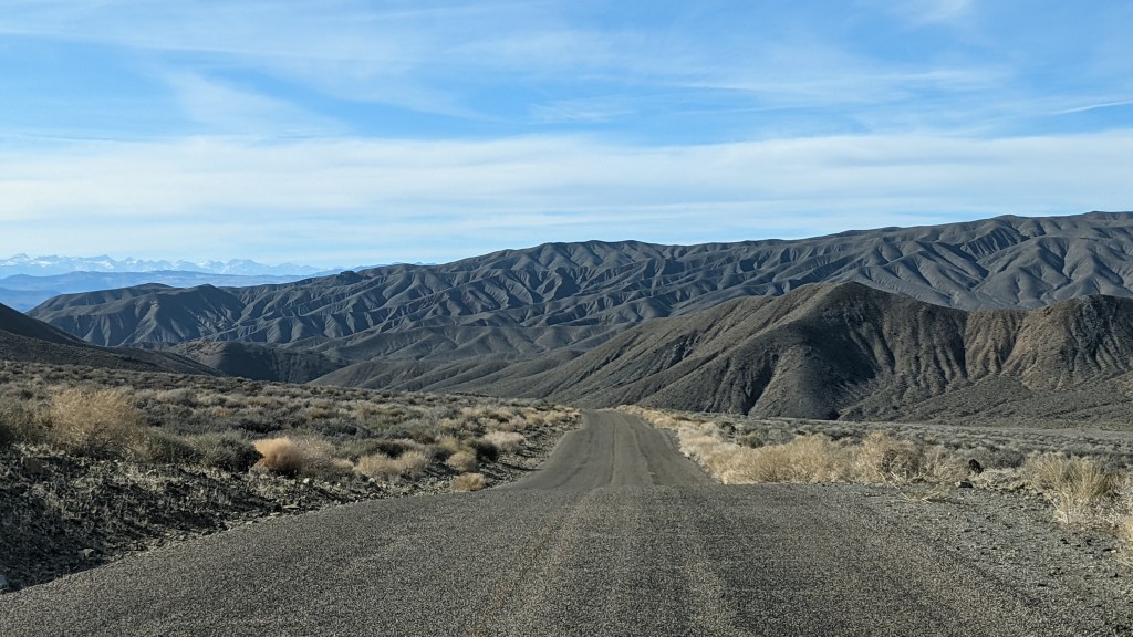
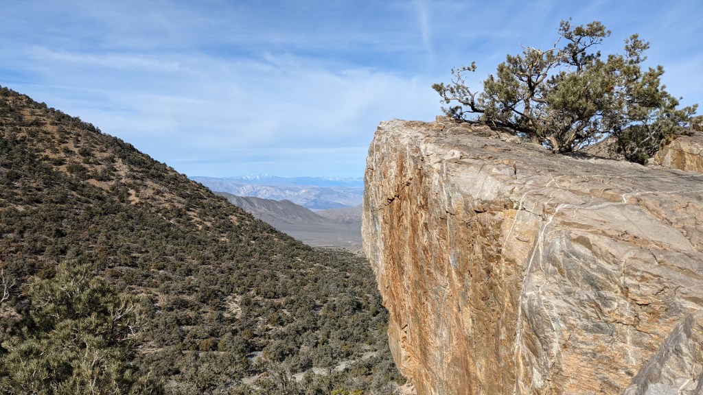
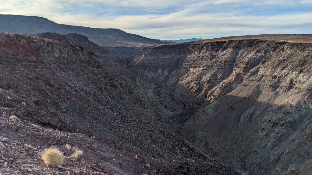
I had plans to stay at Stovepipe Wells Campground (green on the map), but I wanted to do some things on the west end of the park first, so I headed that way once I hit 190. First stop was the Father Crowley Vista Point, which overlooks Star Wars Canyon. The name is somewhat ironic because, while some features of Death Valley made it into Star Wars Episode IV, this was not one of them.
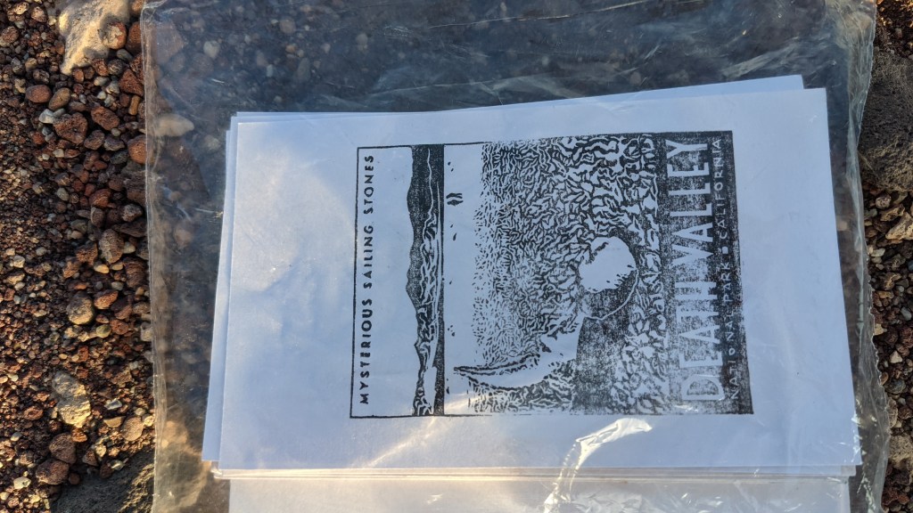
The view was beautiful, but to top it off, there was a letterbox nearby! It has to be one of my favorite stamps I’ve found yet.
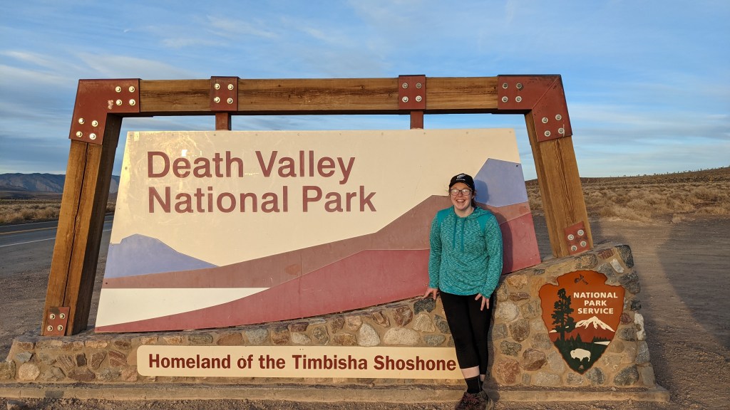
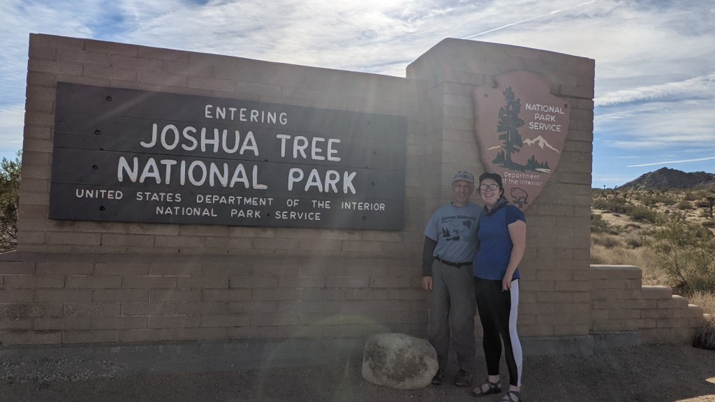
Since I was so close to the west entrance, I drove there and got a picture with the sign.
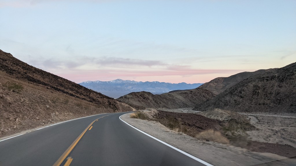
I caught sunset on the way back to Stovepipe Wells. What a gorgeous park.
I snagged a campsite and set up for the night. Stovepipe is definitely one of the strangest “campgrounds” I’ve seen – it was essentially a large gravel parking lot with room for tents around the edges.
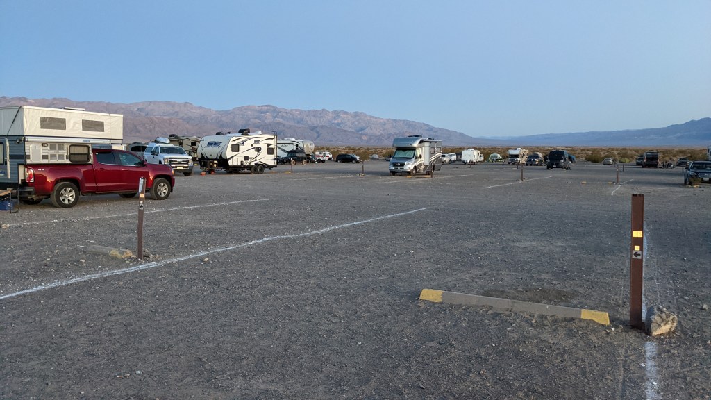
I can’t really complain though – it had flush toilets and it was cheap! Only $7 a night, since it was off-season.
I packed up early the next morning and hit the road. I filled up first thing and nearly gagged at the price of gas – $5.30. If I only knew…
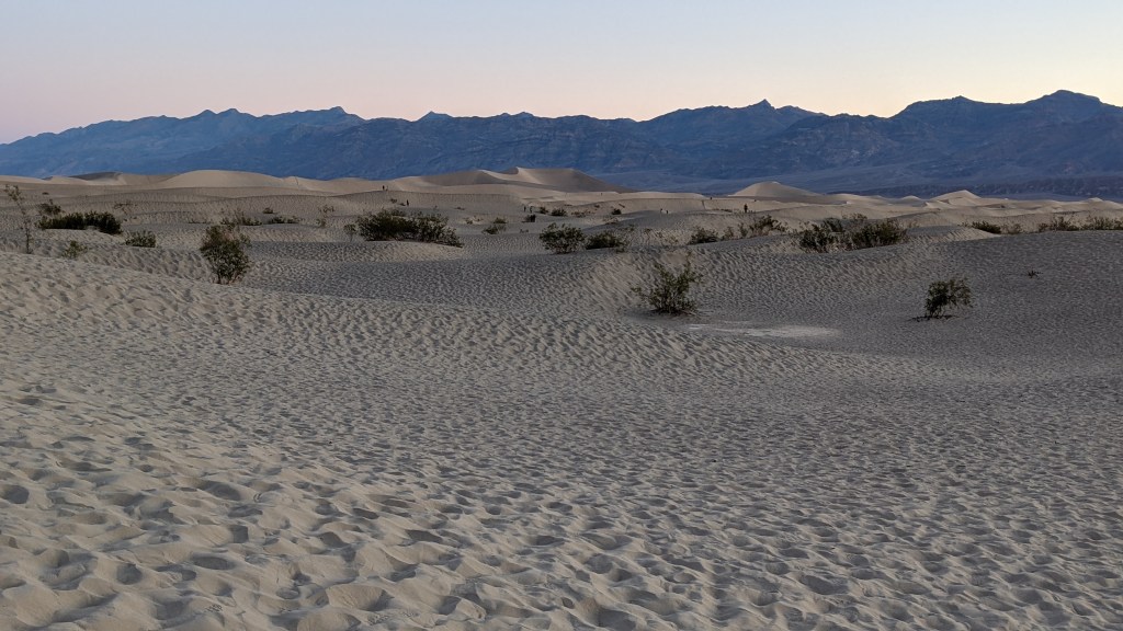
My first stop was the Mesquite Flat Sand Dunes. It was neat, but I decided not to stay very long. I had several things I wanted to see, and after experiencing the Great Sand Dunes in Colorado, these dunes seemed rather small.
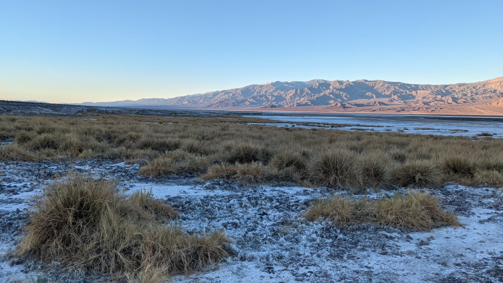
I made a few quick park-on-the-side-of-the-road-to-run-and-catch-a-great-shot stops along the drive. Sunrise was just too pretty to resist.
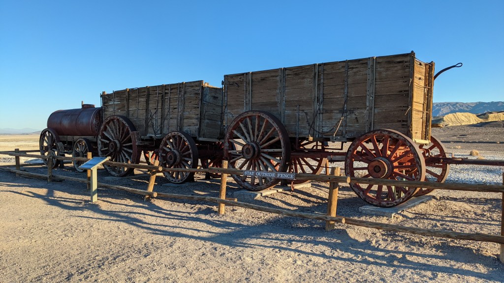
Next up was the Harmony Borax Works site. Apparently Death Valley was once primarily used as a mining site. It wasn’t very productive, however, and its owner soon determined it was more profitable as an attraction and started building infrastructure to support tourism. One of the materials most mined was borax, and it was famously hauled out of the valley with 20-mule teams, which went on to become the namesake and symbol of a borax brand.
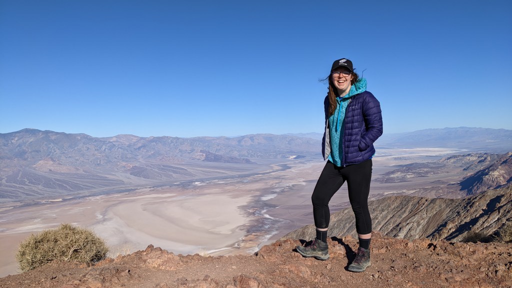
…And my fourth was Dante’s View, which requires a 30 minute drive off the main drag. I thought it was well worth it for the views of the valley floor.
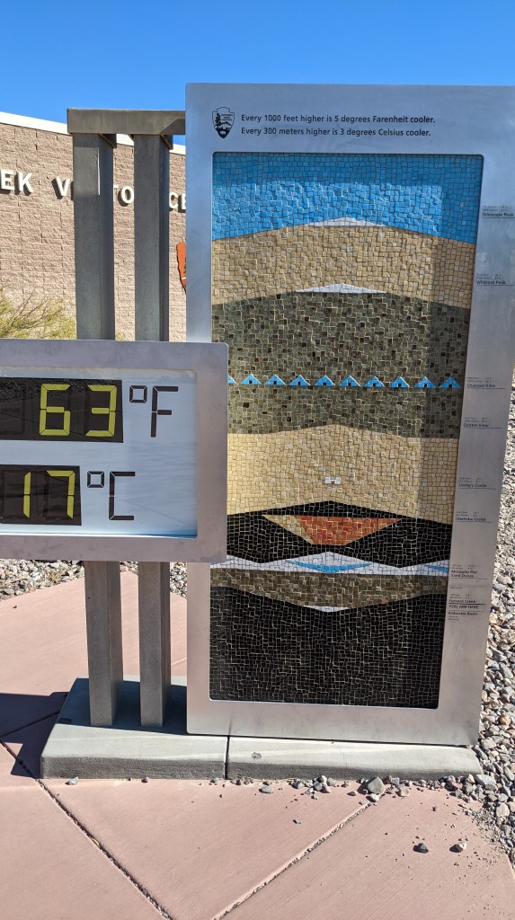
I drove back and stopped at the visitor’s center, which had some pretty neat exhibits and interesting information. Death Valley is many things: the hottest place in the world (134 degrees back in 1913), the lowest point in the country (200 feet below sea level at Badwater Basin), and one of the driest places in the world (an average 2 inches of rain per year). I enjoyed the outdoor thermostat, which showed the temperature change between different elevations.
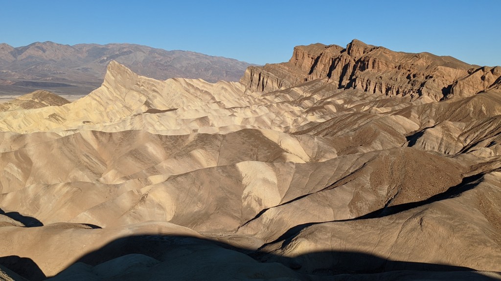
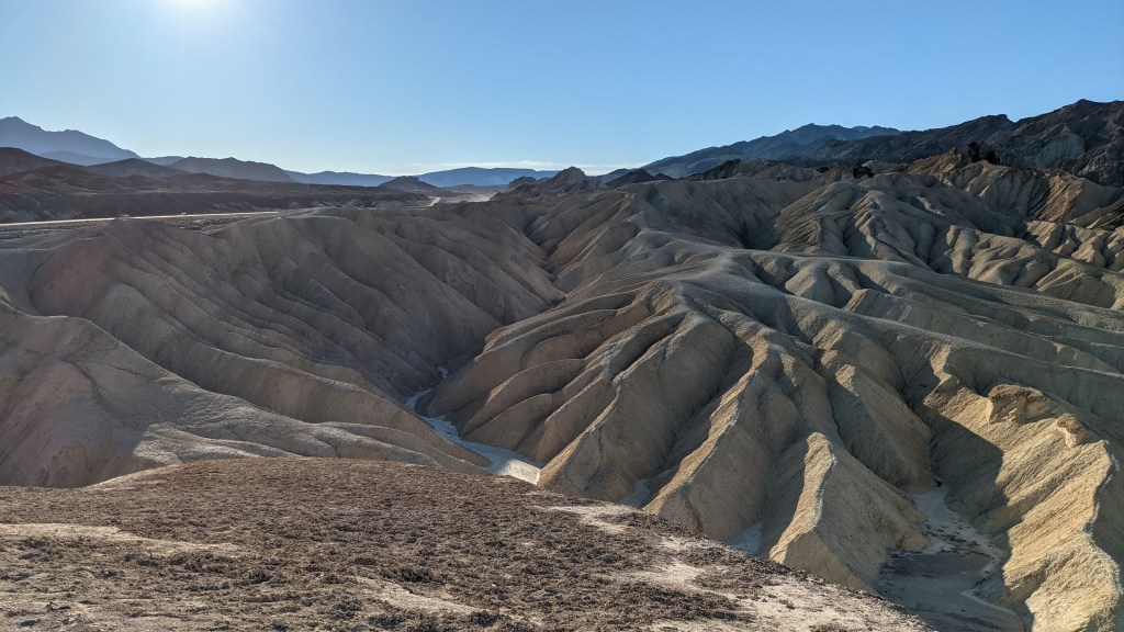
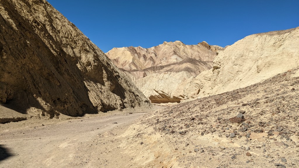
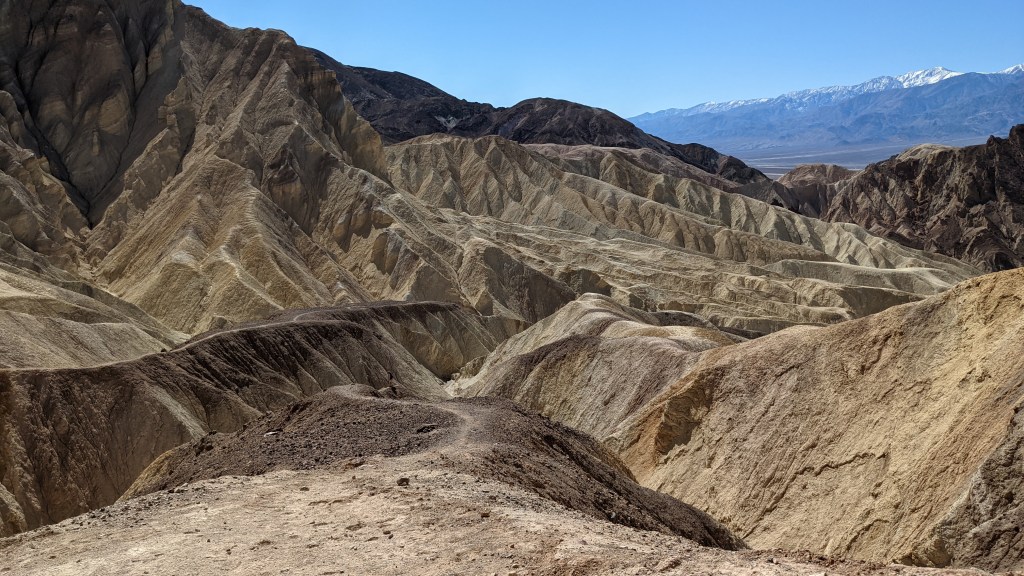
Next up was the drive down Badwater Road, which winds through multiple interesting park features. My first stop was the Golden Canyon trail, which is on the other side of Zabriskie Point. This trail was short and a pretty neat hike, especially the further you went in! I hiked back to the Red Rocks Cathedral and was not disappointed.
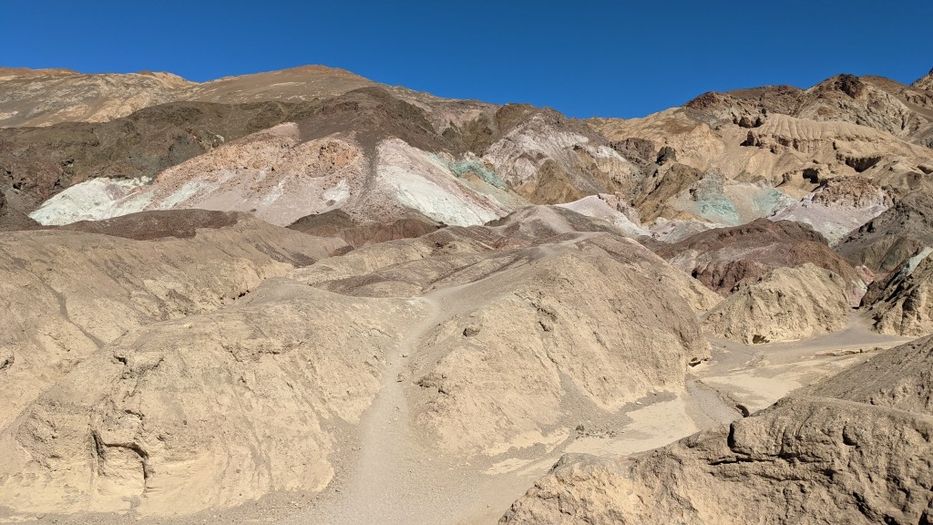
Next I did the drive down Artist’s Road and stopped at Artist’s Palette, known for its many-colored hills, due to the chemistry of the soil.
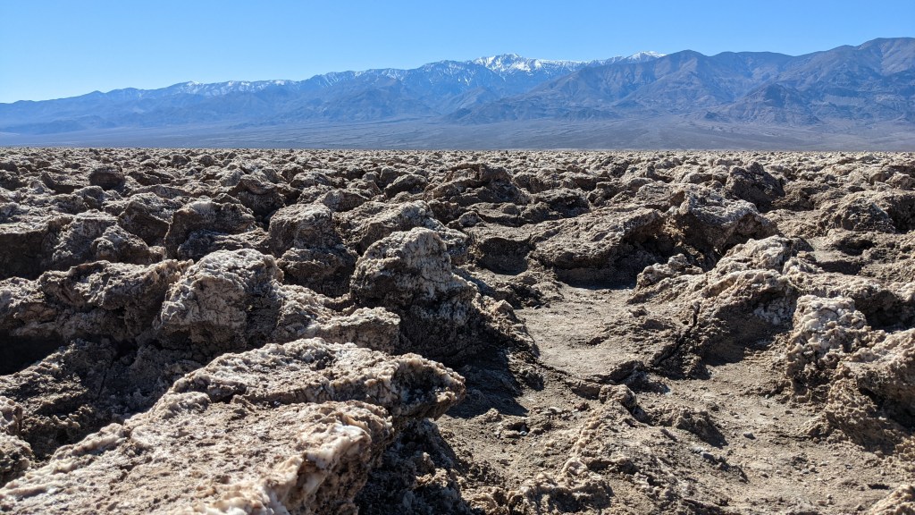
The next feature I visited was Devil’s Golf Course, which made me chuckle. It’s essentially a bunch of salt formations, which look cool but are understandably pretty difficult (and painful) to walk on, so I didn’t spend much time there.
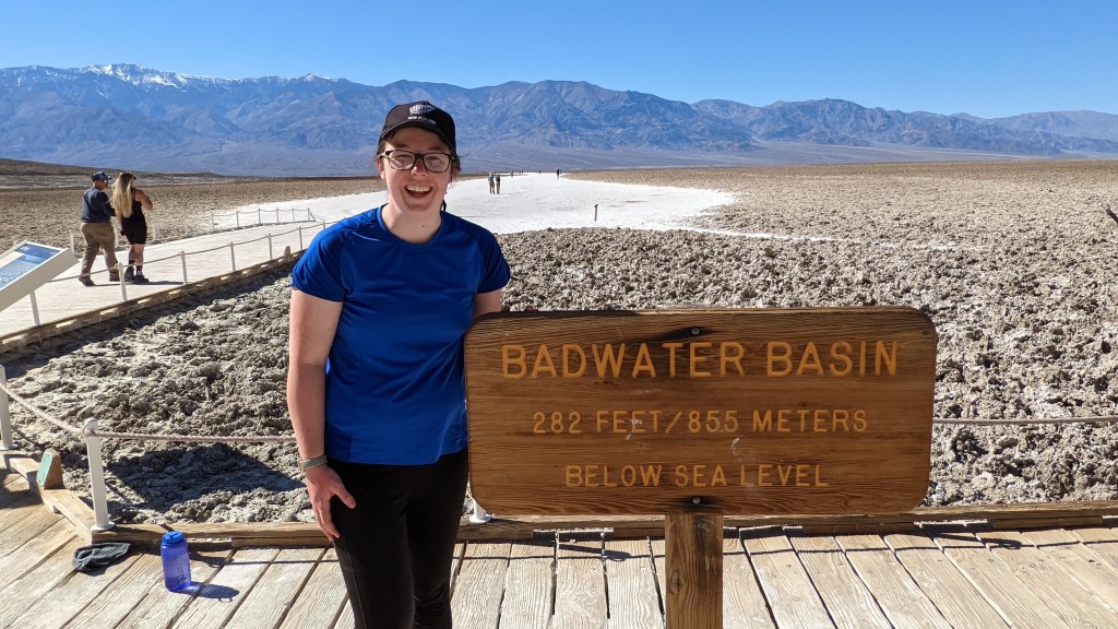
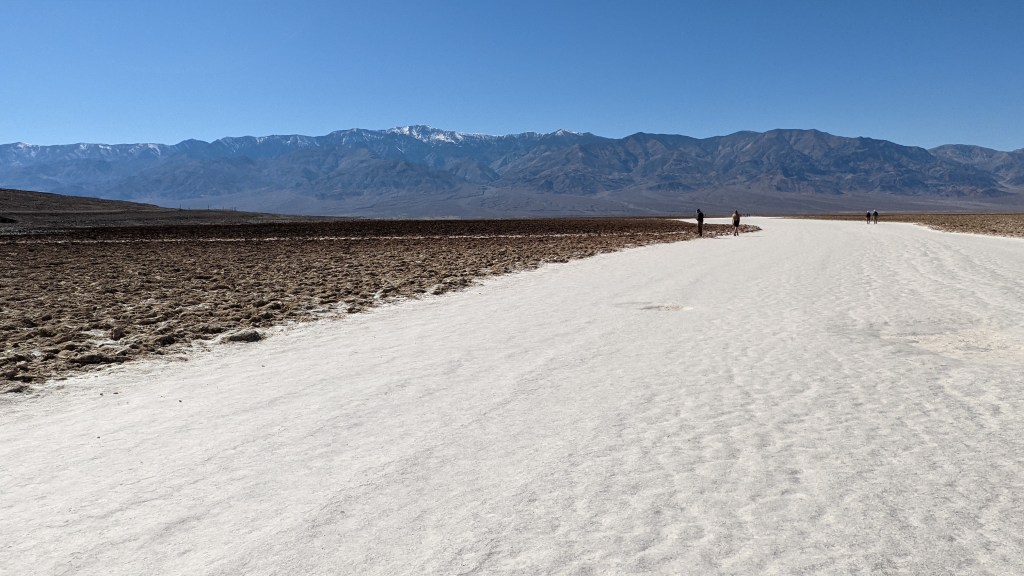
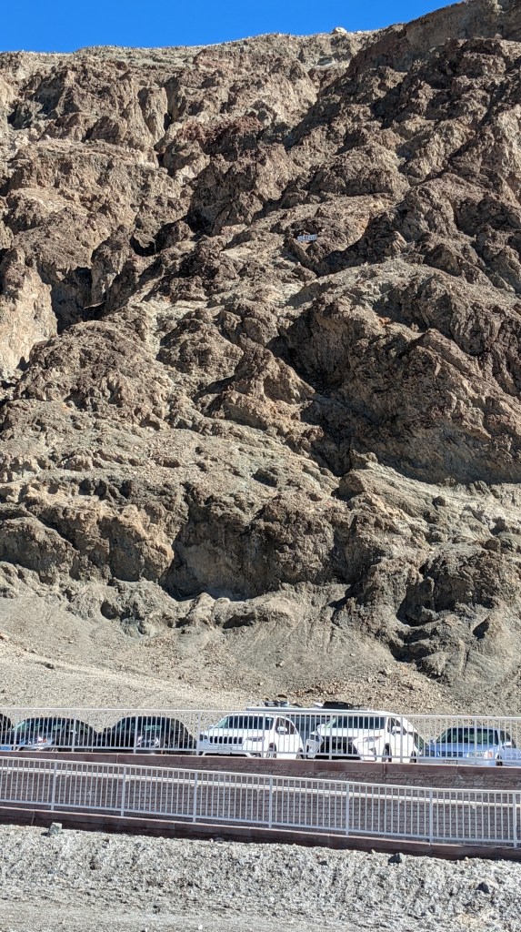
My final major stop in the park was Badwater Basin, the lowest place in the country. It was pretty neat, despite being packed full of tourists. I got a kick out of the sign pointing out sea level – can you spot it?
My time in DV had run out, so it was time to hit the road again. I drove back towards LA and snagged one of my favorite travel partners from the Ontario airport for the second leg of the trip, Joshua Tree.
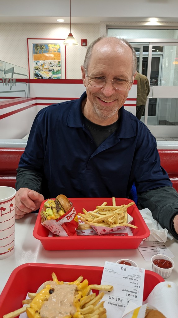
Of course, our first stop was In’n’Out. SO good.
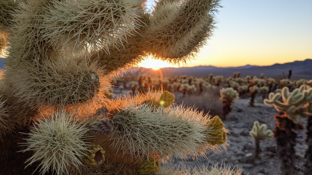
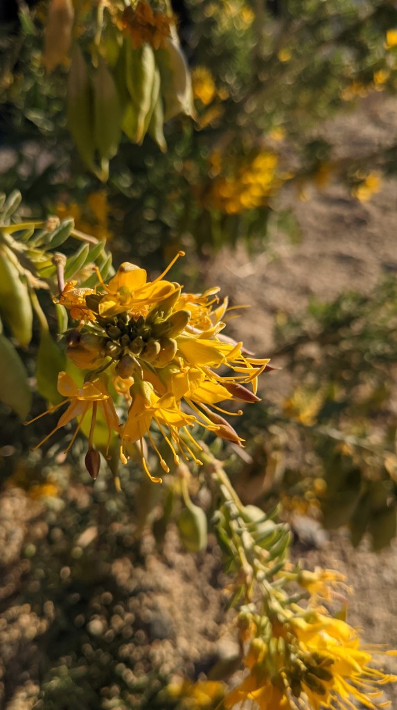
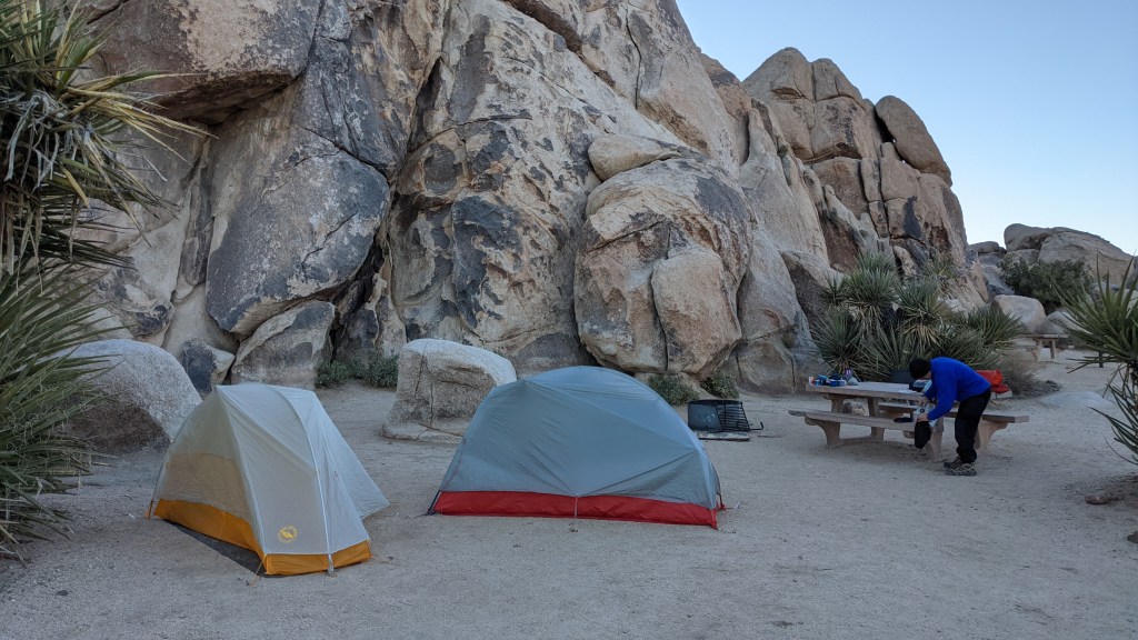
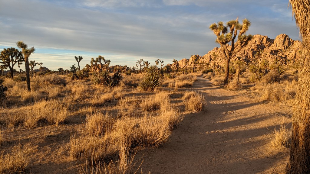
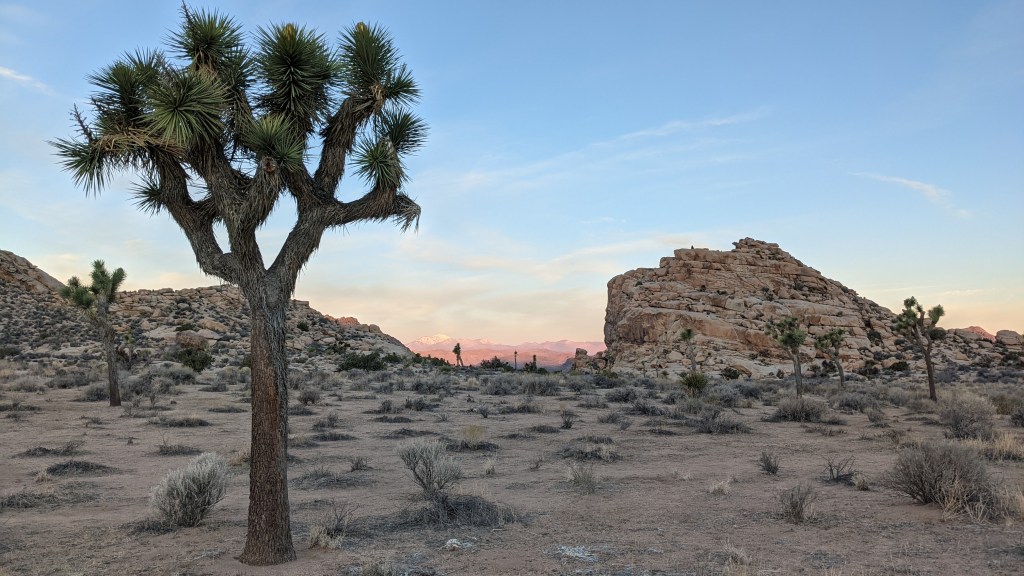
Dad and I drove the rest of the way out to Joshua Tree that night, set up camp at our site in Ryan Campground and promptly crashed. We were up a few hours later to catch sunrise at the Chollah Cactus Garden. Man, it was as beautiful as everyone said it would be.
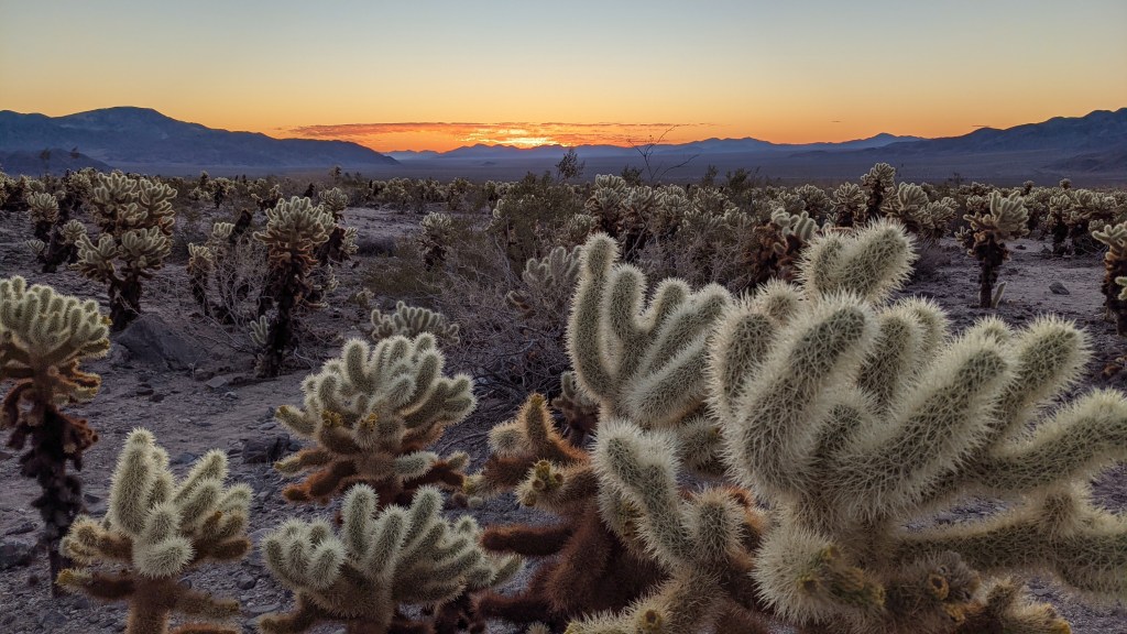
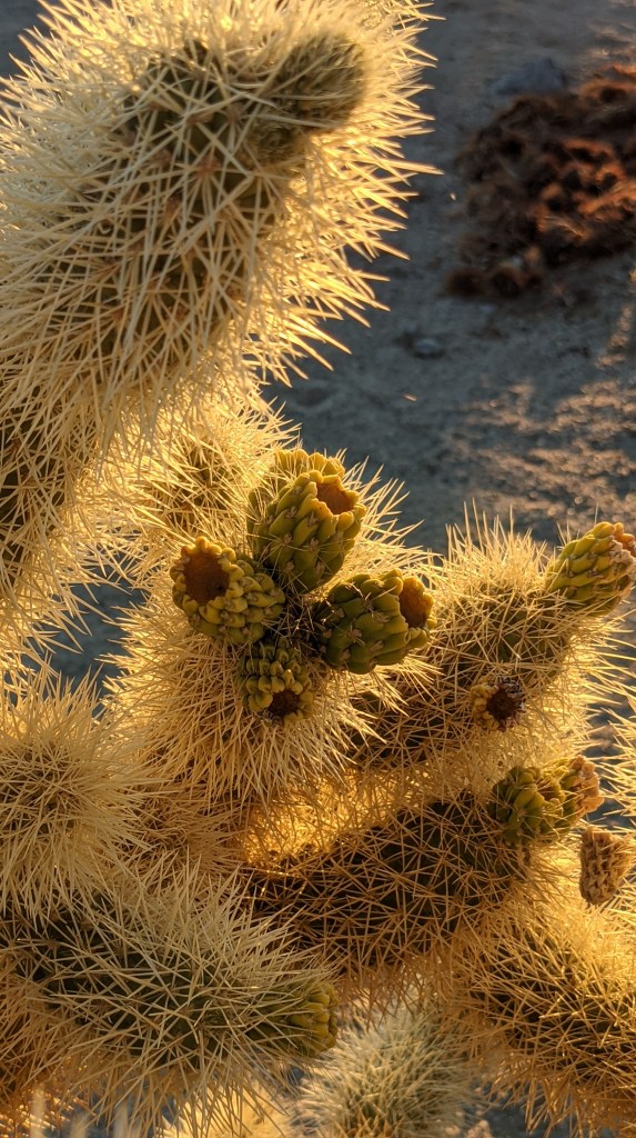
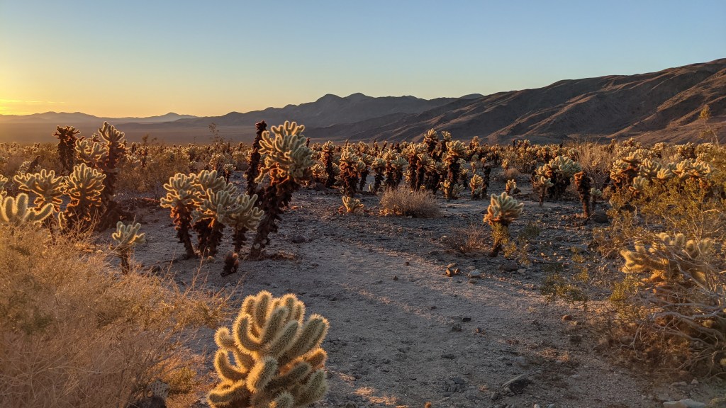
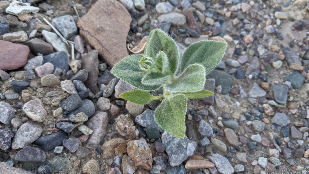
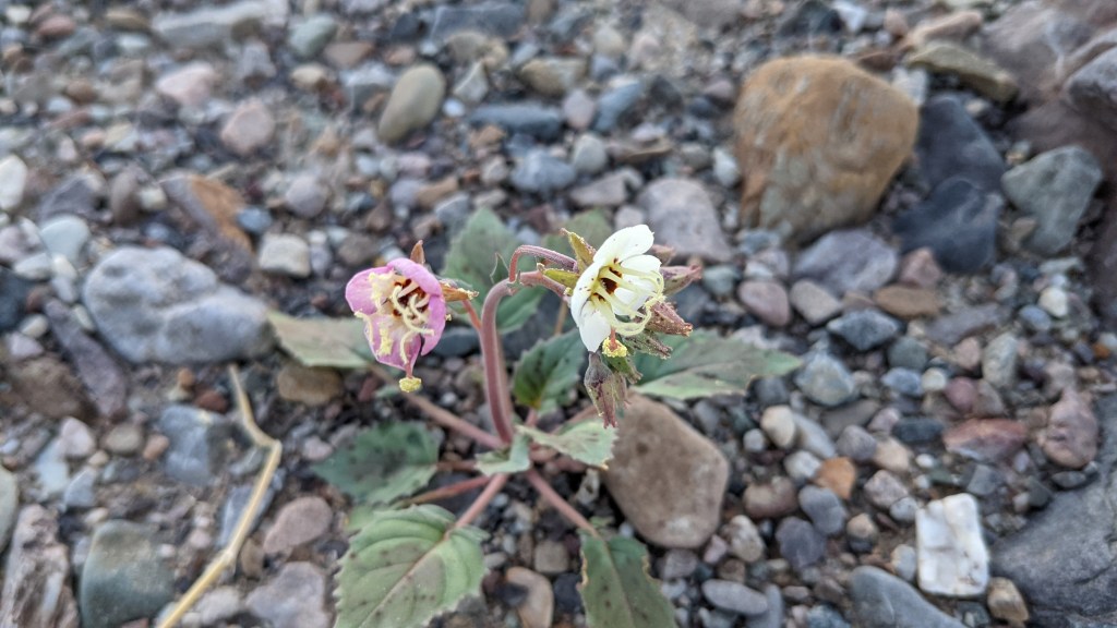
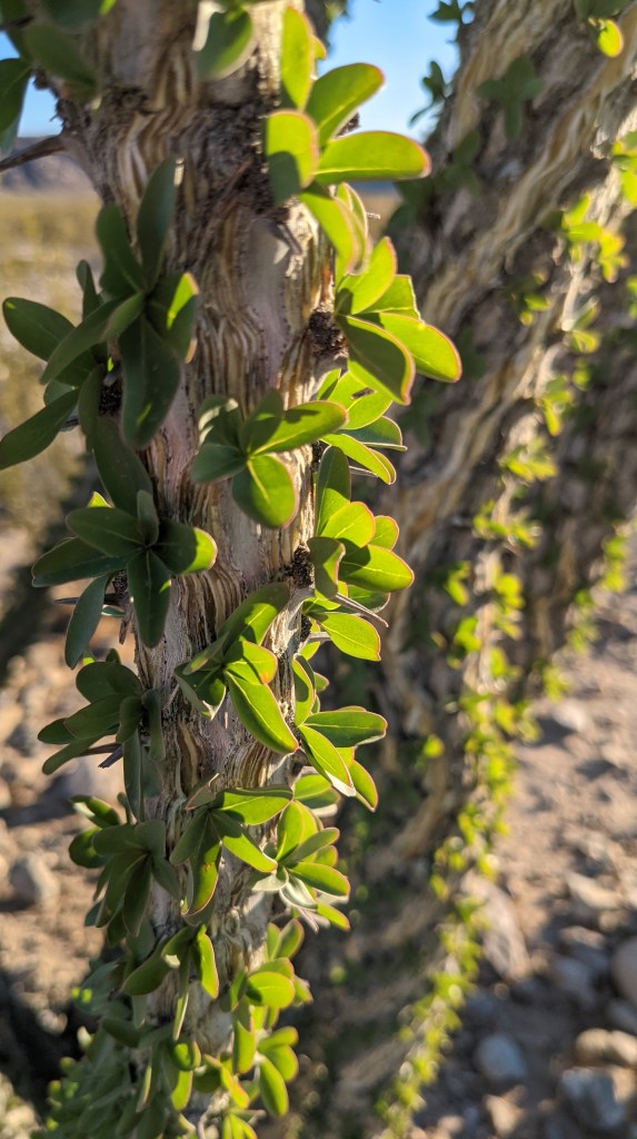
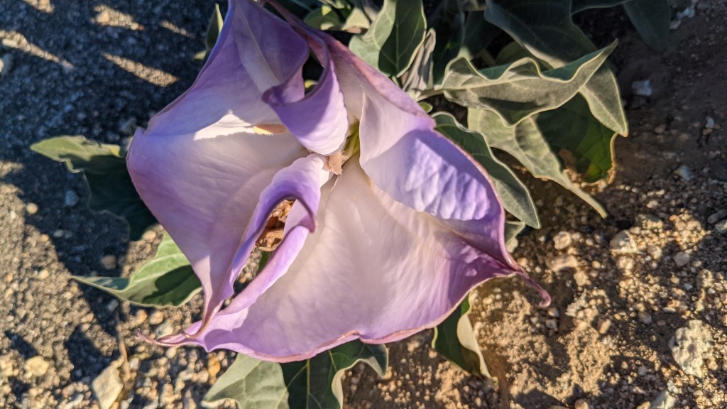
After I had finished running around like a madman taking photos, we slowly made our way back to the campground, taking photos of other cool plants we found on the way. Again, the desert is amazing.
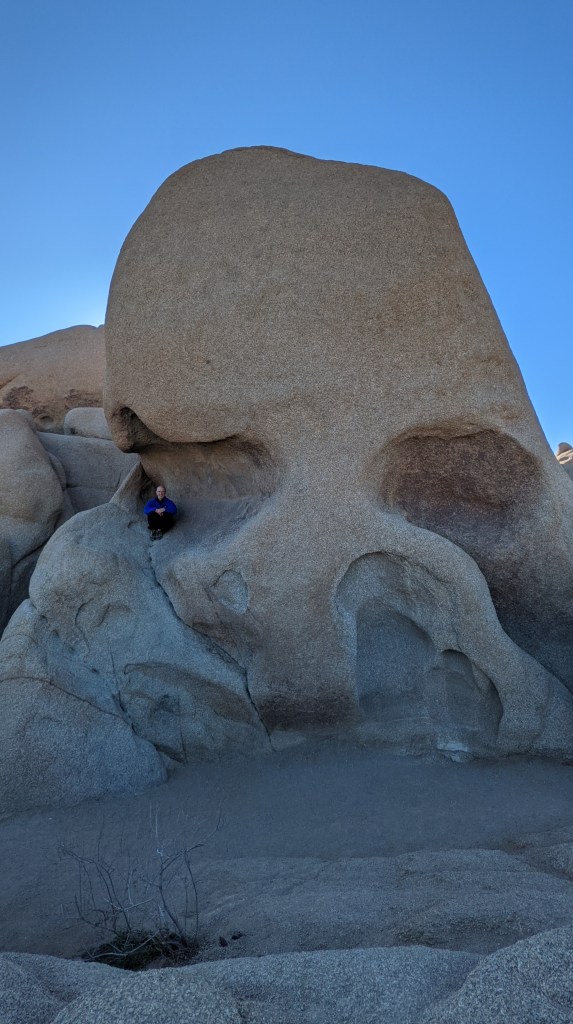
We also played on rocks a bit near Skull Rock. Much to my amusement, Dad decided to masquerade as an eyeball.
Back at the campsite, we mused over a neighbor’s interesting vehicle over a late breakfast. I saw the website listed on the side (https://exploring509.de/) and guessed they were from Germany.
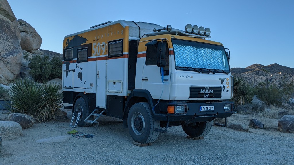
Just a few minutes later, we saw one of them out and about, so I went over to strike up a conversation. Of course, I was right in the middle of brushing my teeth, so first impressions probably weren’t stellar, but oh well…
Turns out, they were from Germany! Michaela and Peter are a married couple who have been traveling the world for the last four years. We had just a quick introduction that morning, as Dad and I were eager to go hike some trails, but we parted with the hope of seeing them later that night.
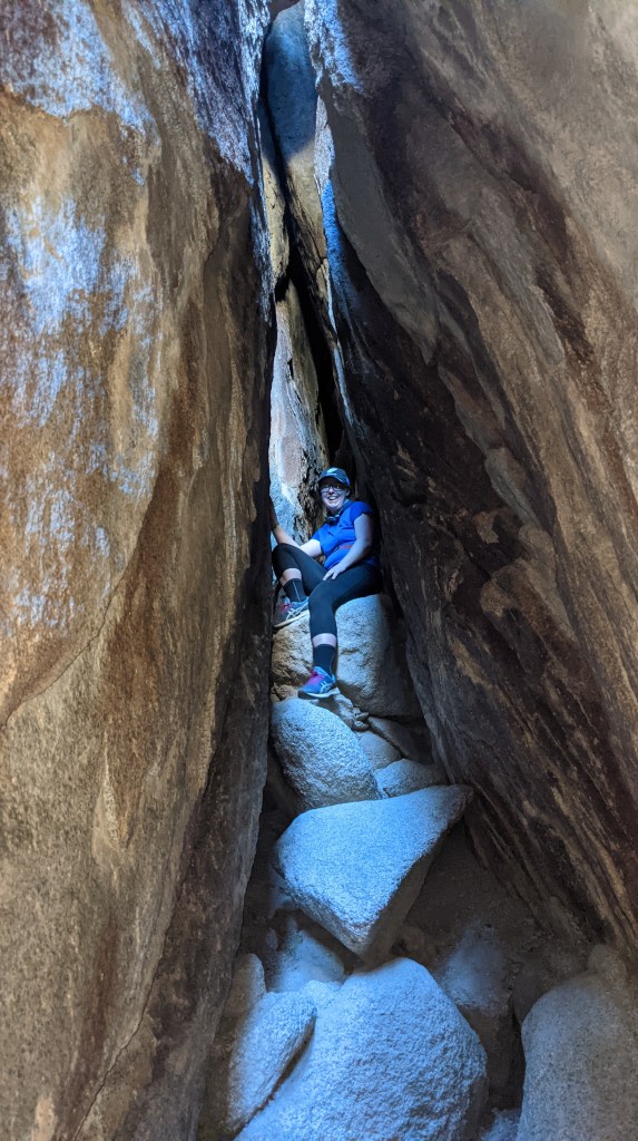
First we hit Chasm of Doom, which is best described as an exhilarating, claustrophobia-inducing passageway through a massive group of boulders. Dad had sojourned through this once before with a group of Scouts, and based on his stories, I was eager to try it. Not going to lie, it ended up being kind of outside of my comfort zone, so I was really glad Dad was with me.
There are multiple ways to start and end it, but the defining element is known as “the coffin” or even the “birth canal”. If you look at the picture below, you can see why:
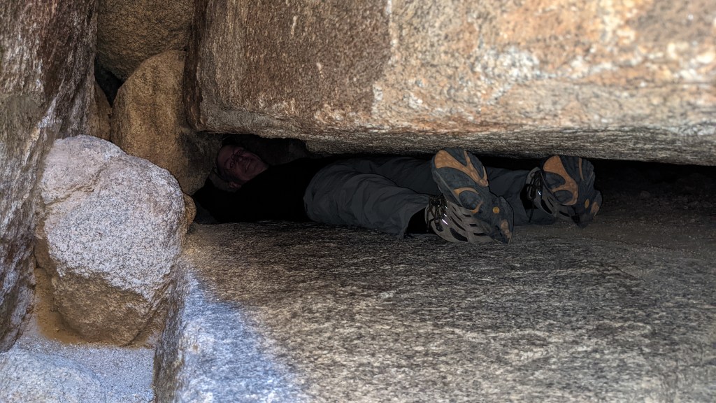
You essentially have to squeeze between these two rocks, pushing off of other rocks, until you get far enough back to reach a vertical shaft that you can climb up. Good thing I’m not claustrophobic.
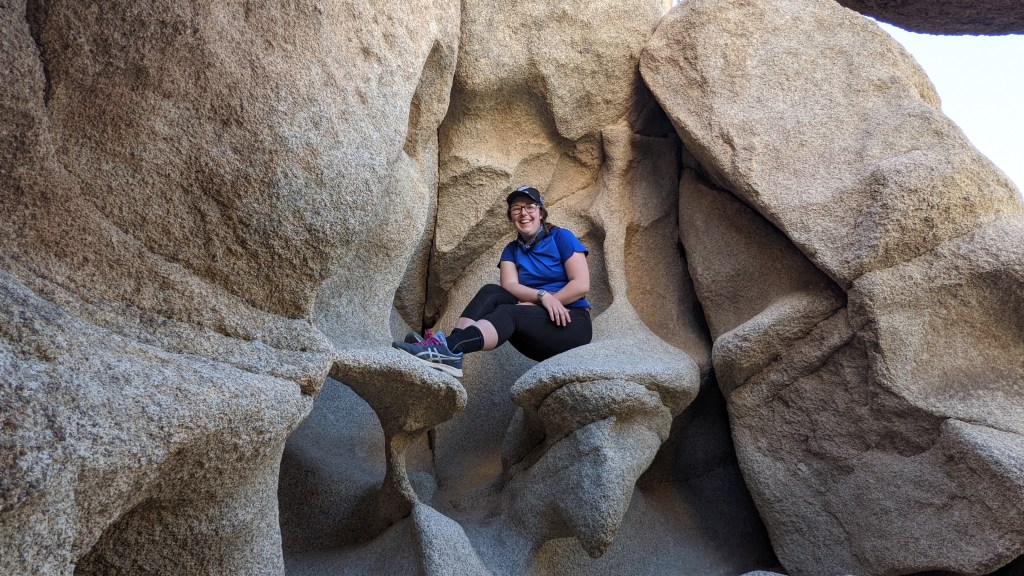
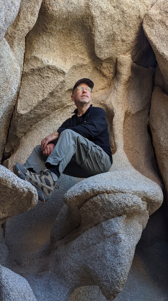
After you top out of the shaft, you enter a narrow hallway between two massive boulders and make your way through.
After we made it out of the hallway, we took some celebratory photos by these cool rocks, thinking the hard part was over.
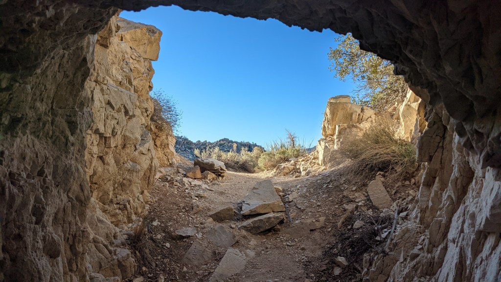
Ha! Getting down proved to be one of the hardest, sketchiest parts of the whole thing, but we made it out okay.
Next up was a hike to the Desert Queen Mine. Much like Death Valley, mining was a big part of Joshua Tree’s history, although it ended much more recently here in JTree than DV. The park service has covered over all of the shafts we encountered on the way out, but they were still neat to see.
What most people don’t know is that if you continue past the main mine shafts, you can hike to the Boulder House, an ingenious little dwelling constructed presumably by an area miner. It’s not marked on any NPS maps, and there’s no signage on the trail – Dad stumbled across it online and thought it sounded interesting, so he printed out directions.
After about an hour or so of picking our way along a tricky-to-follow trail, we made it to the general area of the house, but we had no idea where it was. That’s when we stumbled along David, an older man who was exploring the area.
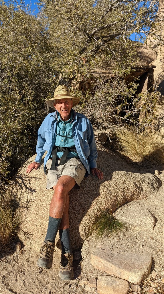
We struck up a conversation with him, and before long we were talking about all of the adventures he’d had hiking around the world. Such a sweet and interesting guy! We have him to thank for showing us where the house was – it’s right behind him in the above photo.
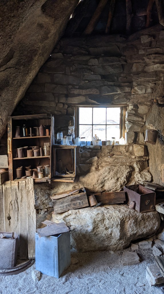
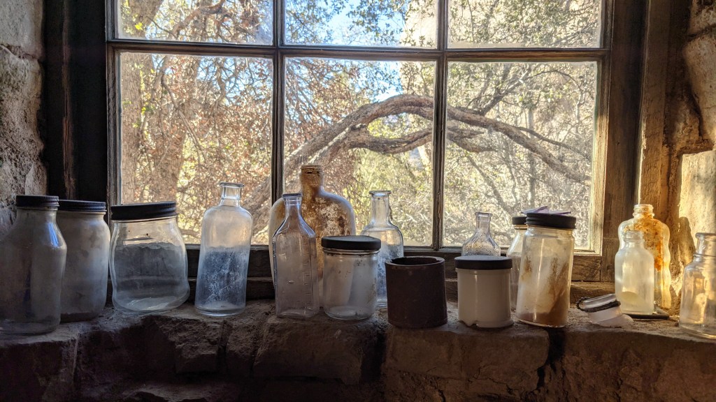
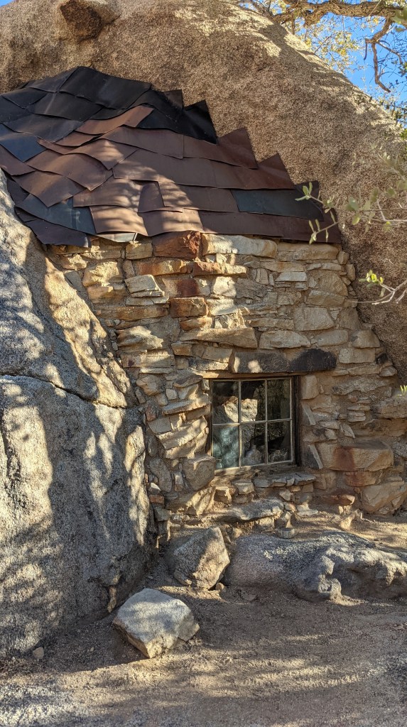
The ingenuity of whoever built this is just astounding. Luckily, its distance from the trailhead and obscurity mean that it’s stayed relatively unchanged, and a lot of artifacts still remain. Highly recommend if you have a few extra hours to spend at JTree and aren’t afraid of going off the beaten path.
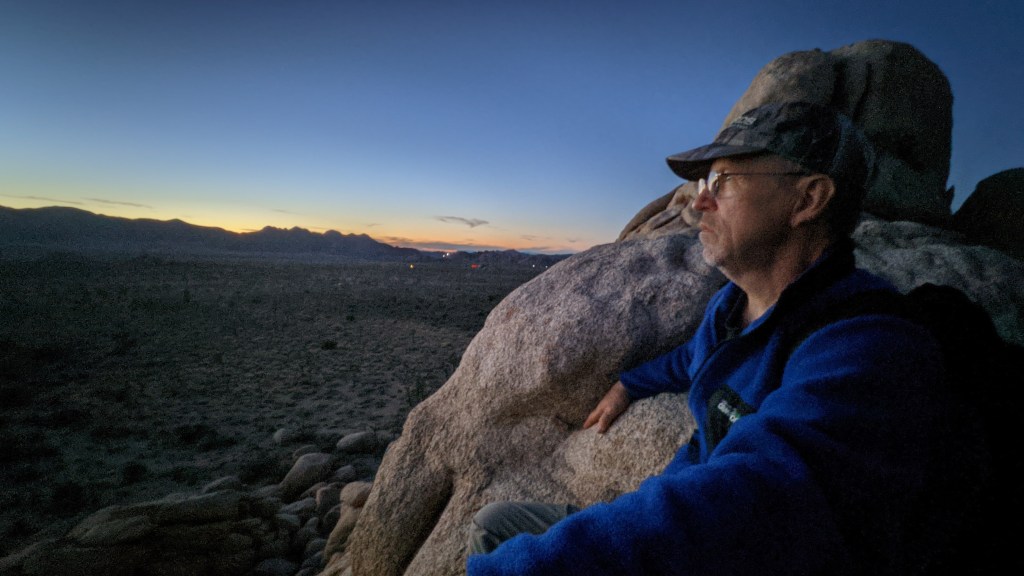
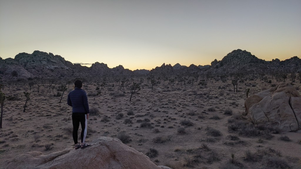
As the sun started sinking lower, we decided to head back to try and catch sunset. We drove back to our campsite, grabbed our headlamps and set out for Ryan Ranch, behind which is the large rock formation known as Oyster Bar.
Dad and I decided to scramble to the top to get some good views. It was pretty awesome, but unfortunately it was just not peak color that night.
We scrambled back down in the dark, eager to go eat dinner. After filling ourselves, we went to go catch up with our neighbors around the fire, sharing Girl Scout cookies and a beer. The stories they told about their travels were just incredible. It’s so exciting to see people live out their travel dreams, and they made me excited for the years to come.
Eventually we bid adieu, as Dad and I had to be up early the next morning to go rock climbing.
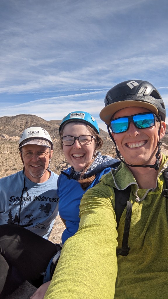
And what a grand adventure that was: my first time climbing outdoors! We met our guide at Intersection Rock, then drove to Cap Rock and did a few climbs around there. It was so much fun, our guide Jarad was great, and we had near perfect weather.
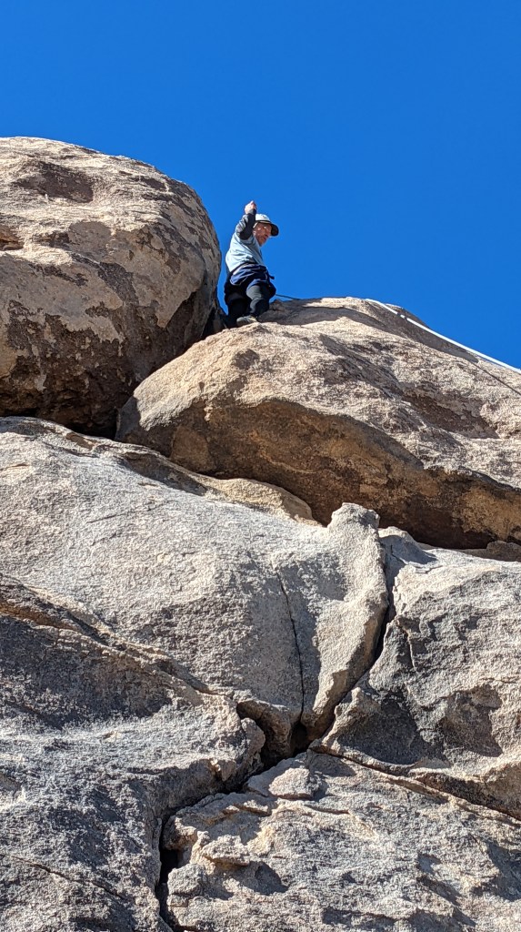
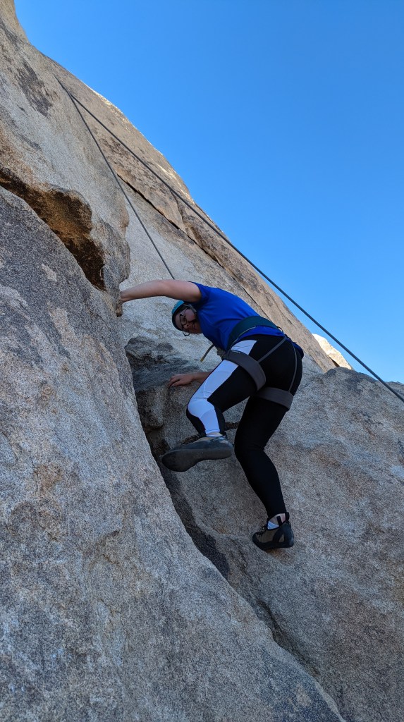
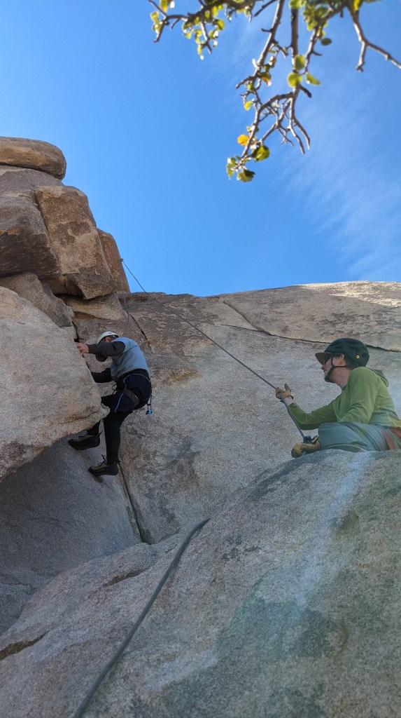
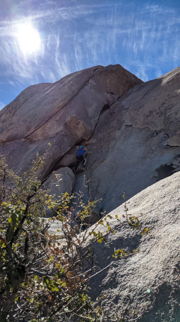
After each doing a couple climbs toprope, we decided to close out the day with a lead climb summitting Cap Rock. We scrambled up to the route, then Jarad lead-climbed it and Dad and I followed. It was pretty sweet.
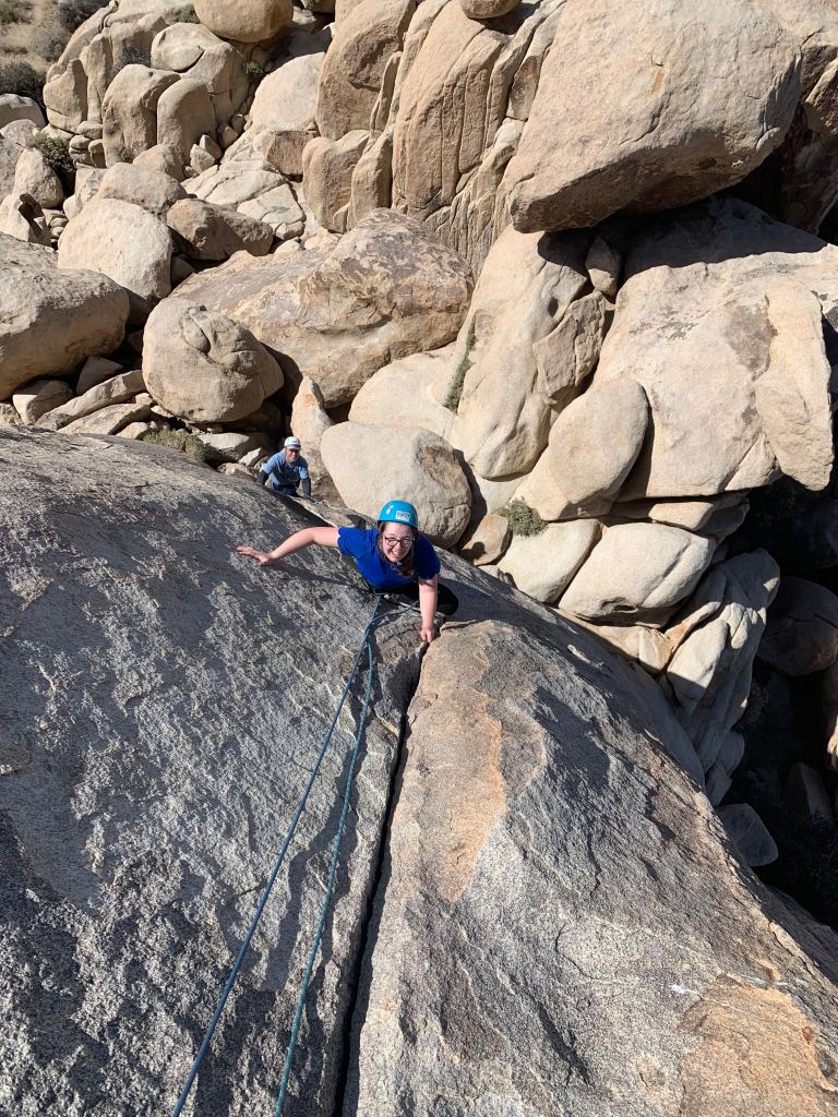
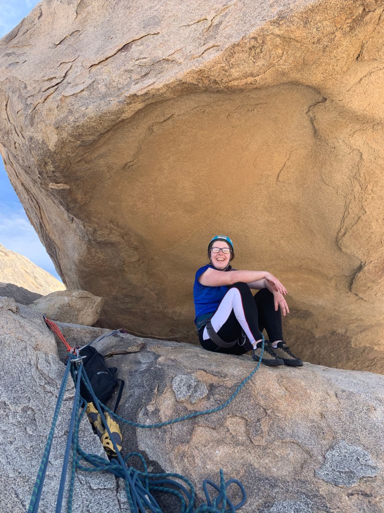
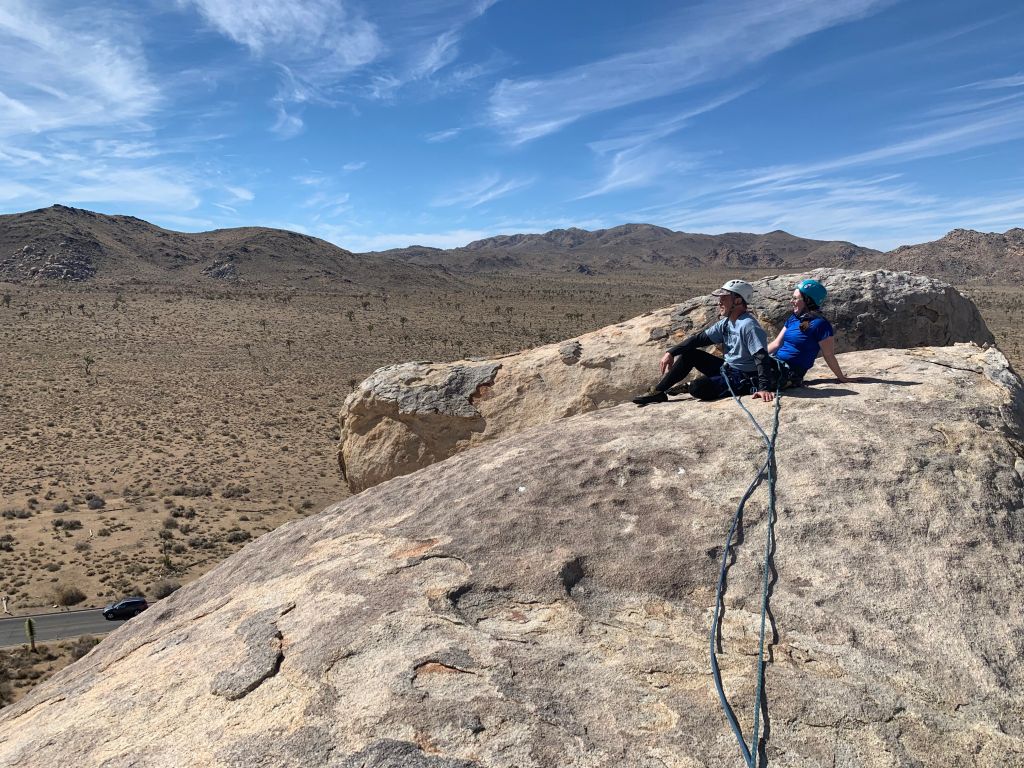
We ate lunch under Cap Rock, then crawled up to the true summit and hung out while Jarad set us up for rappelling back down.
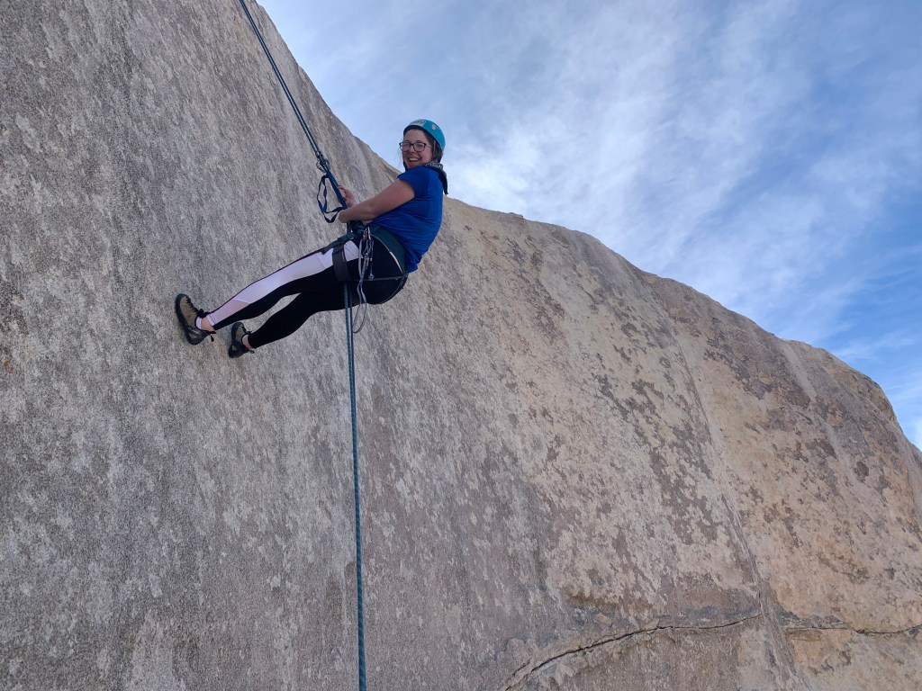
What a great day. Definitely will be doing outdoor climbing again!
Full recommendation to Jarad from Vertical Adventures, by the way. He was so chill, knowledgeable, encouraging, and helpful. Genuinely a great guy and guide!
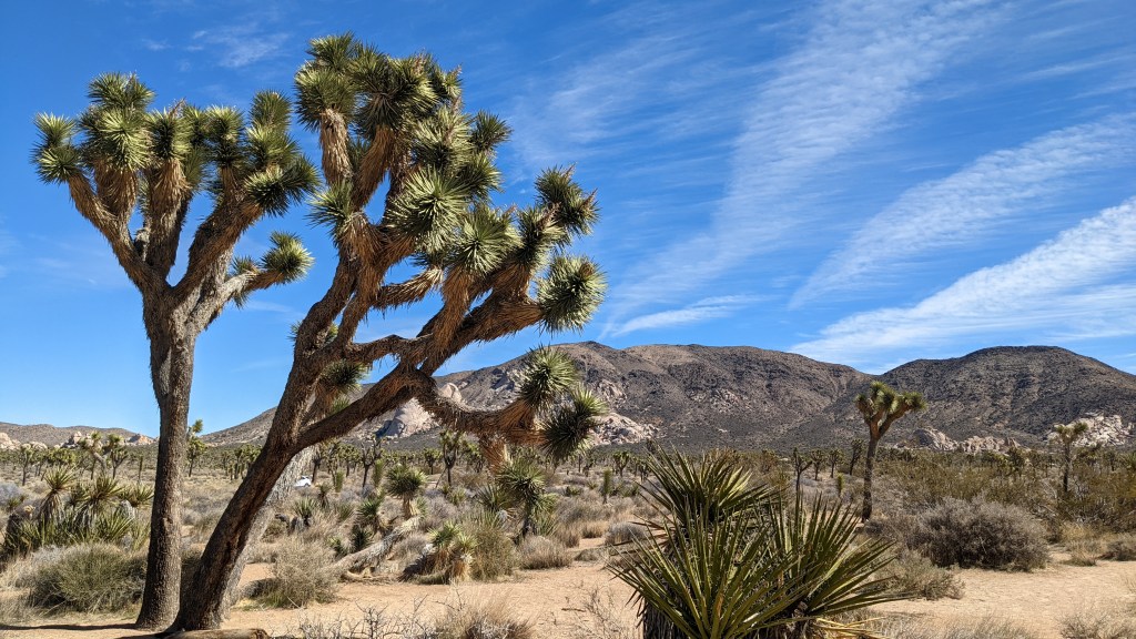
We parted ways, and Dad and I passed time by going on a drive through Joshua Tree. In case you’re wondering, the perfect sound track for this is obviously U2’s Joshua Tree album. What a dream come true – couldn’t help but get teary-eyed hearing “Where the Streets Have No Name” blasting over the speakers.
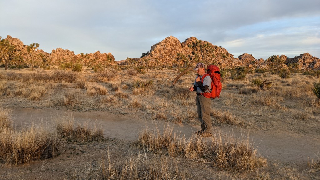
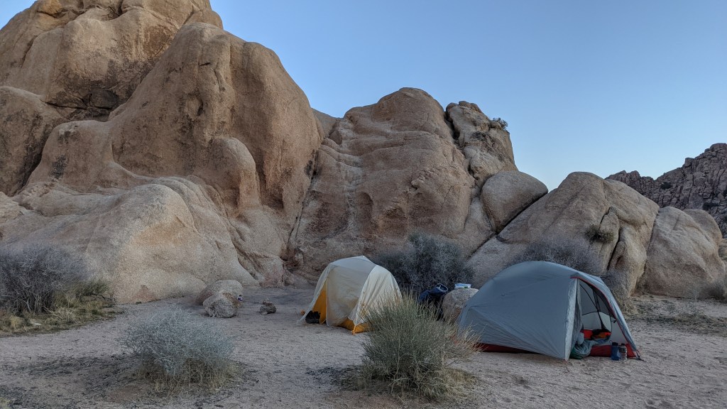
The sun was dropping in the sky, so we drove to the Boy Scout trailhead and got our packs ready. Dad had the genius idea of backpacking our last night so we could have a section of Joshua Tree to ourselves. JTree’s only requirement for backcountry camping is that you be a mile from the main road and not within a day use area, which leaves so many easy possibilities.
We had a location in mind, but Jarad had recommended we instead go to Mustang Ranch off of the Boy Scout trailhead. We took him at his word, and I’m so glad we did – it was the perfect location, and the hike out was gorgeous.
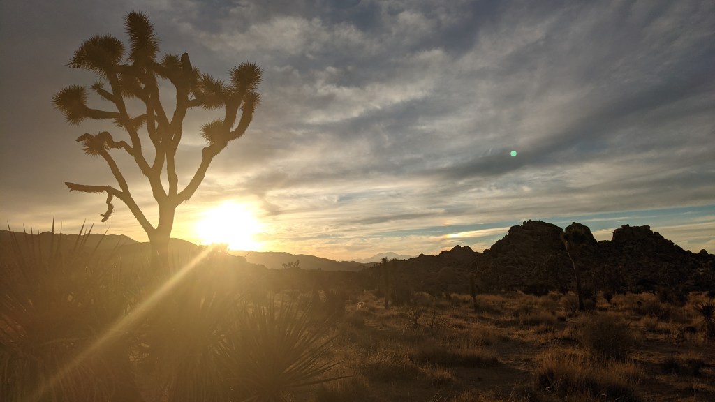
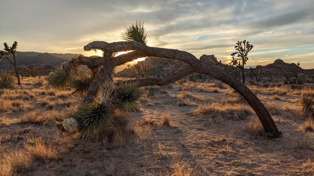
We admired the site for a few minutes, then I dropped my pack and prepared for sunset. With all the clouds in the sky, I was really hoping for a killer show, especially since the night before had been kind of lackluster. Man, it did not disappoint.
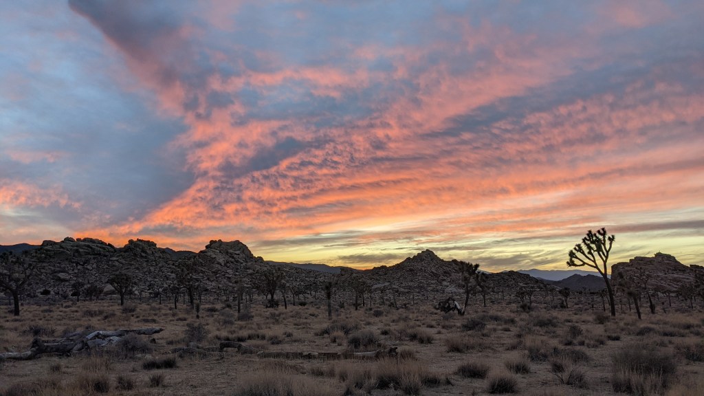
AUGH THAT PINK. This picture just doesn’t do it justice. It was there and then gone so fast.
After I had finished running around like a madman, I made my way back to Dad and we set up camp. We climbed up on a rock for a bit and talked until we started feeling hungry enough to climb down and make dinner.
I set my alarm an hour early for the next morning so we could enjoy our last morning in JTree without being hurried. Dad and I explored for a bit before making breakfast and taking down the site.
We hiked back, put our packs in the car, and bid adieu to Joshua Tree.
We got Dad a shower at a local campground and then headed for Ontario Airport, with a stop at El Pollo Loco for lunch. No photo evidence because, well, we were hungry.
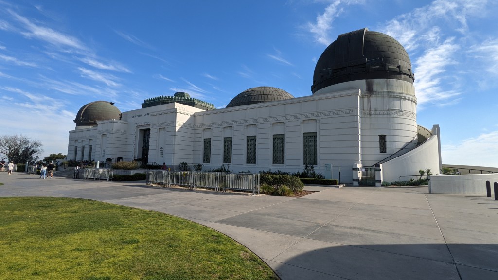
I dropped Dad off and continued on to LA. I had a reservation at the Freeland Hotel downtown for that evening, and with a few hours to kill, I decided to head for Griffith Park. I know, I know – after all this hiking, I head to the second largest city in the country and do what? Yep, you guessed it – more hiking!
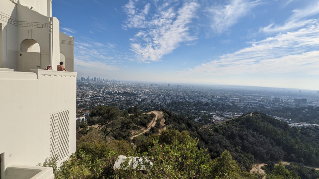
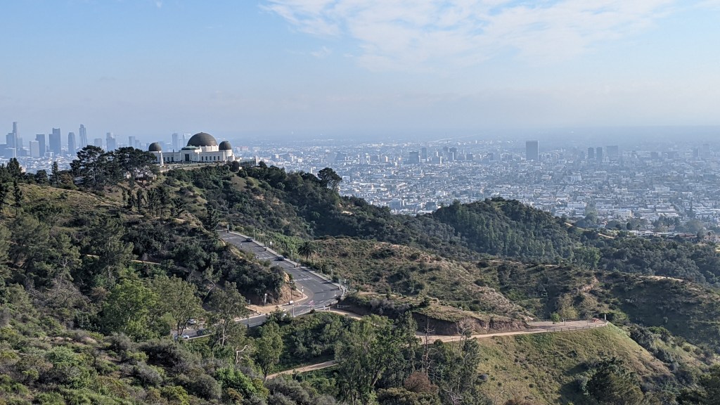
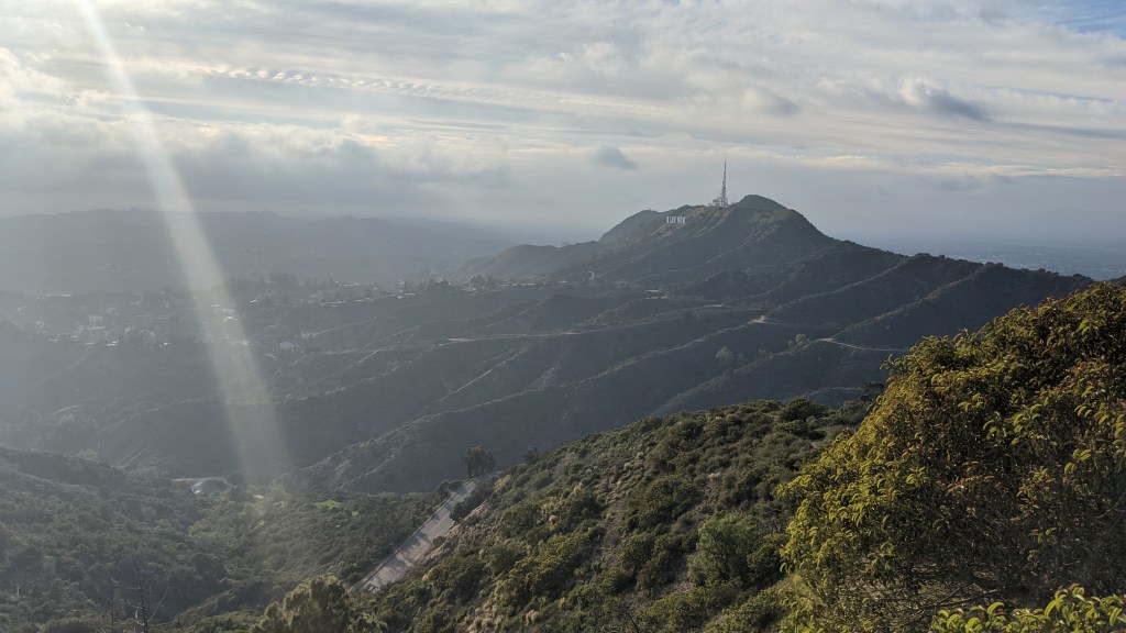
Feeling tired but happy, I trekked back to the car after reaching the summit of Mt. Hollywood and braced myself to enter rush hour traffic. Thankfully, it wasn’t too bad, and I lucked out even more by scoring a street parking spot right outside the Freehand.
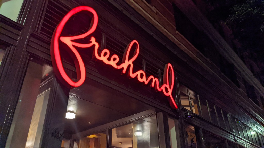
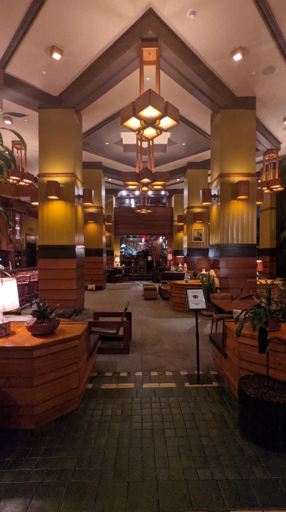
I had chosen the Freehand because it was ranked really highly on HostelWorld and because I was eager to have a hostel experience in such a big city, but it quickly became clear that it actually was a hotel that offered some hostel-style rooms. That’s my guess at least – I’ve never seen a hostel this boujee!
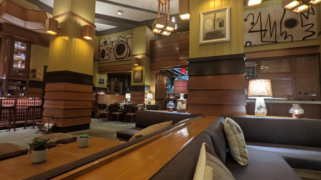
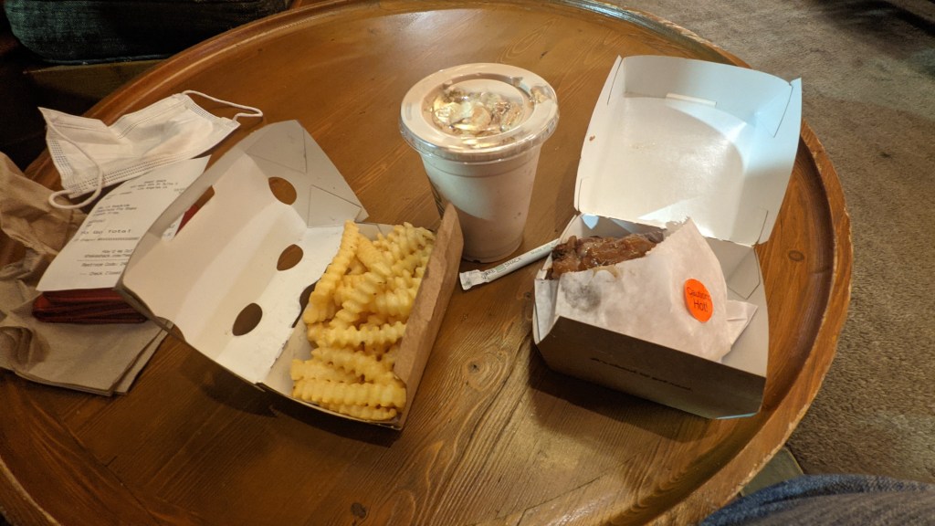
I grabbed a shower, which felt indescribably wonderful, and then went next door to Shake Shack to grab dinner. Man, it tasted so good…
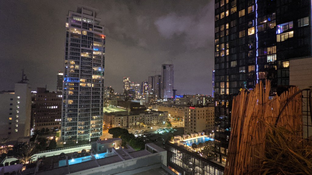
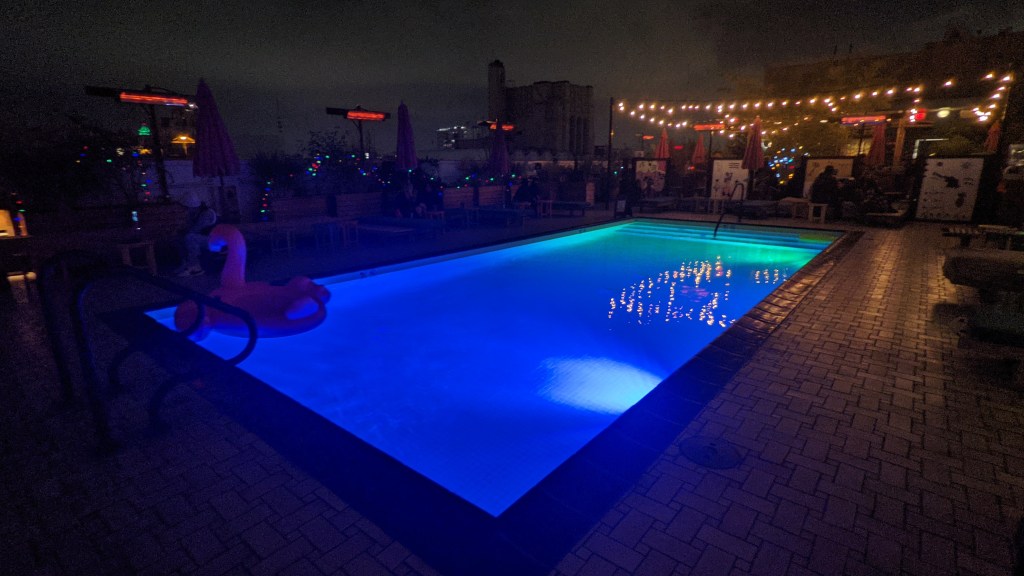
I went up to the roof to check things out, and if I hadn’t had to be up early the next morning, I would have totally stayed and had a drink or two at the bar. Maybe another time.
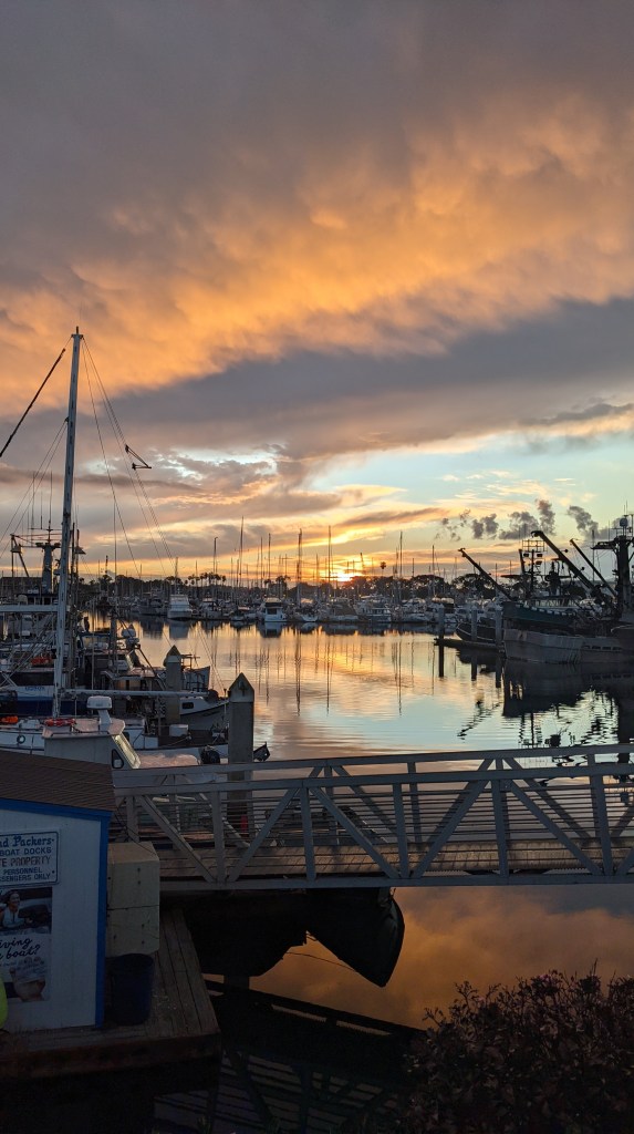
4:00 rolled around too early, especially since I was leaving an actual bed as opposed to a sleeping bag, but I couldn’t risk getting caught in LA rush hour traffic when I had an 8 am ferry to catch. Thankfully I made it to Ventura with plenty of time and a gorgeous sunrise to boot.
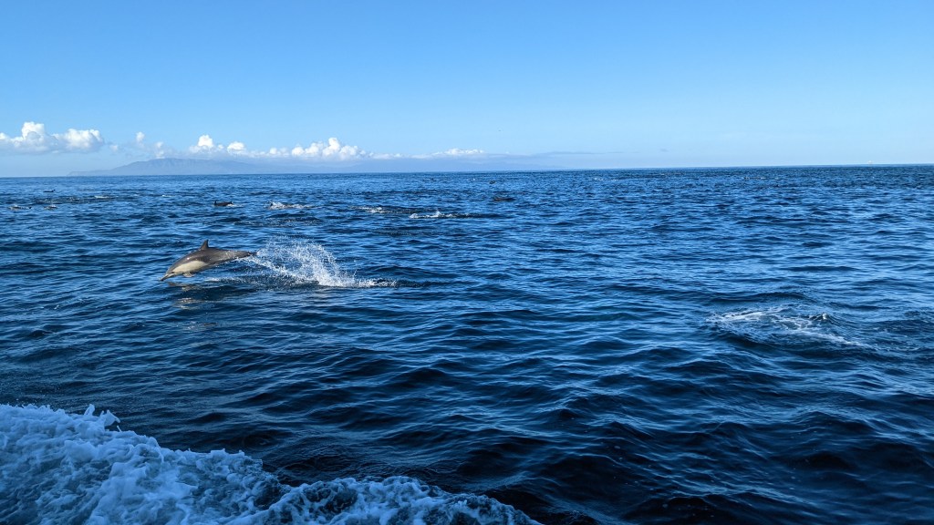
Before I knew it, I was off to the Channel Islands! Santa Cruz Island, to be specific. We were lucky enough to encounter a pod of dolphins along the way – I about could have cried of happiness.
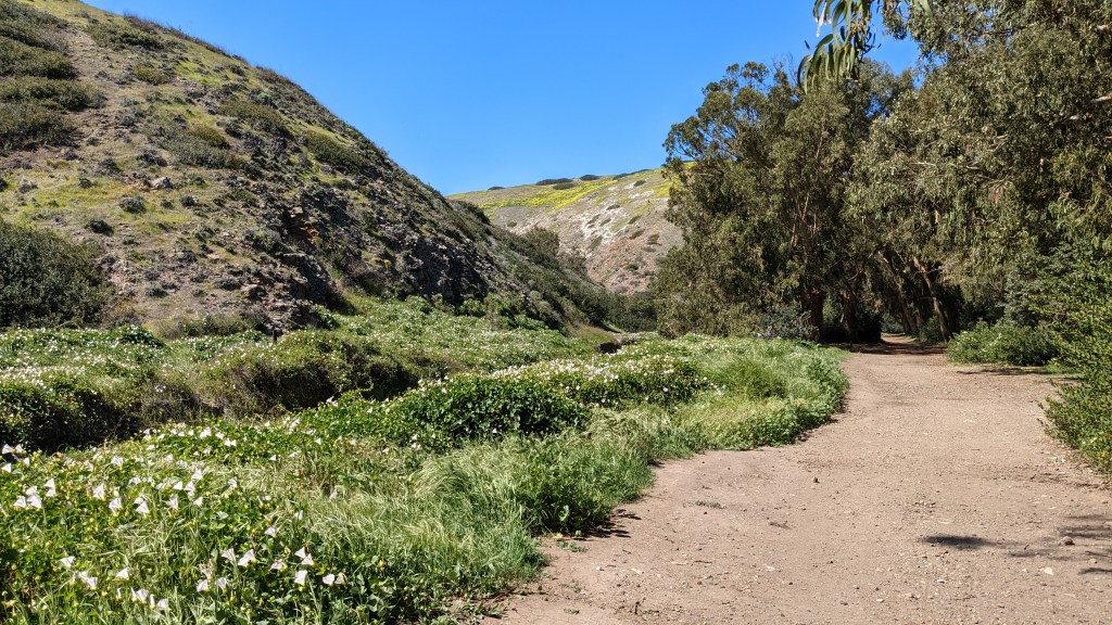
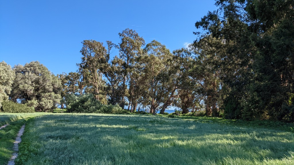
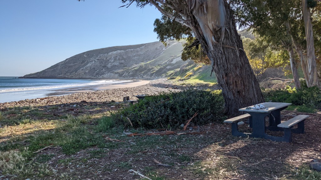
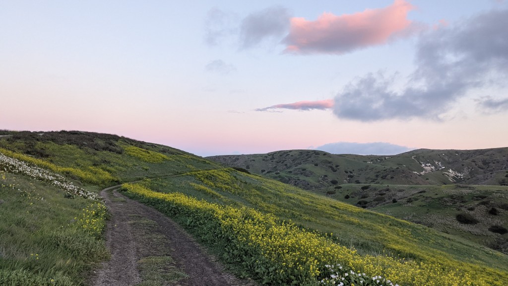
After about 1.5 hours, we docked and disembarked. First impressions were stunning – so green, especially after having been in the desert the last week.
While walking to the campground, I struck up a conversation with two older men who were leaving the island that day. They started giving me suggestions on some hikes to do, and of course from there we started talking about the various places we’d been. Turns out, they were old mountaineering buddies who, even though they now lived across the country from each other, would still travel together. I was bummed that our island time hadn’t overlapped more, but still glad I got to meet them.
The campground was just beautiful. I set up my tent and just breathed for a moment.
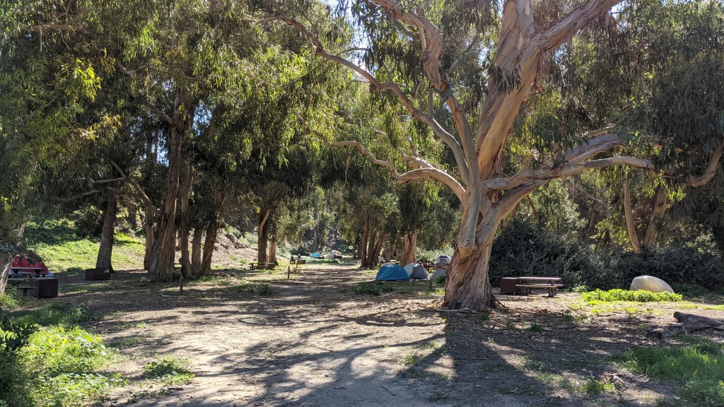
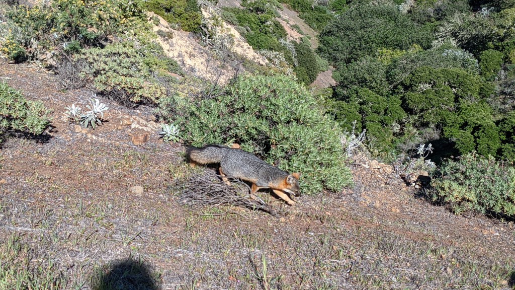
Each site had a “fox box” – identical to bear boxes in other parks, except intended to keep out the tiny but fearless island foxes, endemic to the island. They patrolled the campground, so I saw quite a few!
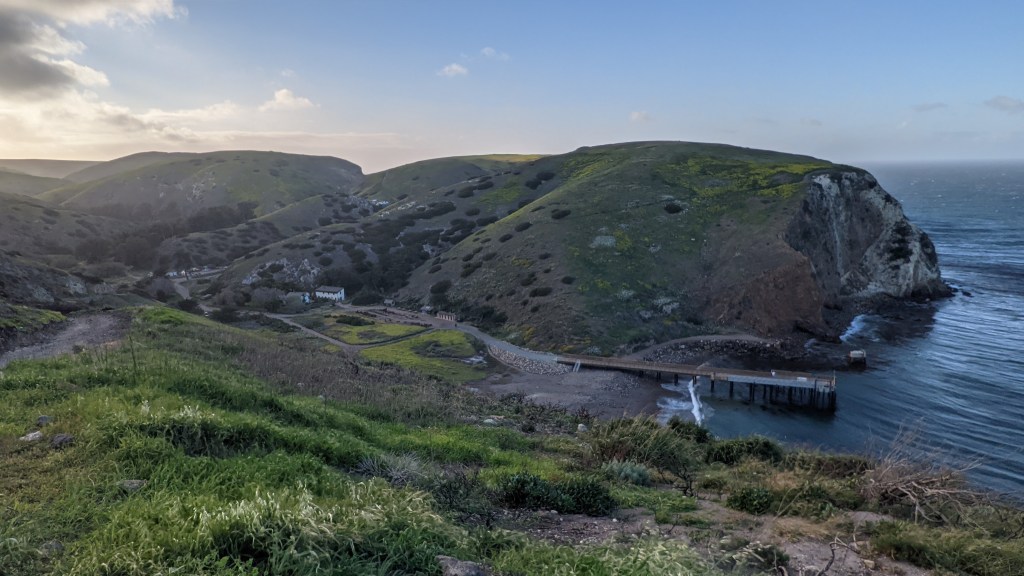
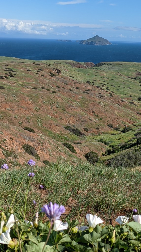
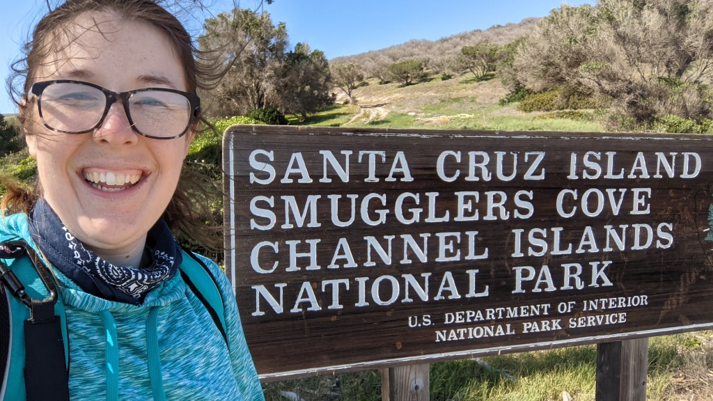
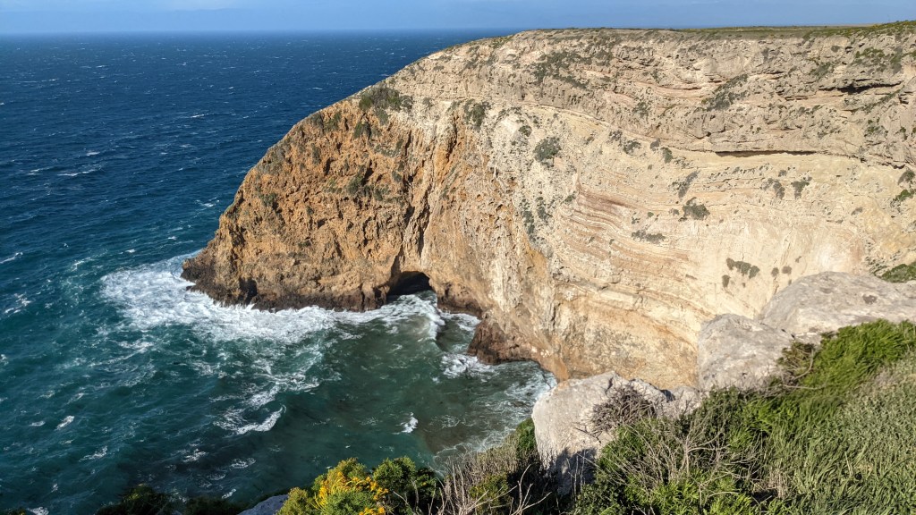
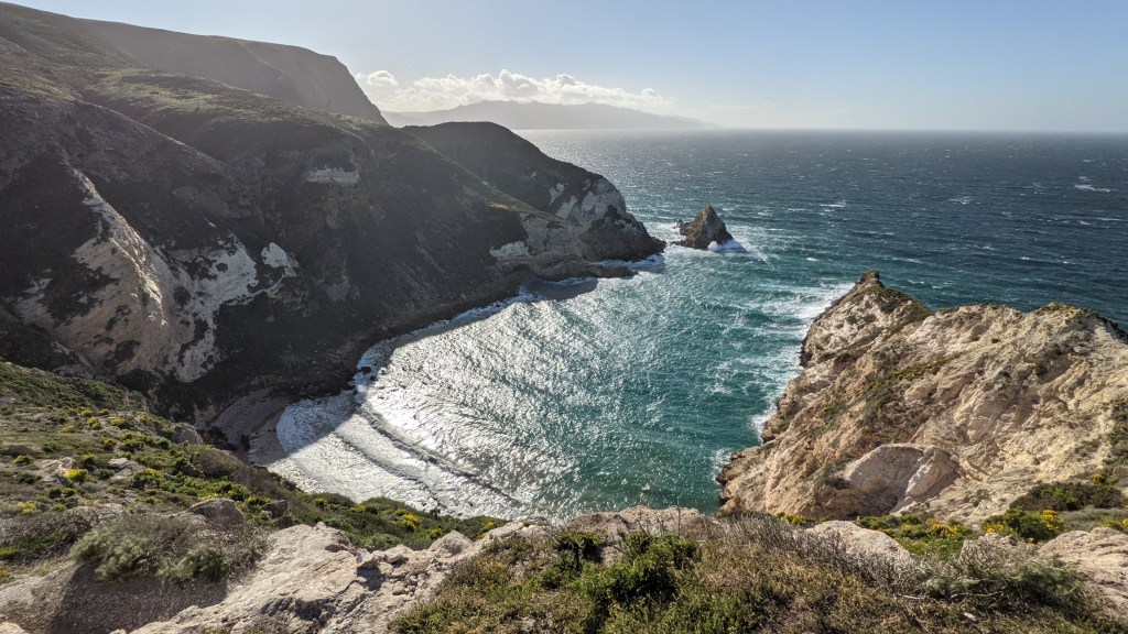
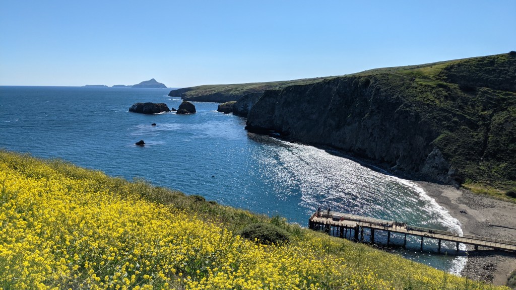
I had heard a lot about the hike to Smuggler’s Cove – one of the few accessible beaches on the island – so I decided to knock that one out that afternoon. It was absolutely gorgeous – 7.5 miles RT with sweeping views of the ocean and nearby Anacapa Island.
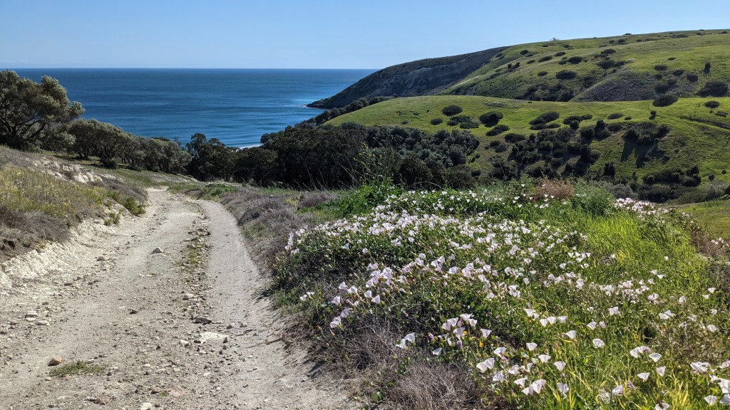
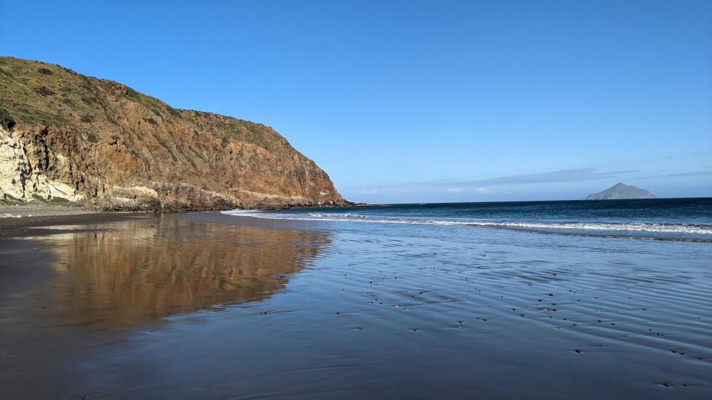
Even better, I had the whole place nearly to myself! I explored Smuggler’s Ranch, ate lunch, then laid on the beach for about an hour, soaking up sunshine and listening to the waves. Life was grand.
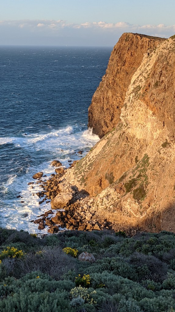
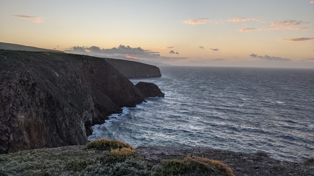
I headed back when more people started arriving, eager to catch a good place for sunset. I caught the ranger at the campground, and she recommended heading towards Potato Harbor, so I grabbed a headlamp and off I went.
Unfortunately, the winds had really picked up at this point, so it was slow going along the exposed cliffs. I gave up before making it to Potato Harbor – being pelted with dirt and pebbles blown by the wind was just not fun – but I still got some great views.
I chose mashed potatoes for dinner since they required the least amount of cooking time, but even then I was fighting the wind to keep my stove going. I climbed into my tent immediately after cleaning up and passed out.
I slept in the next morning, and it felt so good. I swear, there’s hardly anything better than waking up in a tent warmed by the sun – bonus points if it’s in a beautiful place. On top of this, winds were strong enough that they had cancelled all ferry trips, which meant we campers had the whole island to ourselves!
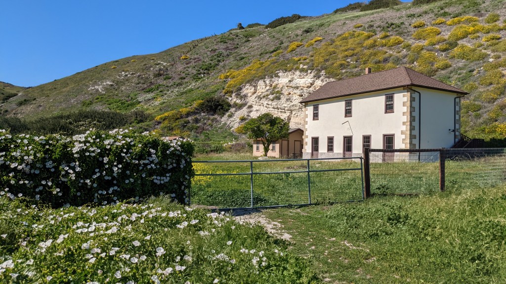
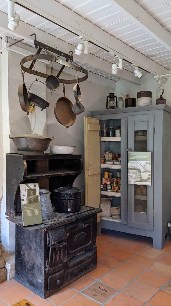
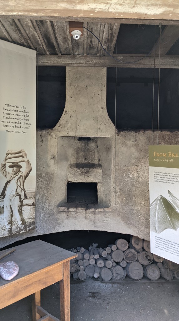
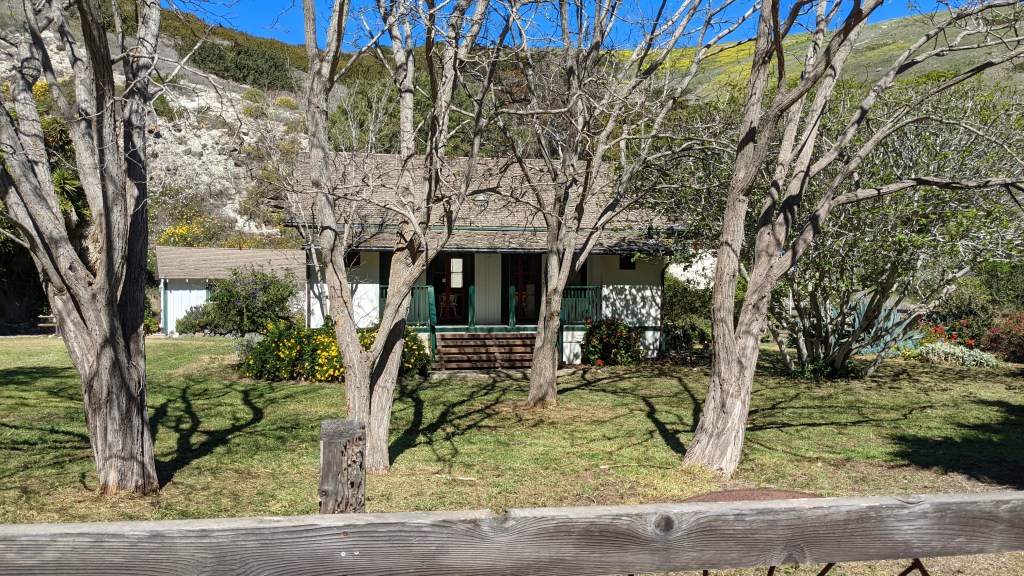
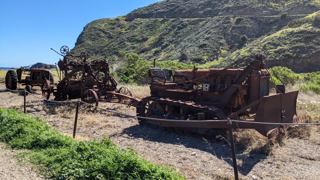
I took time to explore Scorpion Ranch that morning. Ranching is a huge part of the island’s history: the island at one point was used almost entirely for raising sheep and cattle and had 10 ranches and offranches. Santa Cruz island even had the largest telephone system in the country at one point as wires, as wires were laid between each of the ranches. Stock wasn’t the only product of the island, however; olive orchards and vineyards were also planted, and the island boasted the most productive winery in the US for a while.
Today, the western 75% of the island is managed by the Nature Conservancy, and the eastern portion is managed by the NPS. Hiking on the Nature Conservancy side requires a permit, so I stuck to the NPS side; however, I felt there was more than enough to do for the time I had.
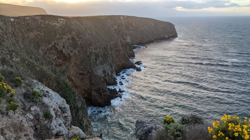
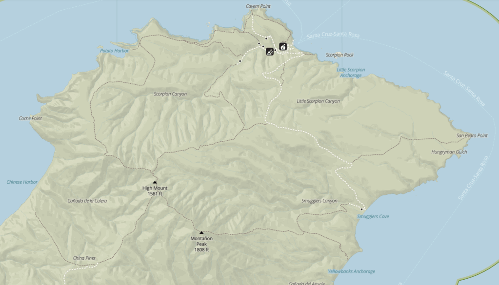
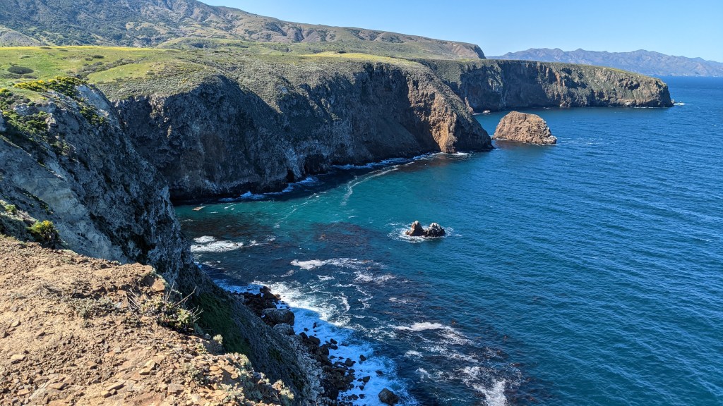
For my second day hike, I decided to do a loop hike connecting Smuggler’s Cove Road to Montañon Ridge to Potato Harbor to the campground. The guys I had met said it was even better than Smuggler’s, so I was excited to check it out.
I don’t know if I agree that it’s better than Smuggler’s (hard to beat the beach!), but it was still pretty stunning!
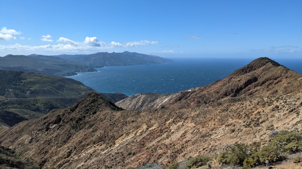
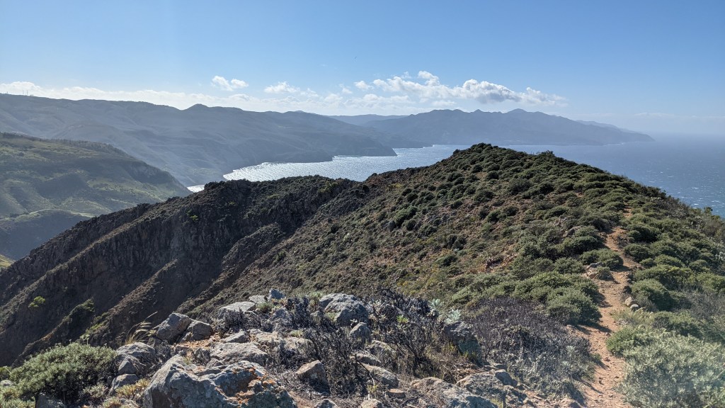
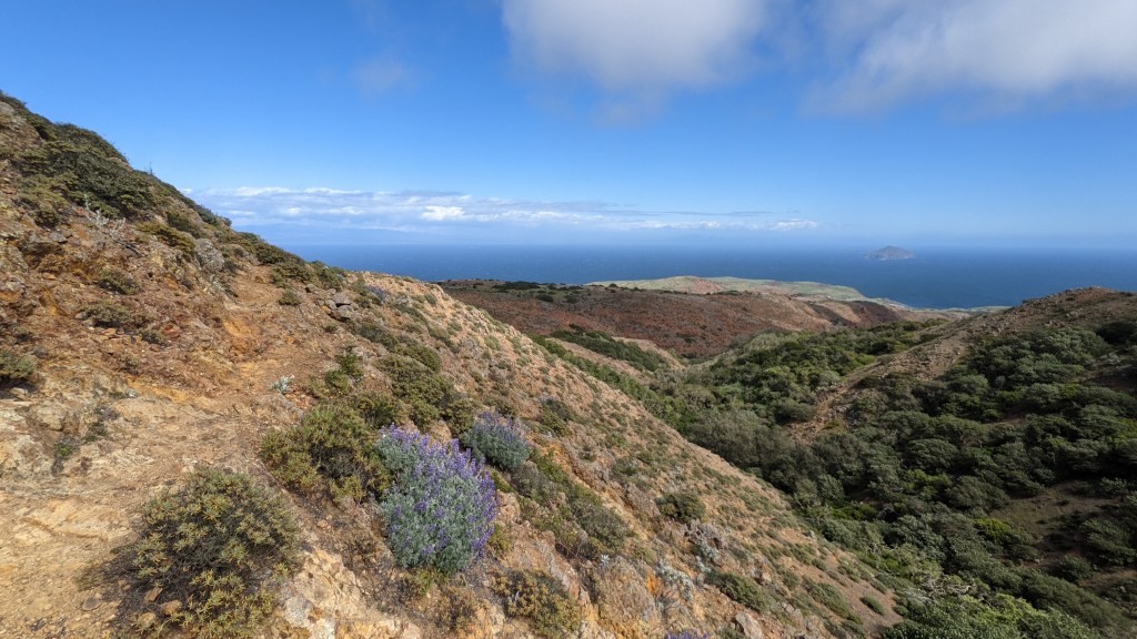
In some high spots on the trail, you could see ocean in nearly all directions – just gorgeous. The only downside was the wind – I kept hoping to stop somewhere scenic to grab lunch, but the gusts were up to probably 45 mph, so I eventually gave up and just snacked.
I made it back to the campground to find my tent had blown over. Luckily all my poles were fine, but it did give me a good scare. I readjusted the angle and reanchored with rocks this time.
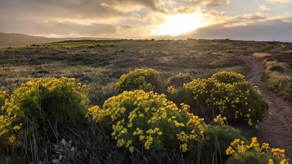
Before long, it was time for sunset again. I stayed closer to the campground but still got some good views.
The rest of my evening consisted of another quick dinner of mashed potatoes soon followed by sleep.
I was relieved to find the next morning that the winds had cleared up enough for the ferry to come pick up campers; however, the winds were apparently still too strong to go sea kayaking, as my guided tour was cancelled. I was a little bummed, but honestly, my island experience has been so good that it just would have been icing on the cake. I’ve heard rave reviews, though, so it may be worth coming back for.
I packed up, squeezed in one final short hike, and boarded the ferry back to the mainland with a wistful smile. Island time is such a special thing.
We were lucky enough to spot gray whales on our way back, though I wasn’t able to get any pictures of them.
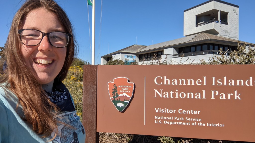
Back on the mainland, I visited the park visitor’s center, which gave a nice overview of all five islands.
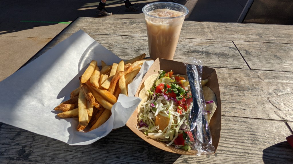
I was hungry and excited to experience my first fish taco, so before long I found myself at the locally famous Spencer Mackenzie’s. And BOY, were there tacos good.
I had some time to kill before heading back to the airport, so I ambled down to the Ventura Pier and people-watched for a bit.
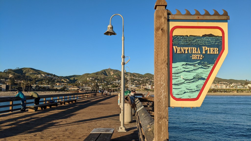
And of course, when at the beach, you at least have to take a stroll, so I walked a ways and caught some surfers at sunset.

I finally tore myself away and trekked back to the car so I could pack up my stuff. Within a few hours, I drove back to LA, grabbed a delicious chocolate malt from Melo Burger, dropped off the rental car, and boarded a redeye back to Indianapolis.
That wraps it up for this trip – stay tuned for a Dakotas road trip with the fam in July! Thanks for reading!
