Happy summer all! It’s so nice to have warmer temperatures again – perfect time for a national parks road trip!
On this trip, I hit four parks: the Great Smoky Mountains, Congaree, Shenandoah, and the country’s newest park, New River Gorge! After a wonderful semester volunteering with student ministry on top of my job, this solo trip was a much needed retreat.
I left after work on Friday and made the seven-hour drive to Cosby Campground in the northern Smokies, where I basically pitched my tent and crashed for the night. My original plan had me ending the trip in the Smokies, but then I realized that being in the nation’s most visited park on Memorial Day weekend was probably not going to be very relaxing, so I flipped the trip around.
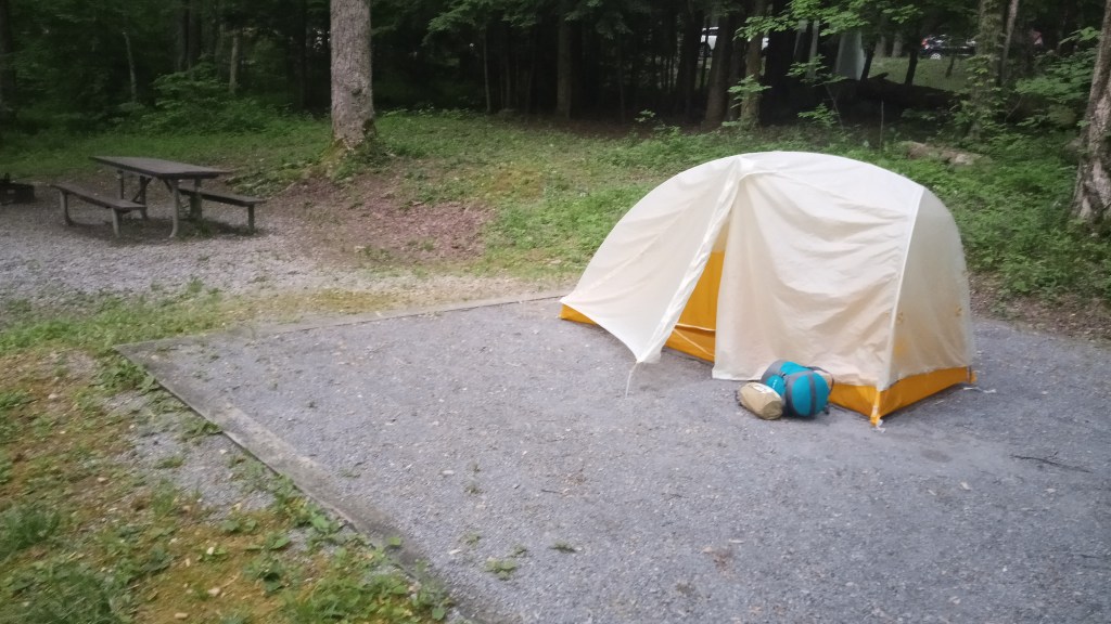
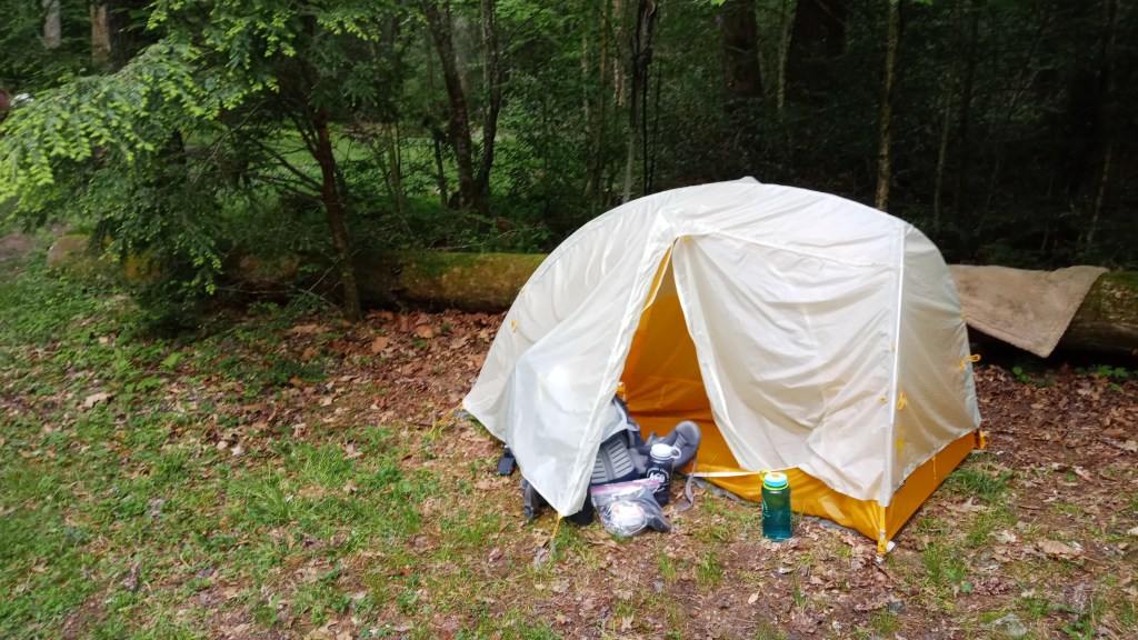
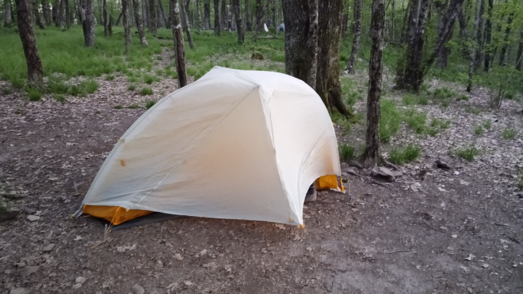
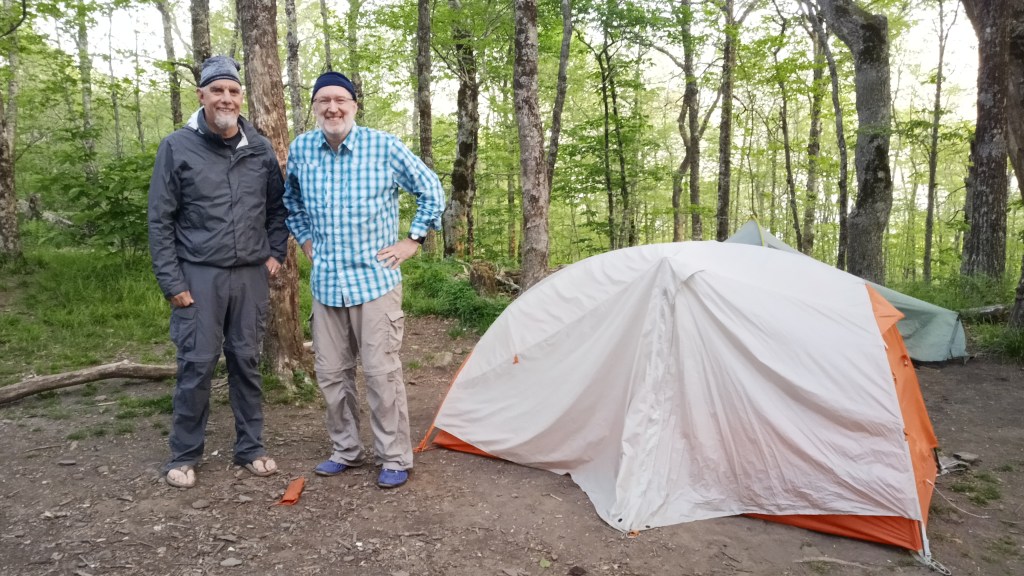
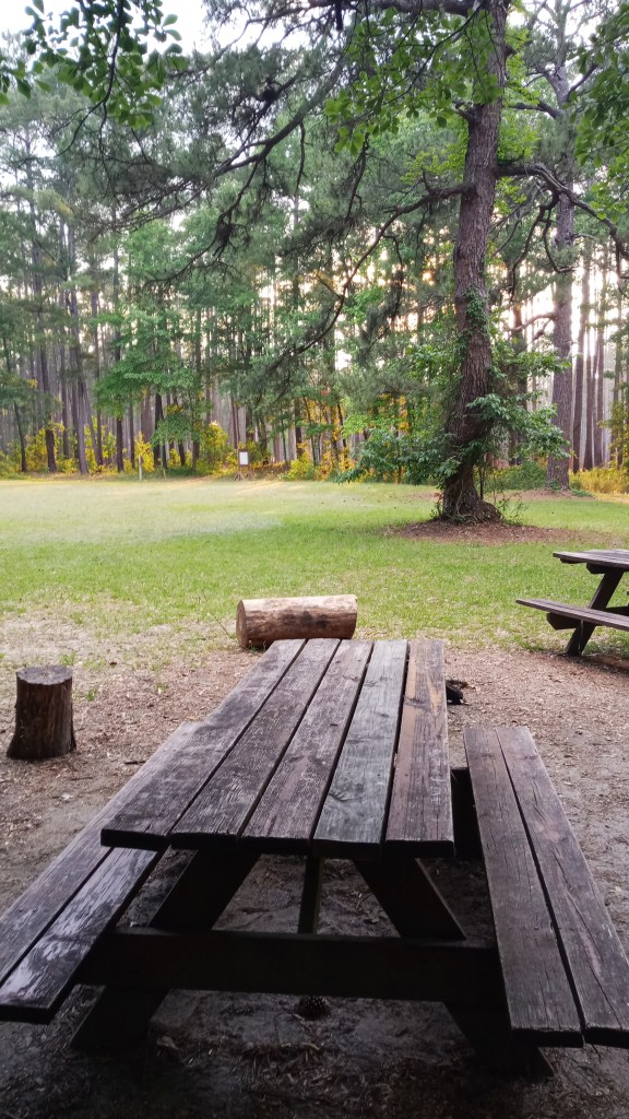
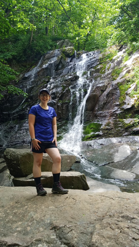
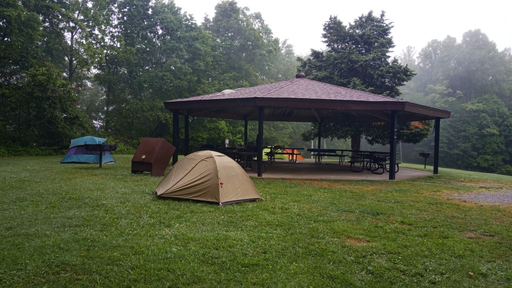
Say hello to Agnes! My little tent sheltered me every night except one on this trip. If you’re interested in specs, it’s a Big Agnes TigerWall UL1. Packaged weight is a whole 2 lb. 3 oz., so it’s perfect for backpacking! It’s semi-freestanding, which for me is probably the biggest downside, since I have to stake it down to get the full amount of room. It performed beautifully on this trip though. It’s definitely on the pricier side, so I may invest in a cheaper tent for car camping in the future, just to save some wear and tear on this one.
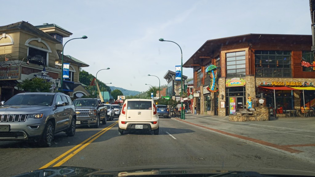
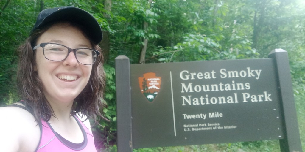
Saturday morning, I made oatmeal for breakfast and packed up decently early so I could hit the trails before traffic got bad. I passed through Gatlinburg on my way to the Paradise entrance. Good grief, I knew it was touristy, but just driving down the main street was a whole other level of tourism.
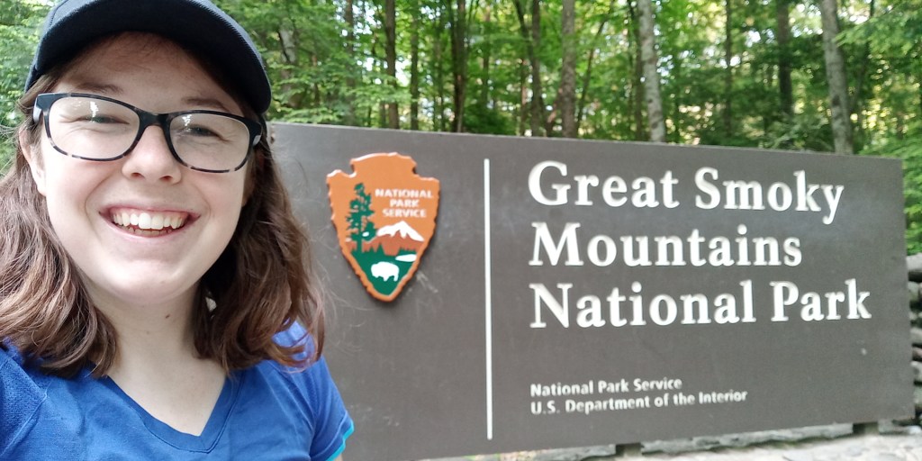
I stopped to get a picture of the sign…
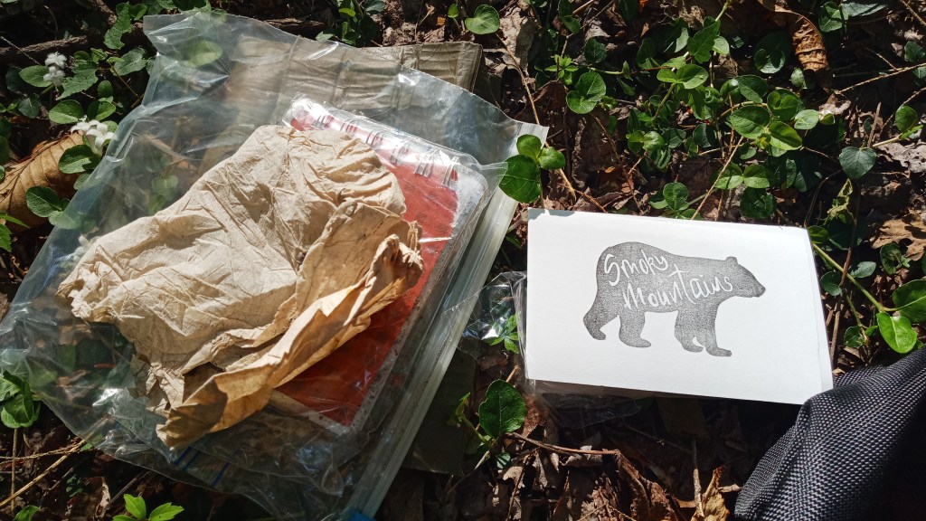
…and then stopped at the Paradise Visitor’s Center to grab a quick letterbox.
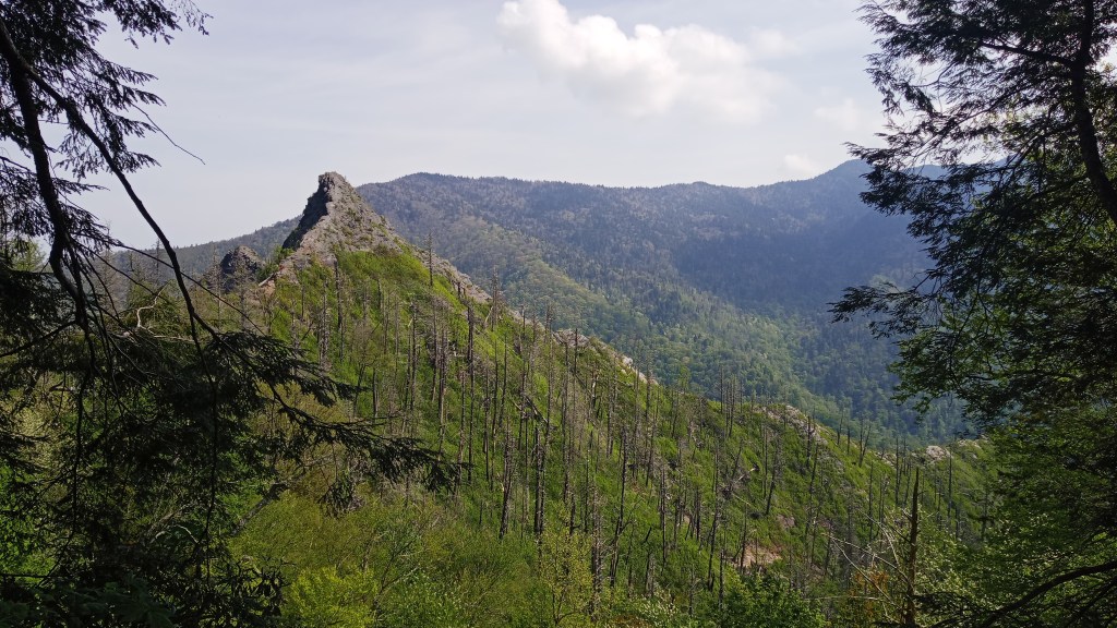
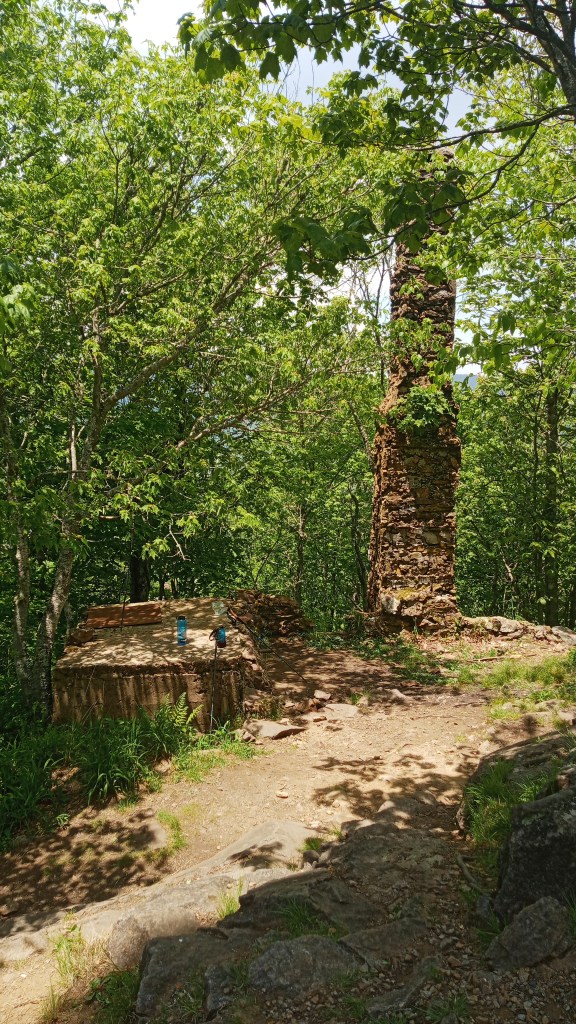
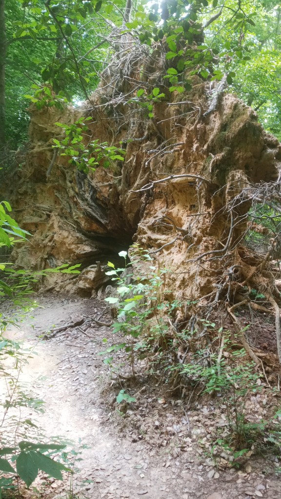
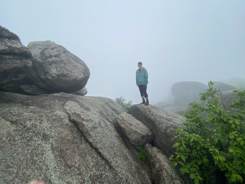
My next item on the agenda was the Chimney Tops Trail, which I’d heard had amazing views. It was about a four mile round trip hike and had about a 2500′ elevation gain, so it was no joke! Be aware that if you do this hike the last quarter mile is closed due to a 2016 fire. The views from the lookout are still beautiful though.
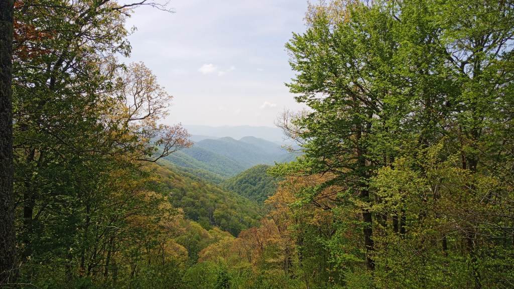
Once I got back to my car, I took off for the Deep Creek trailhead. The road took me through Newfound Gap, and the views were really pretty.
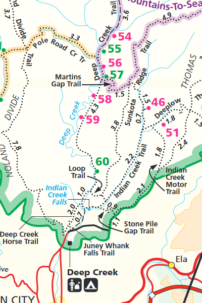
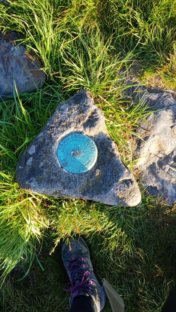
At the Smokies, backcountry campers reserve designated campsites and pay a small fee per night. I had reserved campsite 55 (see map below) and was originally planning on taking the Noland Divide Trail up and over, but it was kind of late by the time I got to the trailhead, and I was (sadly) kind of worn out from the Chimney Tops hike already. I decided instead to take the Deep Creek trail straight back.
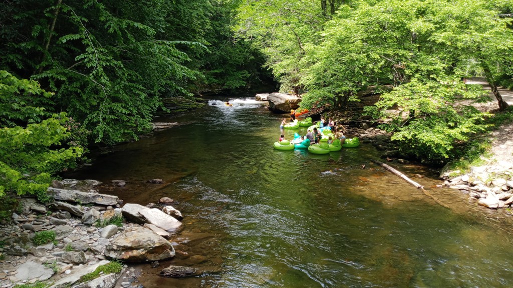
Near the trailhead, they had tubes available for rent, and there were quite a few people taking advantage of them on this toasty Saturday afternoon.
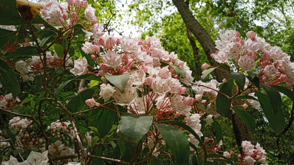
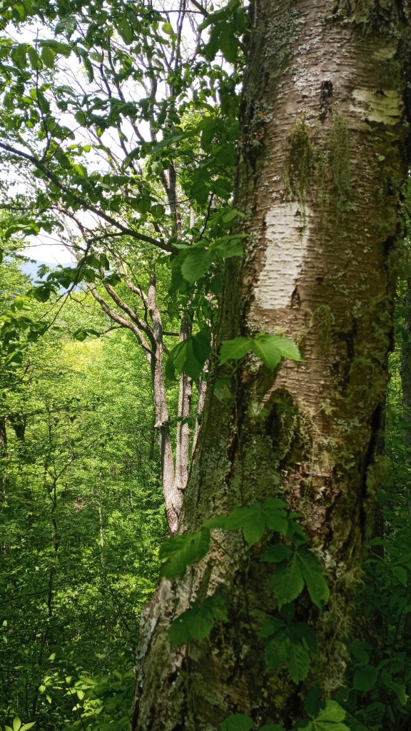
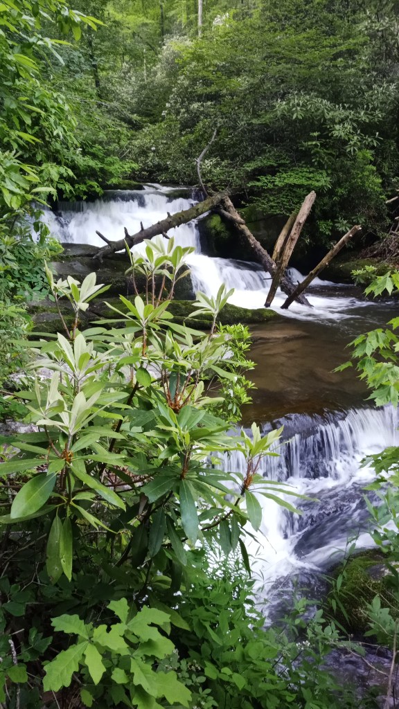
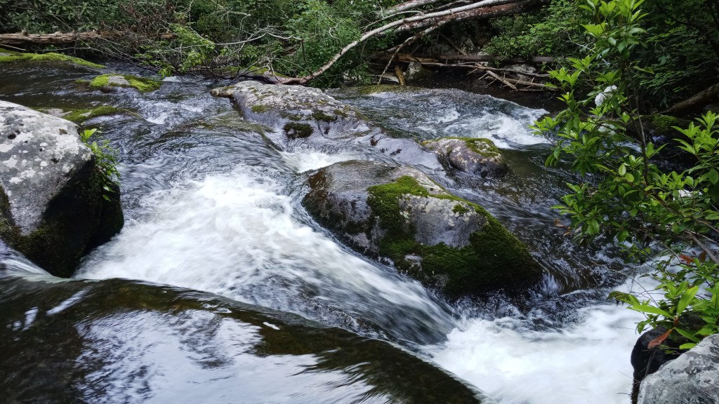
It was a pretty hike back, as it followed Deep Creek most of the way. The mountain laurel was in bloom too!
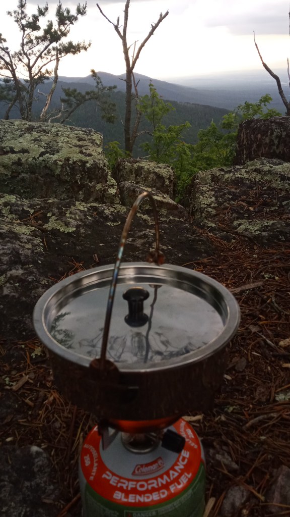
After a couple hours, I reached campsite 55. Because I had booked it a few months in advance, I had forgotten that it was a stock camp! Even better, there were horses and riders there. I’m learning to really appreciate horseback riders – they don’t have to worry as much about the weight they carry, and so they frequently have “luxury” items that backpackers can’t afford to carry. Just look at that campsite setup!
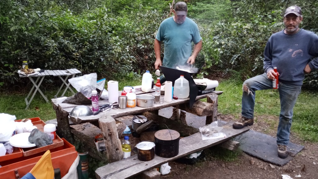
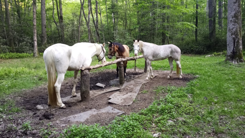
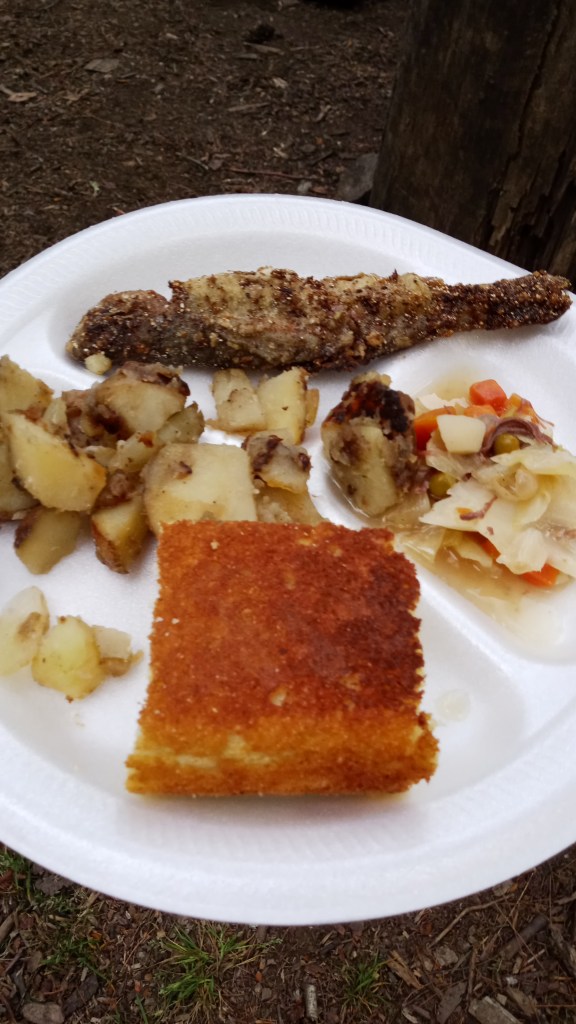
Even better, both this group and the guys I met in Washington were incredibly generous in sharing their food. This was by far and away the best I’ve ever eaten on a backpacking trip. Peep the fried fish, fresh hot cornbread, potatoes with ramps (a local onion relative), and bear meat stew – yep, you read that right! They even gave me a beer to wash it down with!
Our campsite was pretty busy, as there were five guys on horseback, four other backpackers, and myself. We had a good time trading wilderness stories and feasting before we turned in for the night.
Sunday morning, I hung around for a bit after packing up, as they had promised me breakfast the night before. While they got up and got going, I took a quick walk to the old swimming hole in Deep Creek and had a little devotion time.
I didn’t get a picture of breakfast, but it was just as good – canned biscuits with homemade sausage, gravy, leftover potatoes… I was a happy camper!
I bid everyone goodbye and headed out. I had considered trying to do Noland Divide that morning on the way out, but ultimately decided to sleep in a little and enjoy breakfast. To get a change of scenery, I hiked out on Sunkota Ridge rather than going back out Deep Creek. I was a little disappointed in the scenery – I’m sure it would have been beautiful, but there just weren’t many gaps through the trees.
I had my first of three major wildlife encounters that day on the Sunkota Trail. I’m 95% sure it was a rattlesnake: it moved very quickly, hissed, and made a rattling noise. I ended up waiting for two guys I knew were behind me to catch up, and we were able to pass it without any incident. Of course, it didn’t make any noise for them, so I don’t think they believed me, but at least we made it out safe.
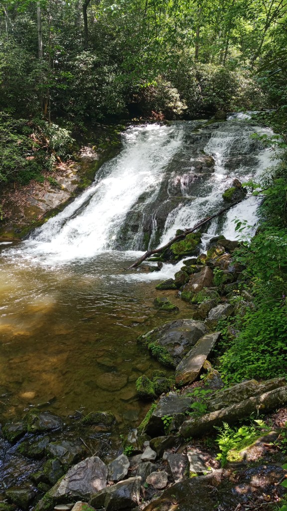
Here’s Indian Creek Falls! Very pretty.
My next destination was the Twentymile trailhead, about an hour west of Deep Creek. This mini-trip was a two-nighter: I booked site 13 near the top of Gregory Bald for the first night, and 93 for the second night.
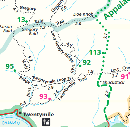
The hike up to the bald was no joke – about 7 miles with 2500 feet elevation gain. I was very tempted to stop at site 95 and stay the night but ultimately decided to push myself to get as far as I could.
A few miles in, I heard a noise that sounded too big to be a deer, so I looked around and spotted a young black bear about a hundred feet off the trail! It wasn’t really scary – I just made a lot of noise and attempted to make myself look as big as I could. It just kind of looked at me as I walked by. I didn’t get any pictures of it, as I decided I didn’t want to be the idiot who stopped to get pictures of a bear and got mauled!
My third major wildlife encounter that day occurred as I was walking along Parson’s Bald, close to the campsite. I didn’t get a good look because they ran off as soon as they heard me, but I’m pretty sure they were two large feral hogs. They didn’t seem to move like deer or bears, and they made a loud grunting noise.
After about 4.5 hours of hiking, I finally rolled into camp. I definitely didn’t win any awards for speed, but I made it! I set up camp as the sun was setting, then walked over to the neighboring campsite to fix dinner and join in some conversation with two very sweet older guys. We chatted for a while about previous adventures while I tried to finish my fajita chicken and rice, until it got late and they turned in.
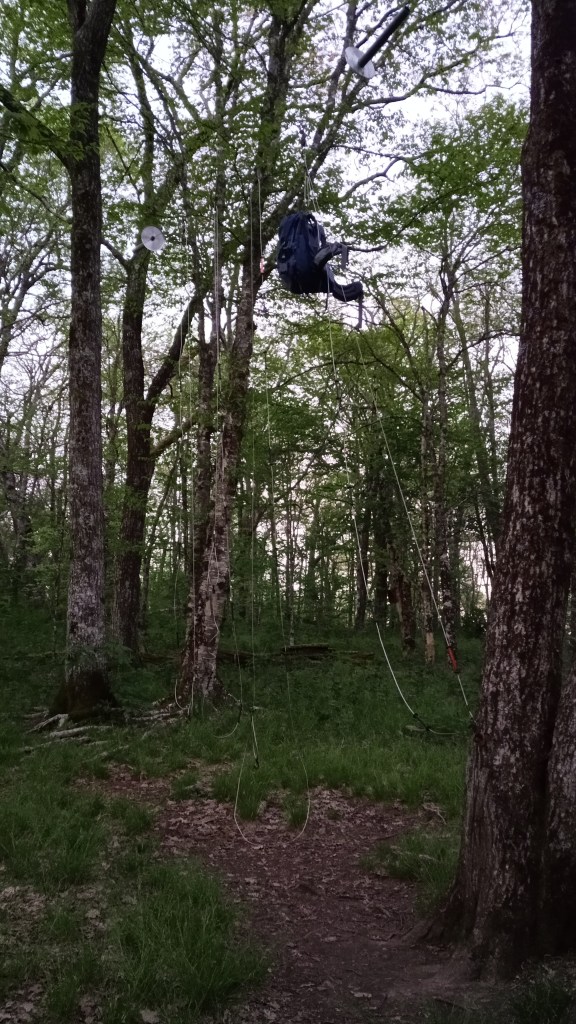
I had a new experience that night! Whenever you’re in bear country, you have to take extra precaution with making sure bears can’t access your food and “smellable” items, both for your and their safety. Usually that means hanging your food bag in trees, but in the Smokies, you’re spoiled with pack hanging cables at every campsite! They were pretty easy to use, and I didn’t have to worry about finding the perfect tree to hang my food from.
I woke up decently early Monday morning, as I was hoping to catch a little bit of sunrise and eat breakfast on top of the bald.
I packed up, got a picture of and said goodbye to my new friends, then hiked the 15 minutes to the top of the bald.
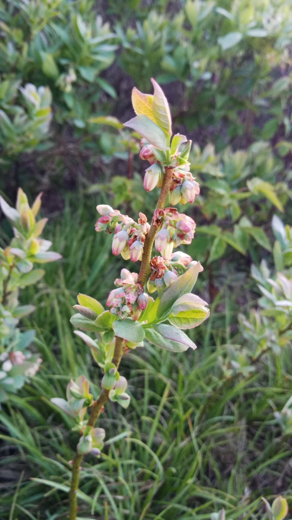
After breakfast, I walked around and explored the bald a little. I was excited to find wild blueberries, though it would be several months before they’d be edible.
I enjoyed the view a little longer, then continued on the Gregory Bald Trail. I had the option of hopping on the Long Hungry Ridge Trail and taking it straight to my campsite, but I decided to hike a little further on the GB trail to the Appalachian Trail.
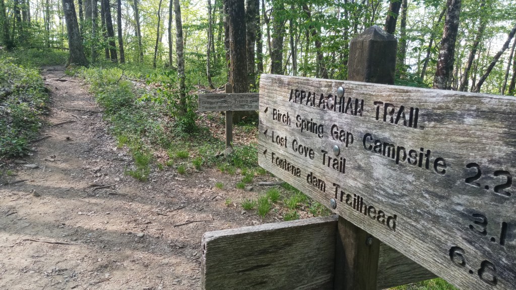
The Appalachian Trail is something I’ve been considering through-hiking for a while now, so I was really excited to get to see it in person. After being on it a few minutes though, my excitement kinda died down, as it seemed a lot like the trail I was just on. I’m not sure what I was expecting, but I kinda overhyped it. In hindsight, though, I’m glad I did it and got to see the famous white blazes marking the trail!
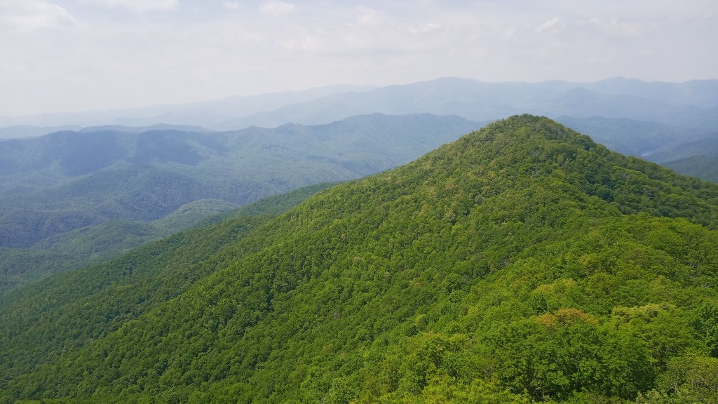
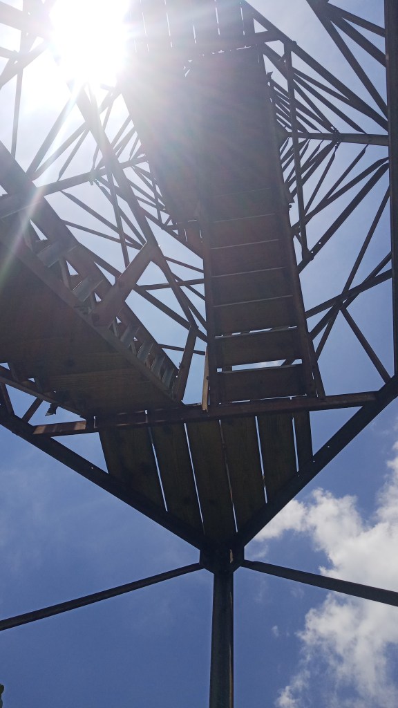
I hiked about three miles to the turnoff for my campsite and debated just heading straight there, but I had heard about a firetower about a quarter mile further on the AT that was supposed to have decent views. After talking with another hiker, I was sold. And oh my goodness, I’m so glad I went for it.
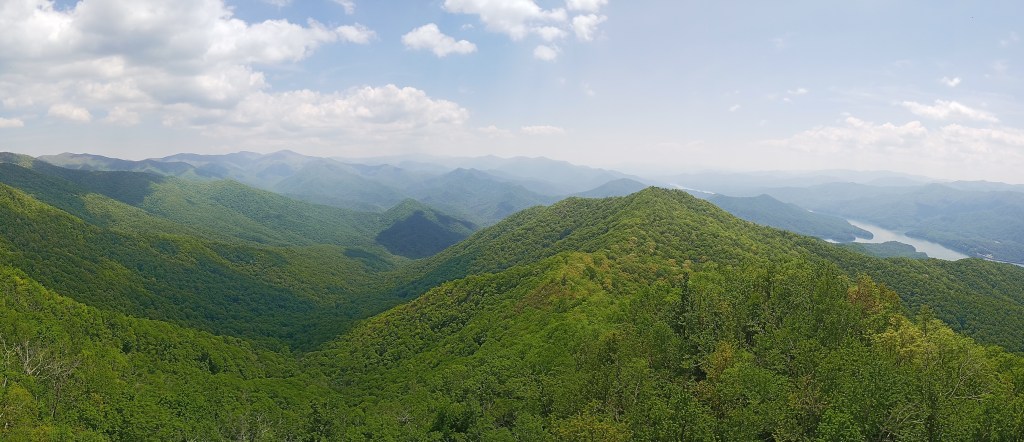
The firetower is called Shuckstack; you can get to it via an unmarked but well-worn side trail from the AT. If you don’t like heights, it may be a challenge for you, but I still encourage you to try it: it had the best views I saw in the park. I think you can make it into a pretty decent day hike from Fontana Dam.
I had the pleasure of meeting a through-hiker who was taking his lunch break up there, and he was really encouraging me to pursue through-hiking the trail. Super neat guy.
After spending probably a good hour there soaking in the views, I started meandering down to my campsite. Today was a downhill day, and it felt so good after the climb yesterday.
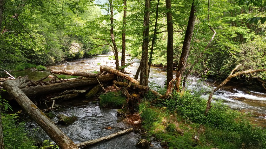
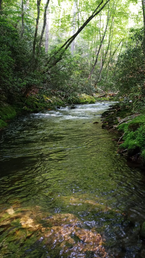
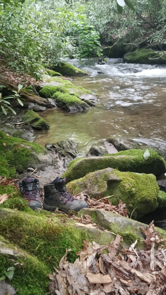
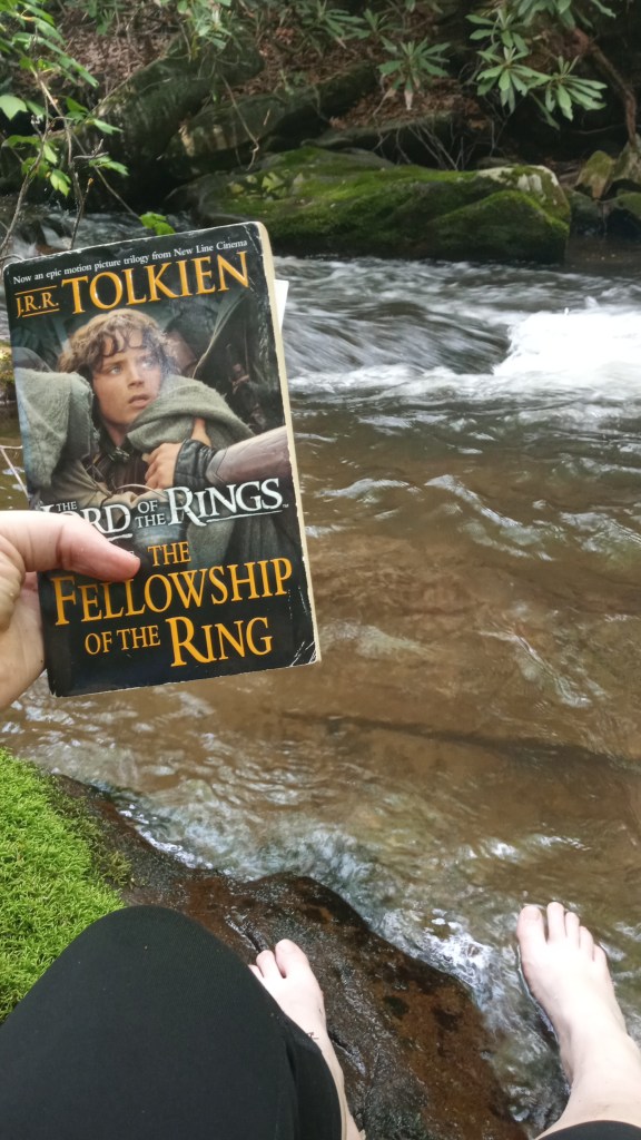
I rolled into camp a few hours later and was pleasantly surprised to have it all to myself. I saw on the map that it was right next to a stream, and I was so excited to take my boots and socks off and soak my feet. It was even better than I imagined: there was a swimming hole very close to the campsite, surrounded by beautiful rhododendron bushes, with the perfect spot to sit and read for a while. And after grabbing a snack, that is exactly what I did for the next several hours. I was so happy…
I finally dragged myself away and set up camp for the night. My appetite had returned with a vengeance, and I was hungry for salt, so I ditched my chicken couscous for beef ramen. That was some of the best ramen I’ve ever had!
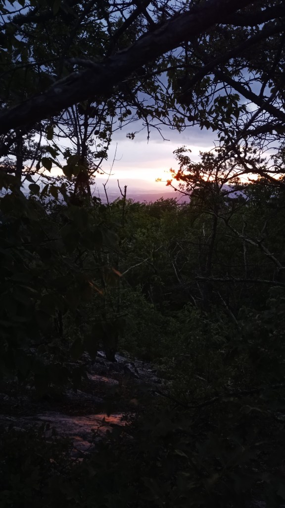
I hung my pack, then climbed in my tent and read for a bit before turning in early. Tuesday morning, I was up early and grabbed a honey bun for breakfast so I could hit the trail quickly. I did stop at the beautiful Twentymile Creek falls for a little while and did a devotion there.
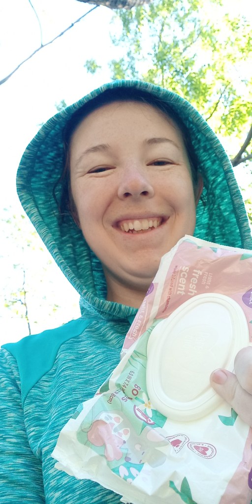
Before I knew it, I was back to the car. I did a quick baby-wipe shower, dunked my hair in the water to get some of the oil out (it didn’t work), then hit the road for Congaree National Park!
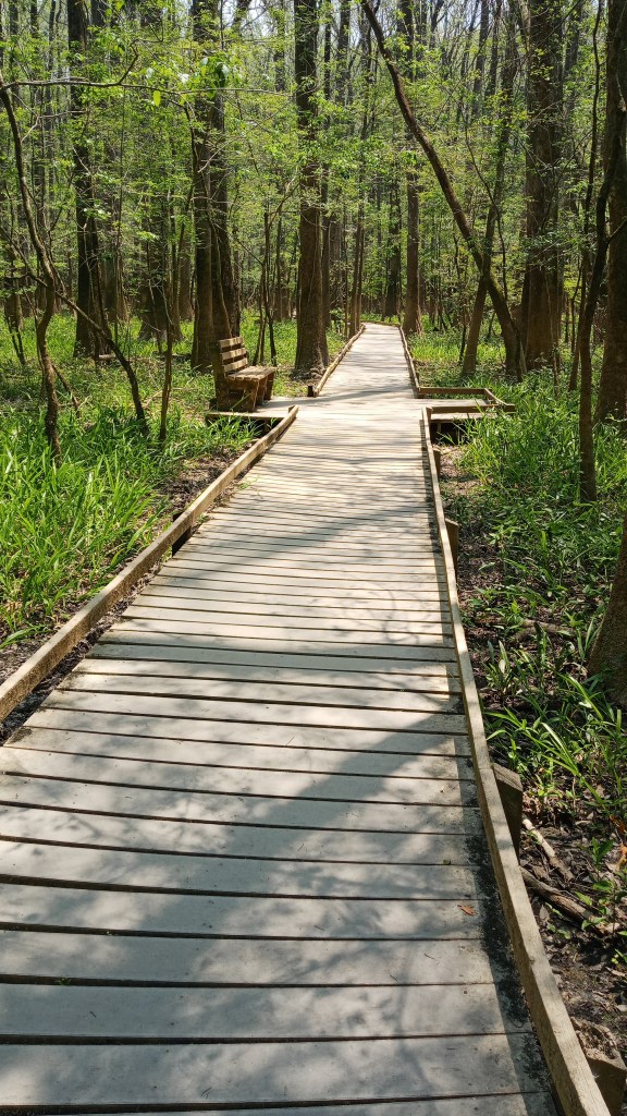
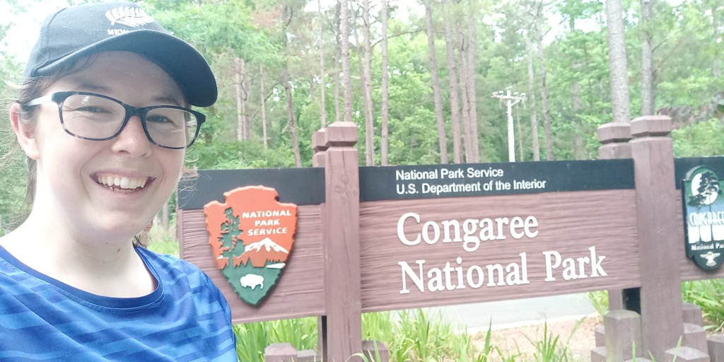
I was almost reluctant to leave the Smokies, but I was also excited to see one of the lesser known National Parks. Congaree is twenty minutes outside of Columbia, South Carolina, and it’s composed mainly of floodplain forest. It’s on the newer and smaller side, so I only budgeted 1.5 days/1 night to see it, and I think that was about right. It’s a cool park, but unless you are a total tree fanatic, you can see all the park highlights within this time frame.
One of the biggest draws of the park is seasonal: the last few weeks of May, a species of rare fireflies that flash in synchrony appears in pockets of the park. Pre-COVID, 18,000 people showed up one year to see the fireflies, but because of COVID, this year they had a lottery system and were closing the park early to all but people with tickets. I just happened to schedule my trip during this time, but I was super excited to see the fireflies.
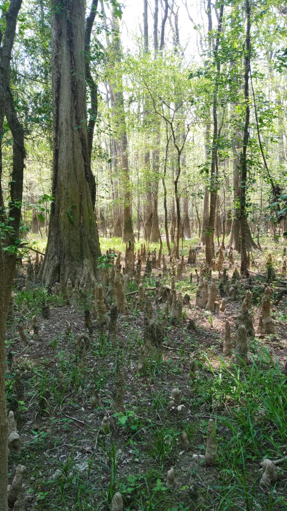
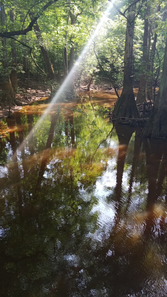
I got there about 2:00 and decided to hike the 2.5 mile boardwalk trail. They offer a self-guided tour so you can pick out some cool sights. One of the coolest parts for me was seeing the bald cypress trees, whose roots send up these strange little nubbins. Scientists speculate they help provide support for the tree, but they’re not sure.
I was originally supposed to do some backpacking that evening near the southern entrance, but when I heard that there might not be fireflies over there, I hopped online to see if there were any last minute campground cancellations, and there were! I was absolutely thrilled.
As it turns out, the campground I booked at, Bluff Campground, was about a mile hike away from the parking lot. This didn’t daunt me since I had my backpack, but if you camp here, plan to be carrying your stuff for a while! There’s also no bathrooms or water at the campground, so plan to hike a mile to the Visitor’s Center for these things.
It was a beautiful hike/campsite, though, and there was only one other couple there!
I set up my tent and fixed dinner. I was really tempted to leave off the rain fly since it was so hot, but I ultimately put it on, and I’m glad I did! A popup shower hit right after I was done cooking dinner, so I ate my mashed potatoes and spam (delicious!) from the comfort of my tent.
About 8:30 or so, I hiked over to a spot on the boardwalk where I had heard there were a lot of fireflies. The next two hours or so were just magical: the rain, which had cooled things off, was dripping from the trees, the crickets were chirping, and the fireflies were illuminating the woods like Christmas tree lights, blinking a softer and bluer light than the ones I was used to. It actually takes them a while to synchronize, but once they do, it’s near perfect.
I was also geeking out because I ran into a computer science researcher from the University of Colorado who was studying the fireflies. We talked for a few minutes about the projects he was conducting and how we both enjoyed travel and hiking/climbing. I also bumped into some cool people I had met earlier.
Unfortunately, I don’t have any good pictures or video from the fireflies, but I highly encourage you to look them on Youtube!
Wednesday morning, I got up and hiked my stuff back to the car, then drove to the Visitor’s Center. I wanted to do the River Trail, a 10 mile lollipop trail that was the only trail to offer views of the Congaree River. If you only have a day in Congaree, I would not recommend this hike: it’s long, is pretty narrow and windy, and has several trees down across the trail, and there’s only one or two spots where you can even see the river. That said, it was kinda nice to log ten miles in this park, and if you’re a real tree fanatic, there’s some big trees along the way.
I hiked out to the Sandbar, and ate lunch, then hoofed it back so I could start the 7 hour drive to Shenandoah.
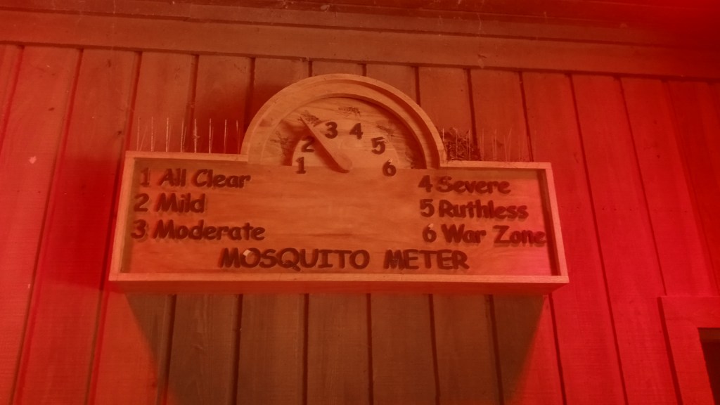
The park is known for mosquitoes, and there’s even a funny sign indicating how bad they are currently, but I lucked out and hardly saw any.
I refilled on water, took a picture by the sign, and hit the road!
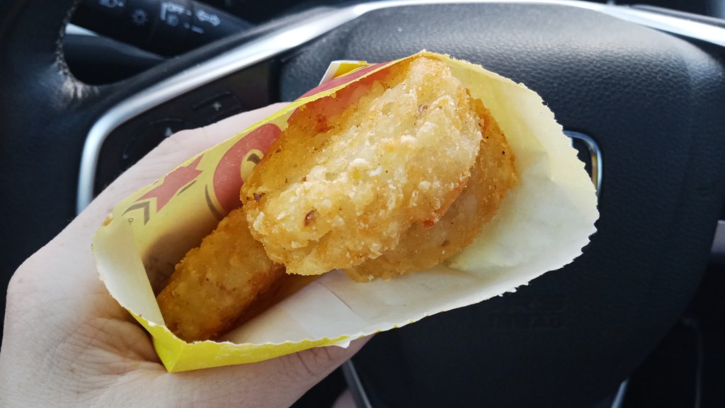
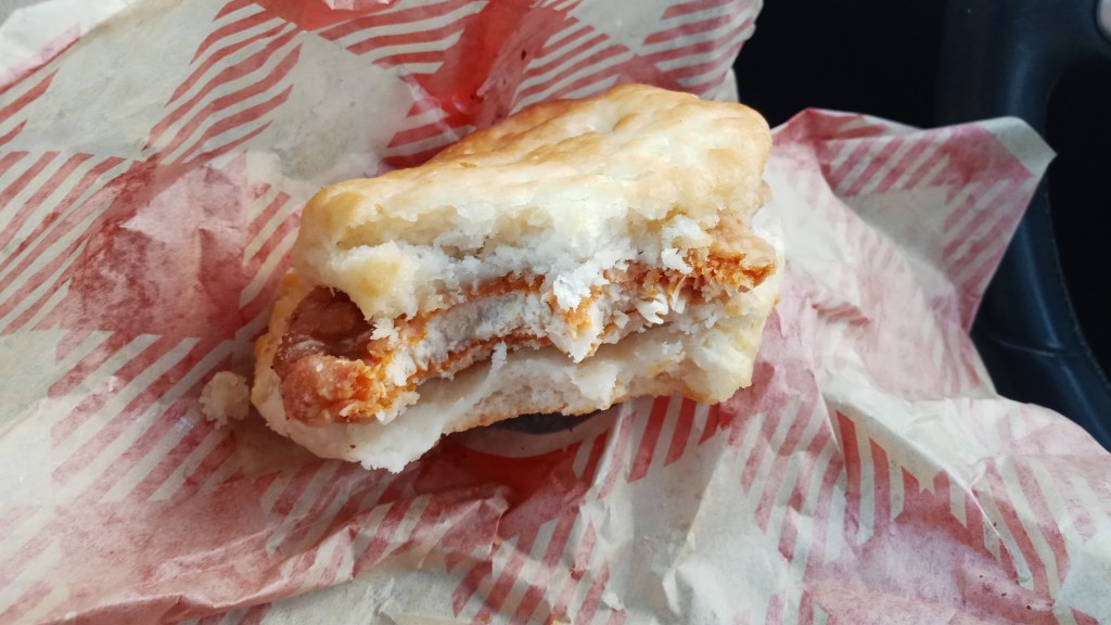
The drive to Shenandoah was pretty long, but I broke it up with a stop at Bojangles for dinner. They’re a popular southern chain and are apparently known for their chicken biscuits, so I decided to try it. I thought the chicken was just okay, but the biscuit and potato rounds tasted heavenly (fair warning: food tastes much better when you’ve just come off a backpacking trip, so I’m probably biased!).
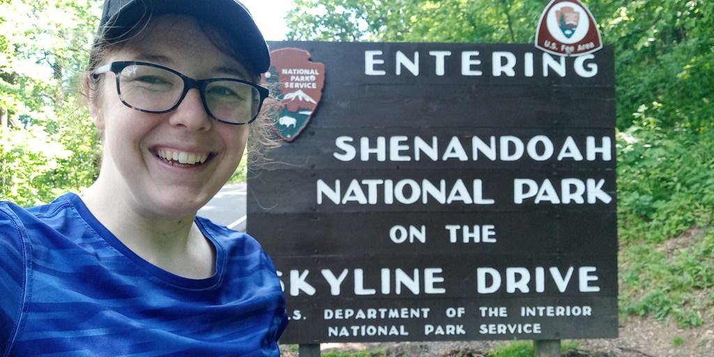
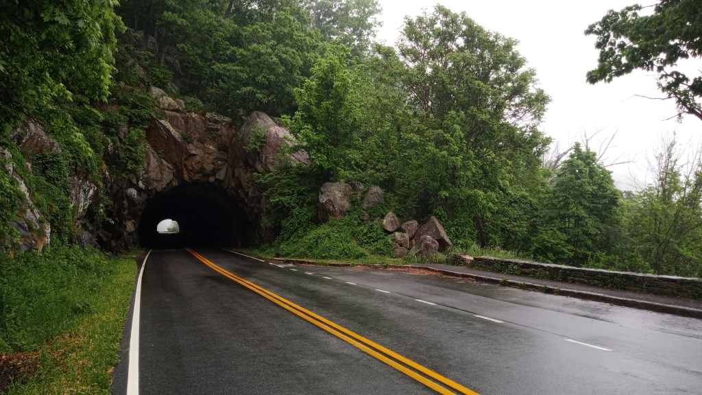
Like the Smokies, Shenandoah is mountainous and contains a good section of the AT, but that’s about where the similarities end. Shenandoah encompasses part of the Blue Ridge mountains and is very long and skinny; the famous Skyline Drive, which is over 100 miles long and takes three hours to drive, runs the length of the park and offers over 75 lookouts. Most of the trails spur off of Skyline, which means you often hike down then hike up on the way back. Definitely not like the Smokies, where you had to work for your views! Also, backcountry camping at Shenandoah means finding a spot that fits the rules and camping there, unlike the reservable backcountry sites at the Smokies.
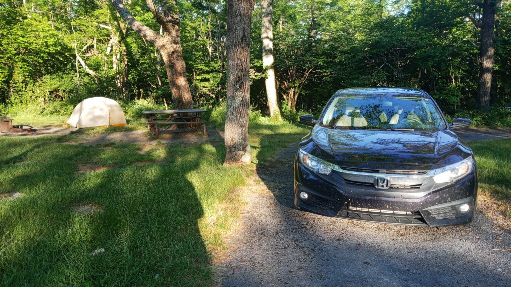
I had a reservation at Loft Campground, the southernmost and largest in the park. I got there late, set up my tent and crashed.
Thursday morning I took a baby wipe shower, packed up, checked weather, and drove back down to the entrance so I could see the parts of Skyline I had missed in the dark.
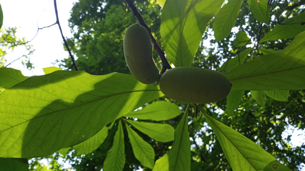
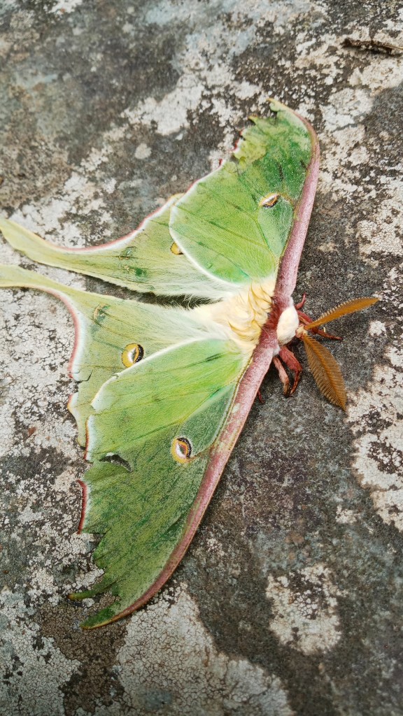
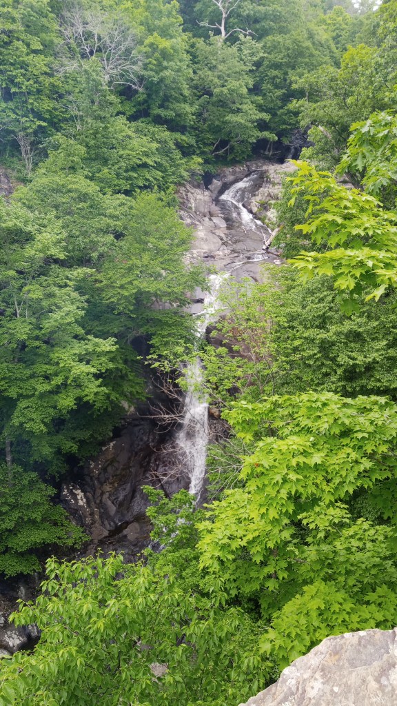
I had a backpacking route planned, but I realized it probably wouldn’t take me all day, so I spontaneously hiked to the Jones Run Falls. The falls were super neat, and I also stumbled across a beautiful moth!
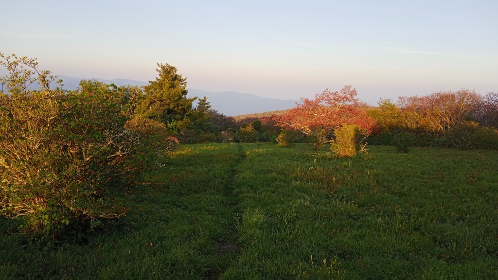
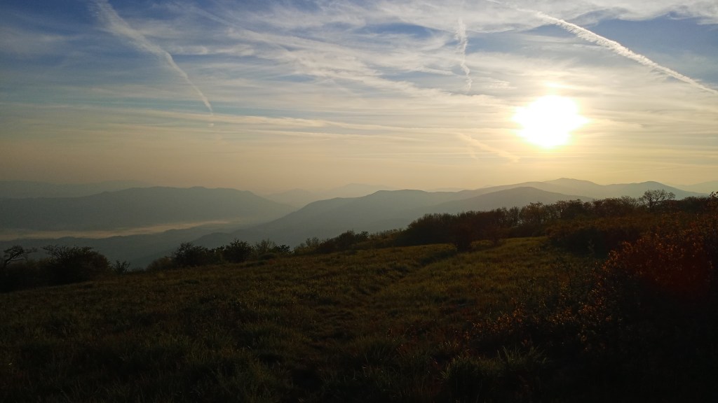
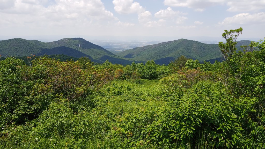
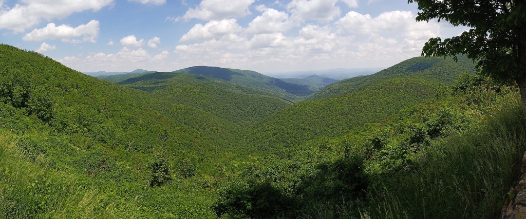
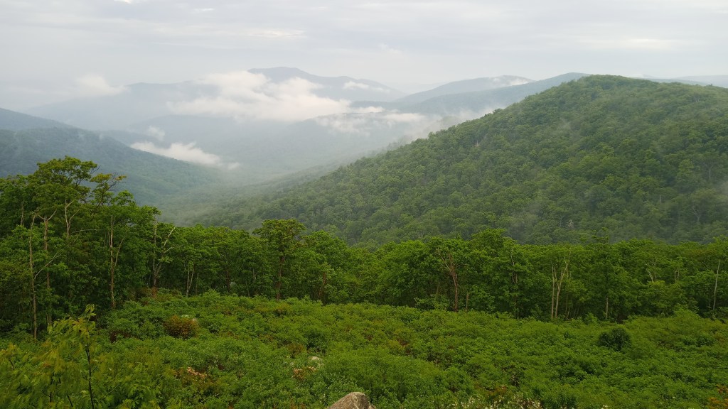
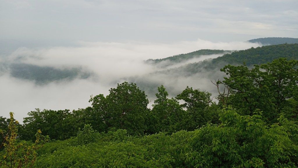
Back on Skyline, I stopped at some more beautiful overlooks…
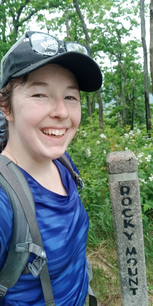
…then headed for the Rocky Mount trail. I picked this one because there was supposed to be a singular campsite with incredible views. There was no parking lot at the trailhead, which made it a little tricky to find; I just parked at the nearest overlook and hiked a short distance to the trailhead.
Most people just make a dayhike of the route shown in blue above, but I decided to backpack the whole loop counterclockwise. It was very isolated – I didn’t see another soul the whole trip – but surprisingly well maintained.
There was a mile or two of downhill along the lollipop “stick”, and I got some decent views.
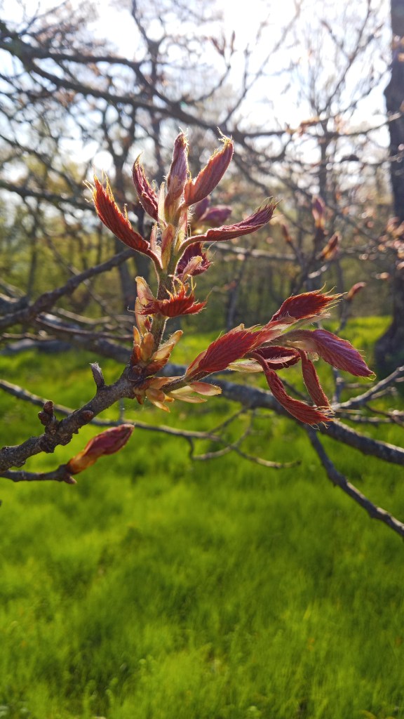
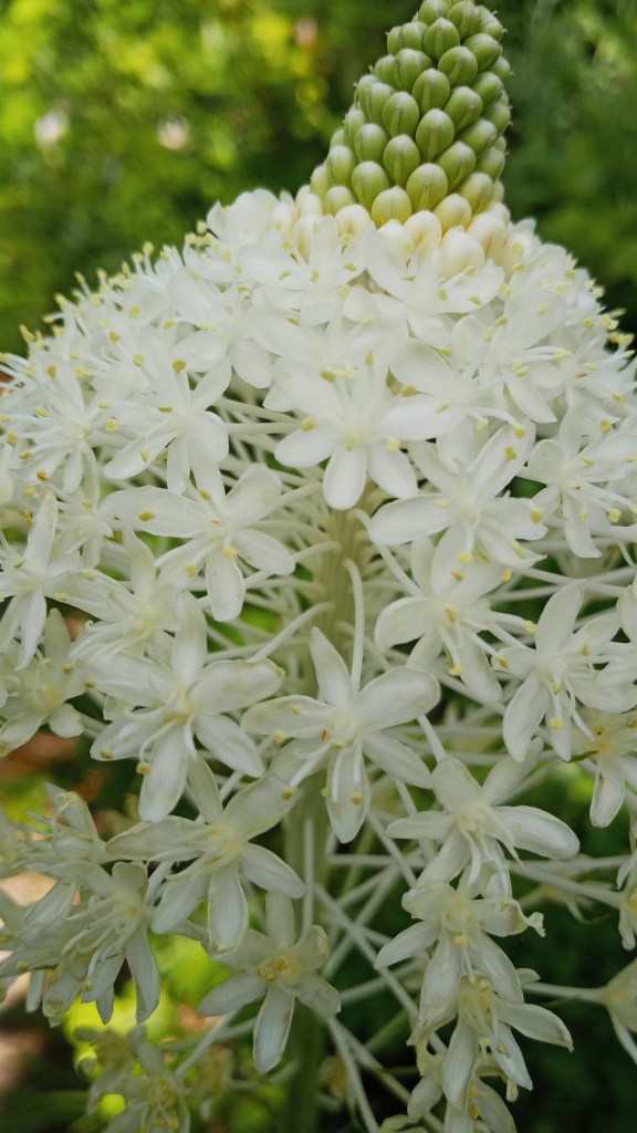
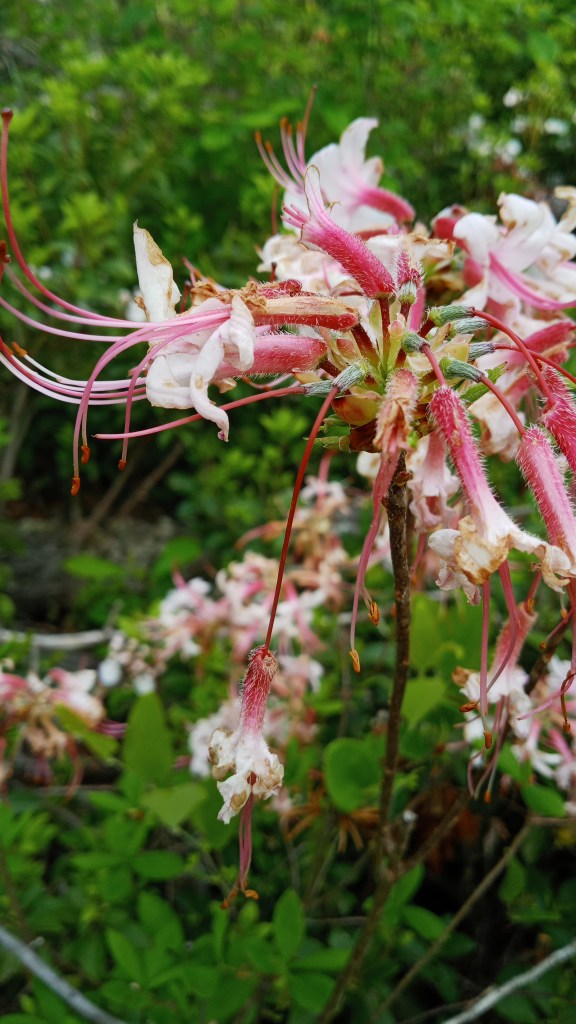
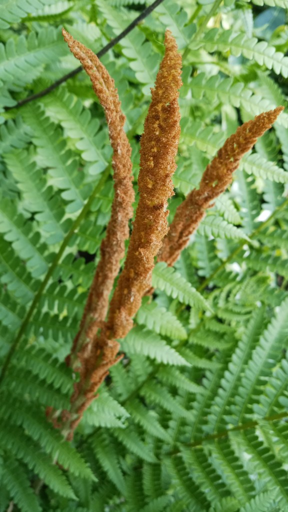
The Gap Run section was pretty flat and went by quickly. Though there weren’t vistas, there were some neat plants I hadn’t seen before!
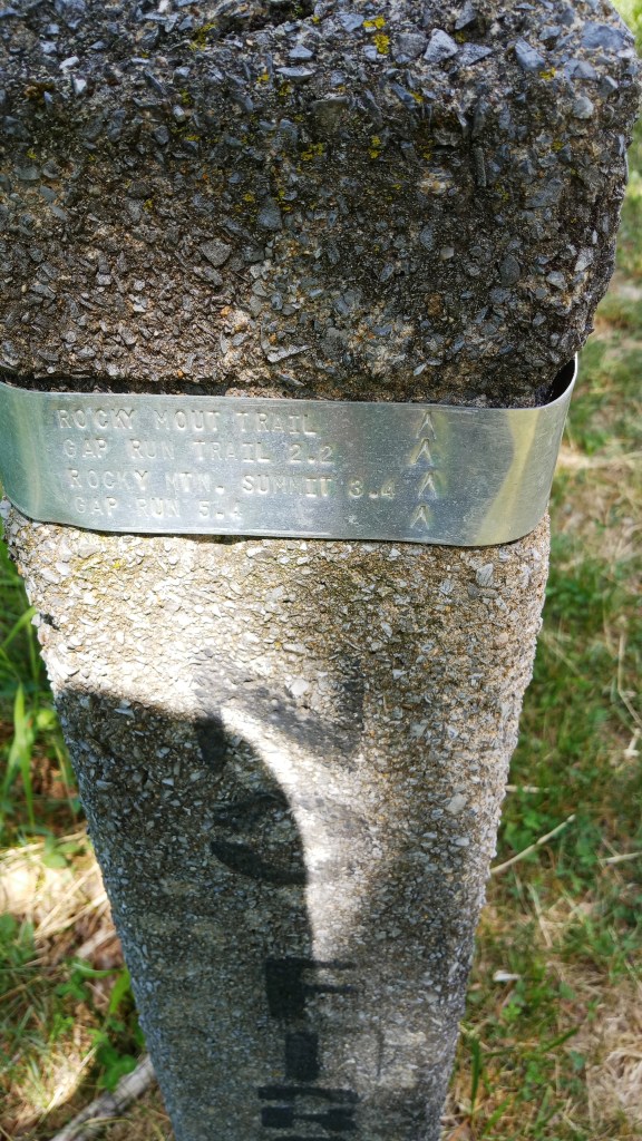
Another interesting aspect of Shenandoah is that trail markers are concrete posts with metal bands that are stamped with trail information. You can see the one below for the turn off for Rocky Mount.
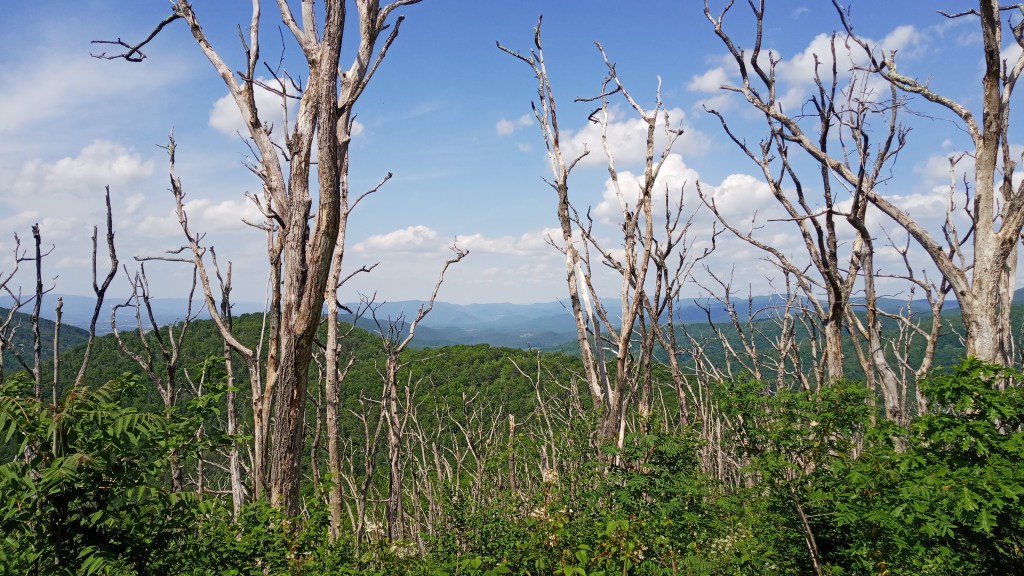
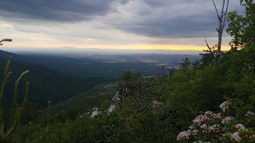
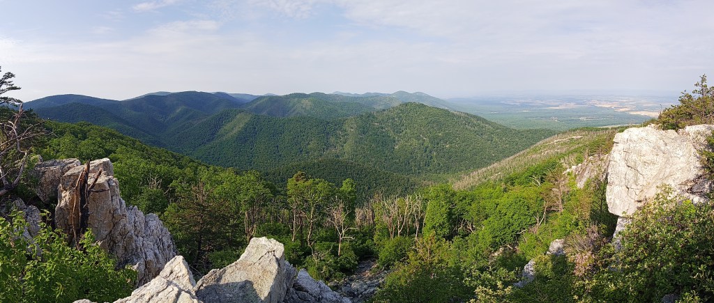
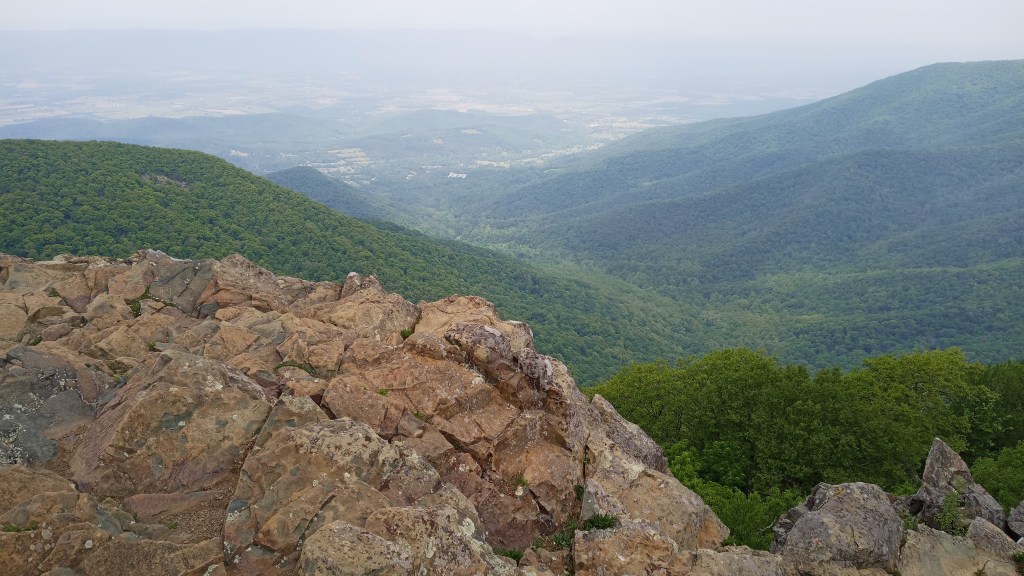
After turning onto Rocky Mount, things quickly got steeper. It was a good, challenging hike up to the summit. The problem was, I couldn’t find the summit. I stopped a few times before I kept hiking and finally stumbled across the summit.
The views really were pretty awesome.
However, I was worried about camping there, partly because it was so close to the trail and partly because it was exposed and it looked like rain might be coming in. I crawled through the bushes for a few minutes and stumbled on this awesome little clearing that was just steps from the trail but still hidden.
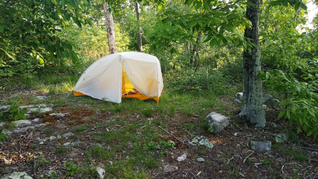
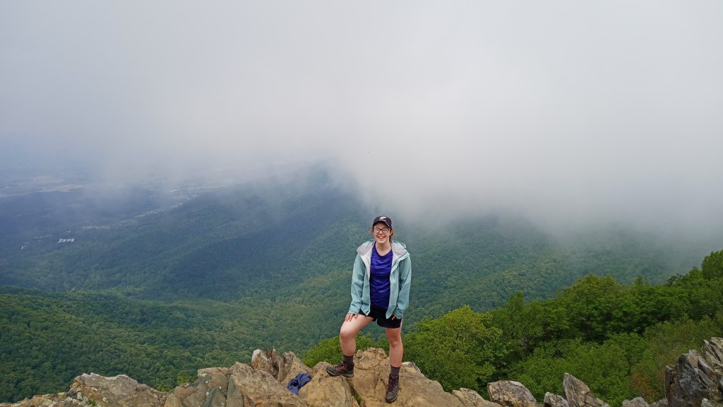
Reassured that I had a safe place to sleep, I went back to the summit and made dinner with that awesome view. I amused myself by calling my little setup Ray’s Cafe, with a different location every night.
Unfortunately, Ray’s Cafe that night had a great location, but pretty so-so food. My stuffing with chicken was a great idea, but execution was another matter. I’ll have to play with that one a little.
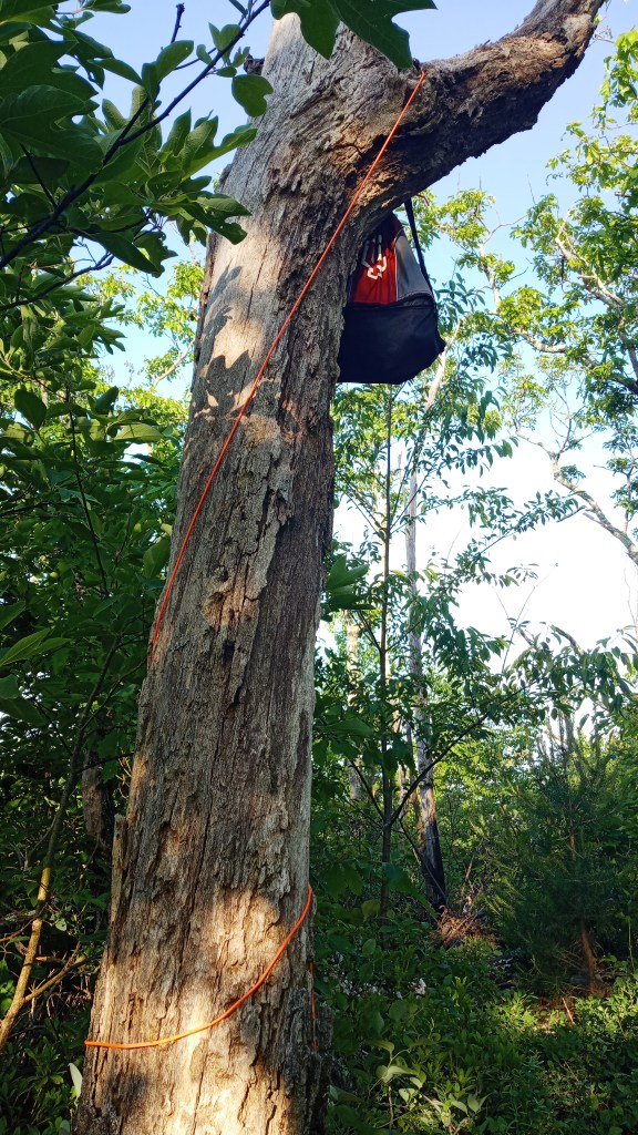
After dinner, I hurried back to my site and set up my tent before dark. I had a new experience that night: hanging a bear bag. I didn’t follow the exact rules of hanging it on a branch so far out from a tree, so please don’t use my photo as an example, but I felt a huge sense of accomplishment just getting it up in the tree.
Friday morning was bright and sunny when I woke up. I retrieved my bearbag, grabbed a small breakfast and packed up. I spent a few more minutes at the summit enjoying the views, then hiked down and stumbled across the actual campsite advertised online. It did have some pretty amazing views, but I was pretty happy and felt safe with the little clearing I had found.
It was largely downhill until I got to the lollipop stick, and then it was uphill back to Skyline. Overall, it was a pretty good hike, but if I did it again, I would probably skip Gap Run trail and just hike up to Rocky Mount. If you can’t get a spot at Rocky Mount, though, there are a few sites along Gap Run, as well as access to water – water was scarce to nonexistent on the Rocky Mount section.
Ta-da! Done.
I kept driving north on Skyline and stopped at Hawksbill Mountain. This is the highest point in the park, but it’s only a two-mile RT hike from the trailhead. Unfortunately, the clouds moved in while I was up there, but it still had some pretty sick views.
I also hiked to the White Oak Canyon Upper Falls, which was about 4.6 miles round trip. It was much taller than Jones Run, but you couldn’t get up close to it; you could only really see it from the lookout. I much preferred Jones Run, but it was still pretty.
Back on Skyline, I got some good but cloudy views from a few lookouts. I also grabbed another neat letterbox!
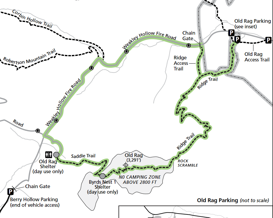
My final stop for the night was the Old Rag trailhead. Old Rag is probably the most popular trail in the park and also happens to be one of the few trails not really accessed via Skyline. You have to drive outside of the park, then back in from the side to reach the two Old Rag trailheads. The whole trail is about 10 miles, and there’s a couple ways you can hike to the summit: 1) Park at the Old Rag TH and hike the entire loop, which includes a 1+ mile rock scramble; 2) park at the Old Rag TH and take the old fire road in to the summit and then back out; 3) park at the Berry Hollow TH and take the fire road in to the summit. Despite a ranger cautioning against doing the scramble while wet, I decided to do option 1.
I technically had backpacking permits for the area, but I was tired, and it was raining, so I parked at the trailhead and decided to sleep in my car.
Saturday, I woke up early, grabbed a quick breakfast and hit the trail before too many Memorial Day vacationers got there.
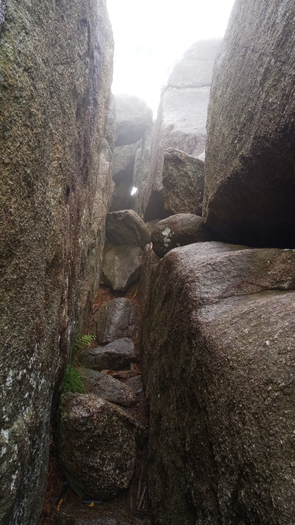
And boy oh boy, what a fun trail it was! The rock scramble section was slippery, and the normally beautiful views were completely obscured by clouds, but it was still a blast. If you have the option though, I would definitely do it on a dry sunny day with someone else. It was kinda easy to get turned around, and I learned later that someone had broken their ankle on the trail the day before and it had taken 10 hours to rescue them (and that was considered a short rescue!).
This was the only picture I got on the rock scramble because I was often using three or four limbs to climb over rocks. If I remember right, it was one of the sketchiest sections of the hike: you had to climb down from the left side, with just a little foothold to grab onto. Shew!
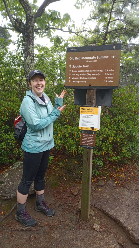
I finally made it up to the summit, where I met a group of three other women who were breaking for lunch. I asked if I could join them, and they gave an enthusiastic yes. We didn’t break for long because it was cold and barely 60 degrees – a far cry from the 90+ degrees I had a few days ago in Congaree! They took my picture by the summit, and I ended up hanging out with them the rest of the hike. We cracked jokes about how great certain lookouts would be if we could actually see anything, and how reviewers had labeled the downhill section of the trail as boring. (“Nope, not boring yet!”) It was a great time.
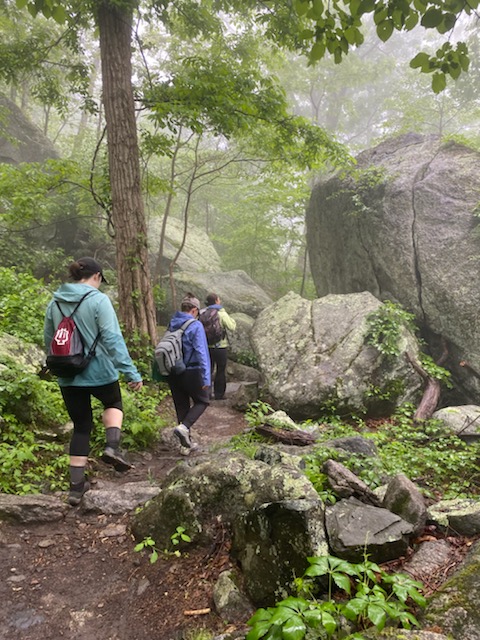
After about six hours of hiking, we made it back to the parking lot, tired and wet but happy. We parted ways, and I took a babywipe shower and changed into dry clothes before hitting the road again. Even though it was really cloudy, I decided I wanted to finish out the rest of Skyline Drive, so I headed that way.
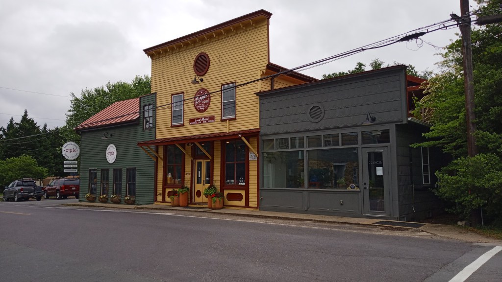
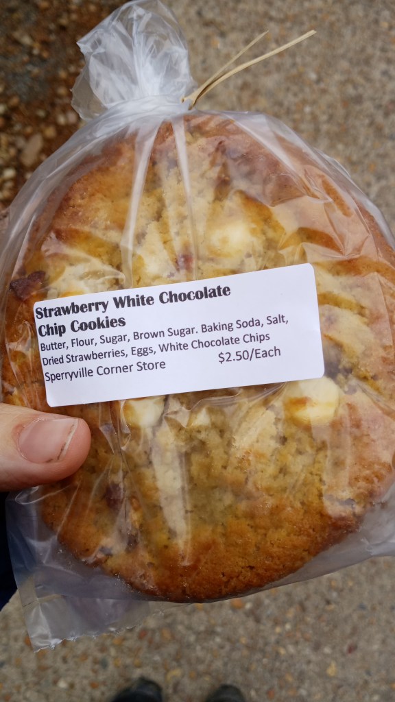
On my way back, though, I stopped in the adorable town of Sperryville and walked around for a little while. There was the Corner Store, from which I grabbed some strawberry white chocolate cookies…
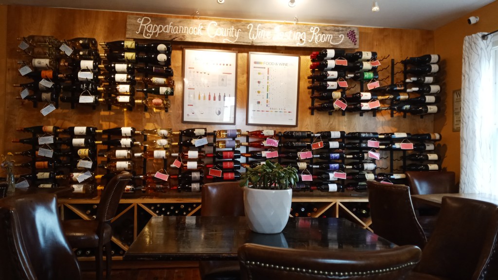
…and a coffee/gelato/wine place called Before & After for a hot honeysuckle latte. It was pretty wonderful!
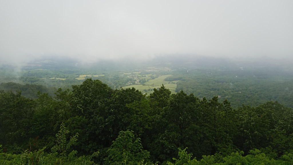
Nearly all the lookouts at Skyline were unfortunately whited out from the clouds. It wasn’t until elevation started dropping that I could see anything.
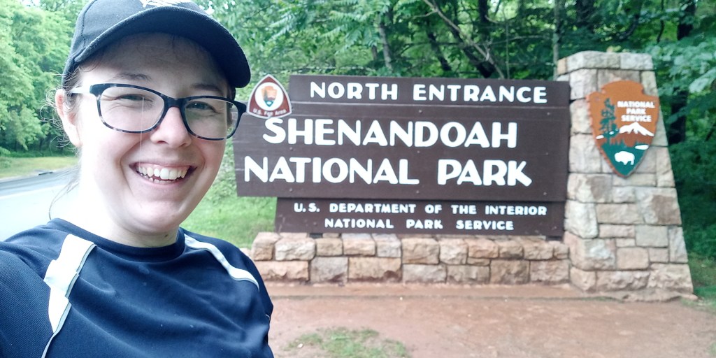
Finally I reached the northern entrance! I drove all 100 miles. Maybe someday I’ll come back and hike all 100 miles of the AT that runs alongside it.
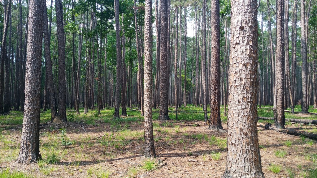
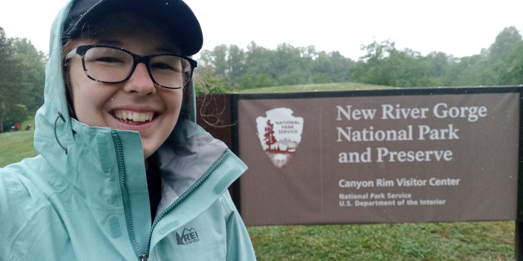
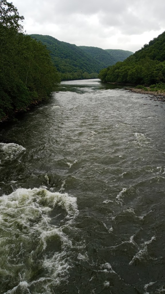
Next destination: New River Gorge NP in West Virginia! The drive was only supposed to be about 3.5 hours, but I got stuck in accident traffic for an hour and a half and didn’t get there until about 11:00. Normal campsites at New River are supposed to be free and first come first serve; I accidentally picked a group campsite (Burnwood), which is apparently not free and is supposed to be reserved. Luckily for me, the group staying there was super nice and let me pitch my tent near them.
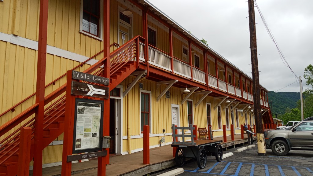
It drizzled most of the night, so I was reluctant to get out of my warm dry sleeping bag the next morning. I finally got to use my hot chocolate though! After hanging out with the group for a bit, I drove across the road to the Visitor’s Center, where I picked up some maps and got a picture with the sign.
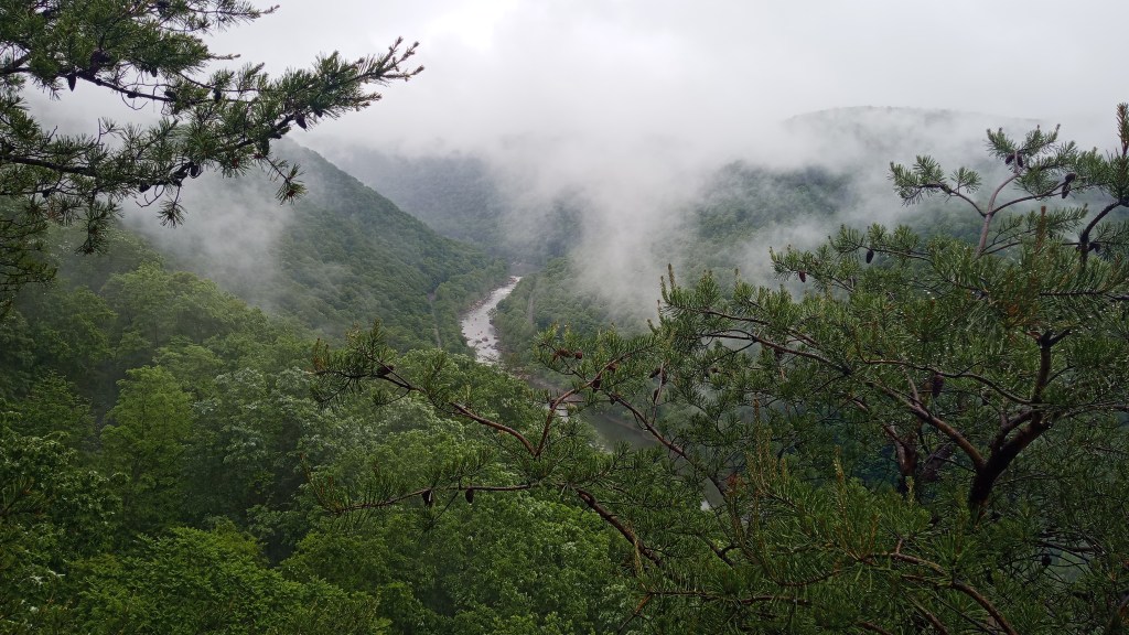
The park is so new that most of the signs still say National River; the main entrance sign just had a canvas wrapped around it.
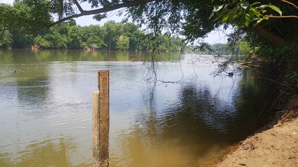
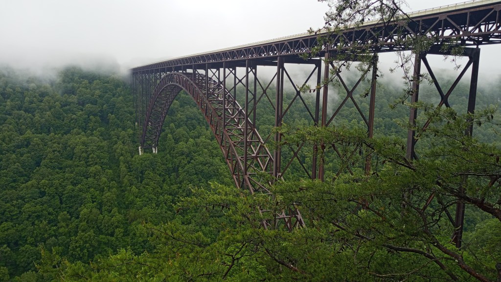
I also did a little hike to see the New River Gorge Arch Bridge. This bridge was super important to the community, as it reduced a 45 minute, winding drive down the gorge to a 2 minute straightshot across. It’s the third-longest arch bridge in the world; plus it makes for great photos!
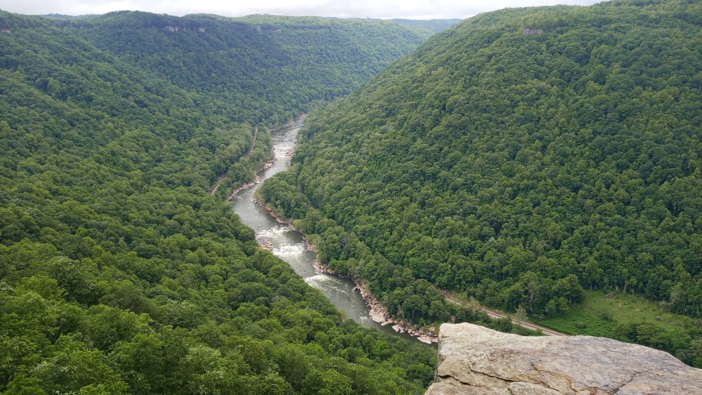
Next up, I decided to hike the Endless Wall Trail to Diamond Point, which was an easy two miles RT. It was pretty neat, especially since I was going to be rafting that section of the river the next day!
My plan was to head to the tiny town of Thurmond after that, but I hit a hiccup when I got a flat tire. I was okay, and was actually really fortunate it happened in civilization rather than on a windy deserted country road. About three hours later, I was back on the road with a new tire, thanks to Walmart!
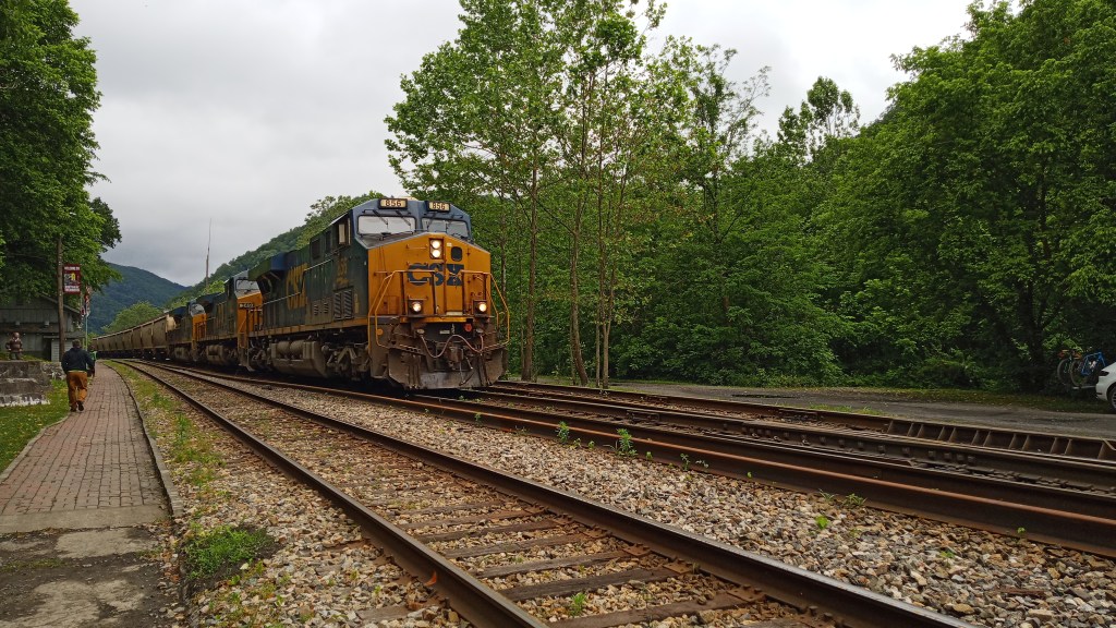
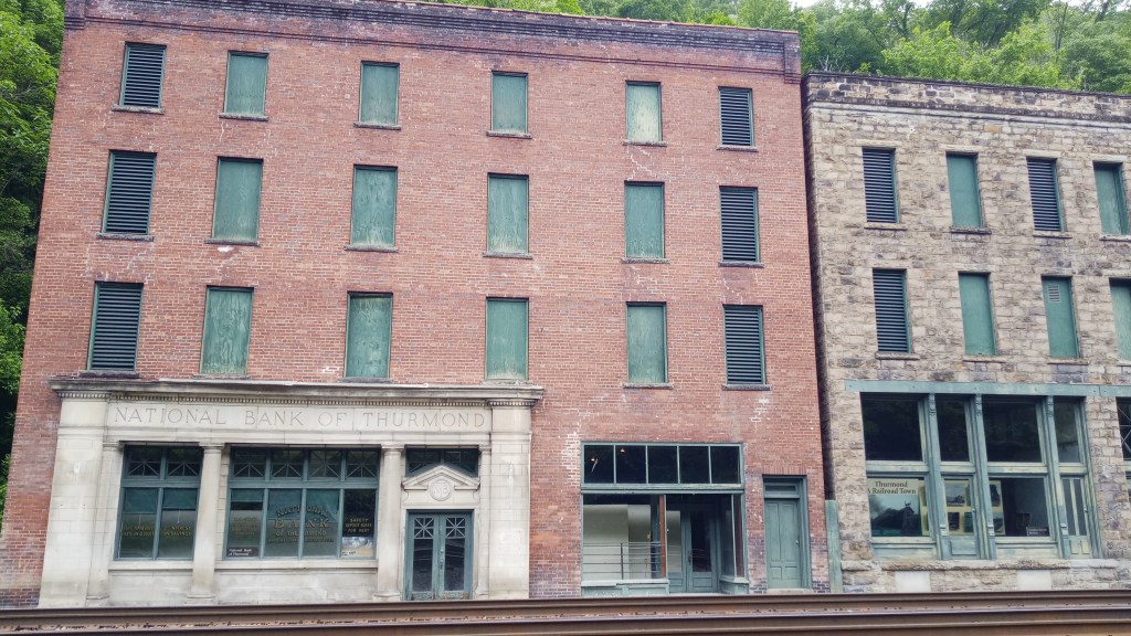
I still ended up going to Thurmond, and it was pretty neat! It’s an old railroad town that thrived off of mining traffic. There’s no shops open there today, but there’s a seasonal visitors center set up in the old depot. The tracks are still active, and it was pretty cool to have a train come through.

After that, I made the unfortunate decision of taking the scenic route (McKendree Road) to my next destination rather than going back out to the highway. The road quickly turned into a four wheel drive road with no cell service, a top speed of 12 mph, and no houses. I was utterly terrified, but my poor Honda Civic pulled through! I’ve never been so glad to see a paved road…
I learned after the fact that there actually used to be a hospital in the blip-on-the-map town McKendree. If you’re intrigued, it’s an interesting story!
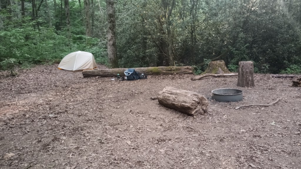
Unfortunately, that little sojourn cut my daylight significantly, and I decided I didn’t want to test my nerves any further by trying to finish a hike before dark, so I sought out a campsite for the night at Grandview Sandbar. My camera ran out of room, so I wasn’t able to get a picture of my site, but it was decent!
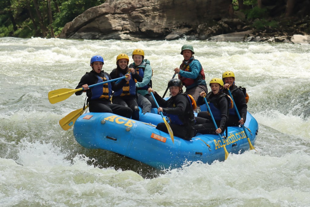
I treated myself to a can of soup for dinner, then read for a little while and fell asleep. Monday morning I packed up early and headed for the ACE Adventure Resort for a 14 mile whitewater rafting trip! I was paired with a mom and four teenagers on my raft, and while there was a little drama, we made it through okay. My guide was really knowledgeable of the area, and we bonded over experiences in New Zealand.
The river was pretty flat the first half of the trip, but it soon picked up after lunch (included!). We hit multiple fun rapids, surfed, and even swam a little bit. It was a great day, and a lot warmer and sunnier than the previous few days! A good way to end the trip.
I had been hoping to do one last hike before heading out, but we got back pretty late, so I made the adult decision and drove the seven hours back home. After 11 days, 70+ miles hiking/backpacking, 2000+ miles driven, 5 pounds lost, 4 parks and 14 miles paddling, my shower and bed had never felt so good!
Well, that’s all for this one folks! Kudos if you made it this far. Next trip will be to Colorado, so stay tuned for that!
