Hello all! What a crazy, crazy year it’s been. At the same time, though, I feel so, so blessed, not the least because I’ve been able to get out of the house and still have a few adventures.
This adventure took place late May of 2020 in the Big South Fork National Recreation Area in Kentucky and Tennesee. This was really my first time out of the house after I was sent home from college in mid-March, and it was a nice reward for graduating and a pre-work/adult-life trip!
We got to brainstorming when we found out Braden (my younger brother) had an ideal finals schedule for taking a trip. We were initially thinking of going to Boundary Waters, but it was a long drive for a short trip. I suggested the Big South Fork, since it was closer and I had never been there. I also wanted to go backpacking, and there were a decent number of trails there. That quickly got the wheels turning, and before long we were decided!
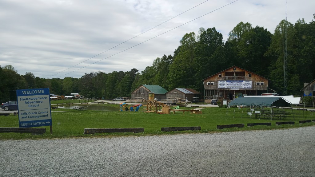
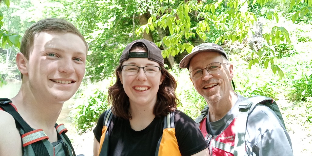
We met Braden in Indy on Friday and began the long drive down. We took our truck, which we hauled the kayaks in, and a car in order to do shuttles. We stayed at the Sheltowee Trace Adventure Resort a little ways outside of the BSFNRA to break up the drive a little. They had covered tent platforms, which were really nice because we didn’t have to pack up dewy tents the next morning. Overall, we had a very good experience there – nice showers, and even wi-fi! Normally I would scoff at wi-fi at a campground, but it was really nice for planning purposes.
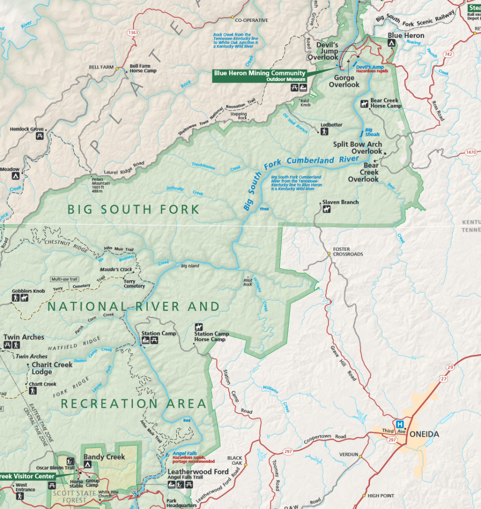
Dad had been keeping a close eye on water levels the past few days; we had hoped to do a section (I think it was the North White Oak Creek?) but we determined Saturday morning that it was just too low. We decided to split the trip into two smaller sections: Peters Bridge to Burnt Mill Bridge for the first 1.5 days on the Clear Fork, then Leatherwood Ford to Blue Heron on the Big South Fork in . Below is a map of the first part. And yes – the BSF and tributaries run from south to north! It confused me too. On the map below you can see the first part of our trip.
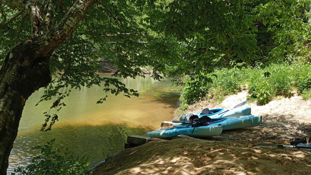
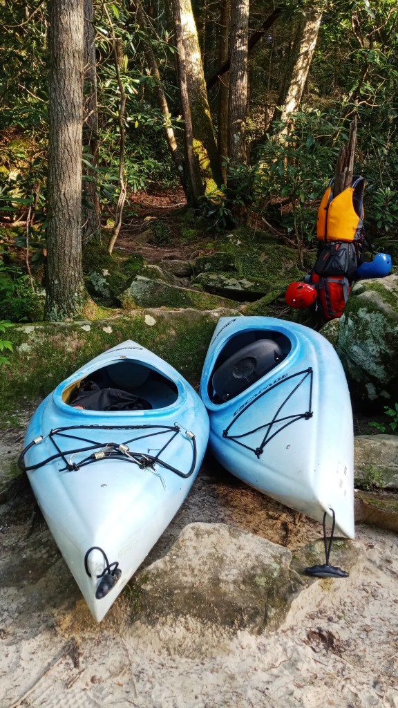
It was a good little drive to Burnt Mill from Sheltowee Trace – some of those back roads are wild! We dropped off the car and took the truck with all the gear to Peters Bridge. Since it was about 1:00, we took a lunch break before finally putting on the water.
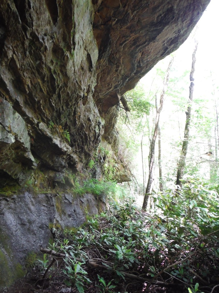
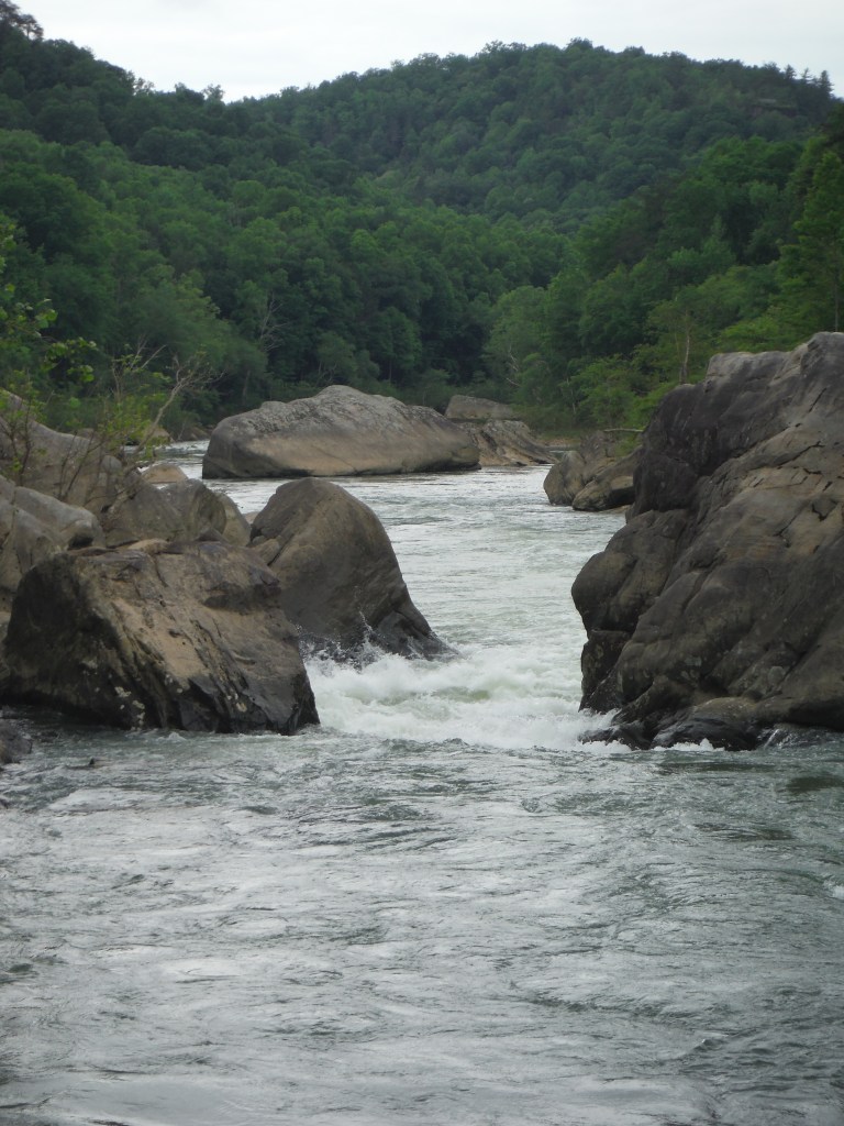
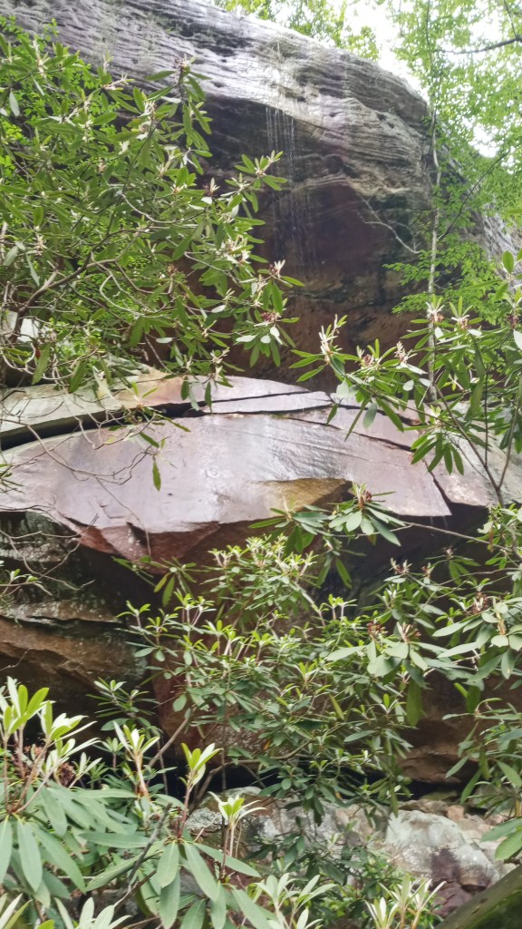
This first section of water started off at a decent pace. The banks were decently high along here, and there were some nice exposed cliff faces – Dad hopped out and took some pictures of some of them.
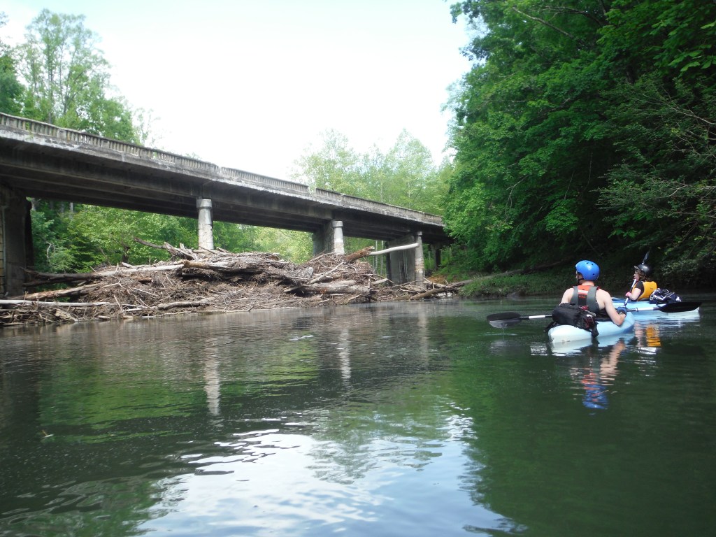
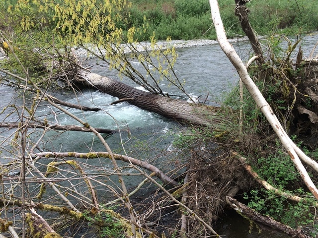
We did hit a massive log jam at one bridge, but there was a small path through it, thankfully.
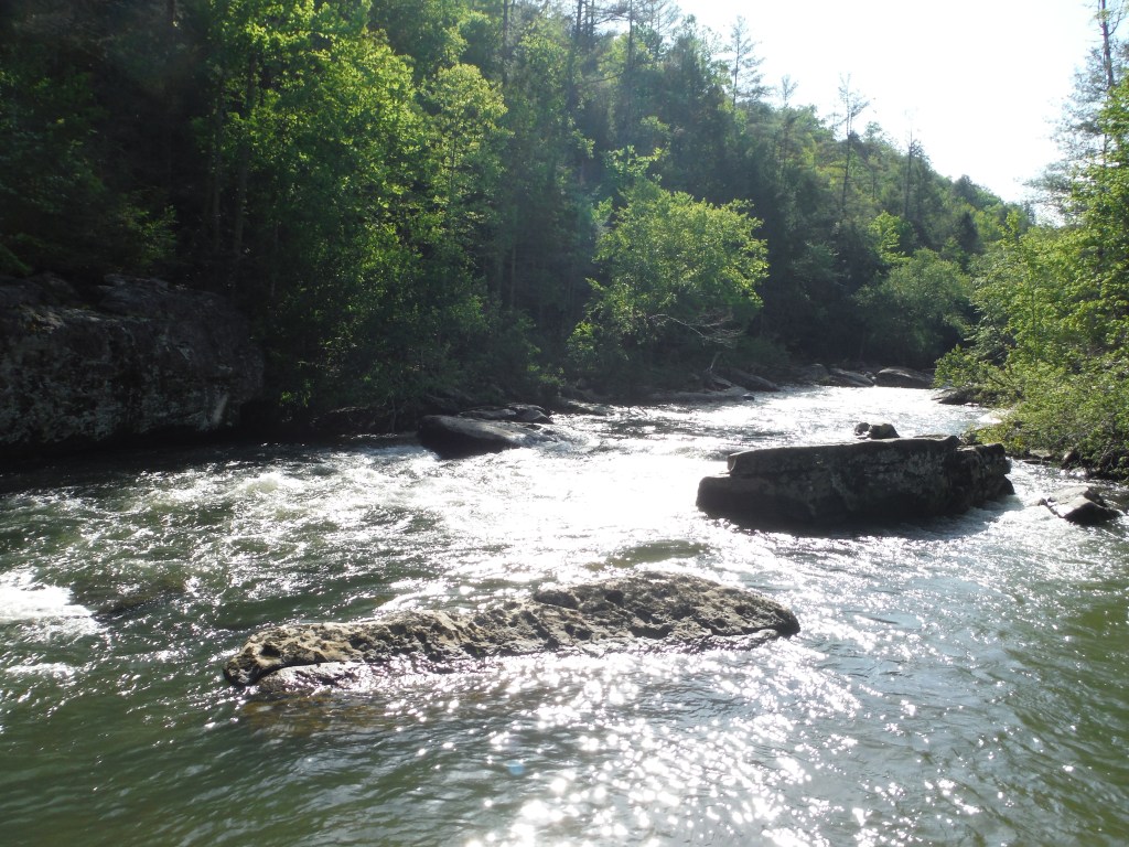
Things really seemed to pick up later on that afternoon. All rapids on this stretch were designated a Class II or lower, but we felt they were definitely a high Class II!
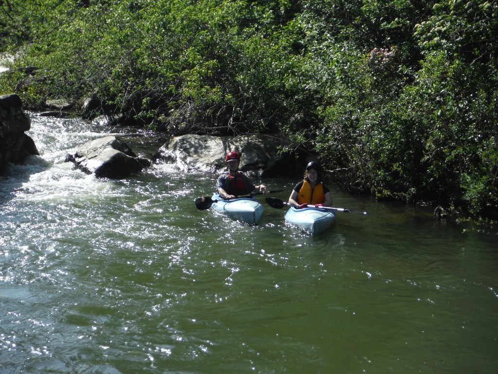
Braden was the first of us to dump – somehow I made it through this rapid! He made the most of the opportunity, though, and climbed up on some rocks to get some pictures.
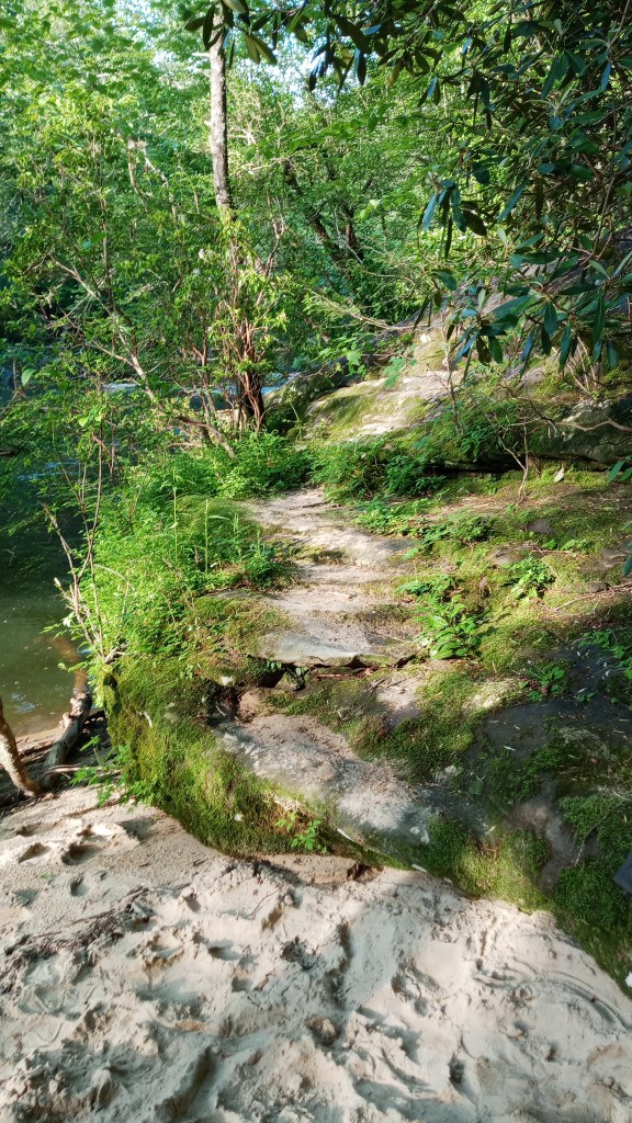
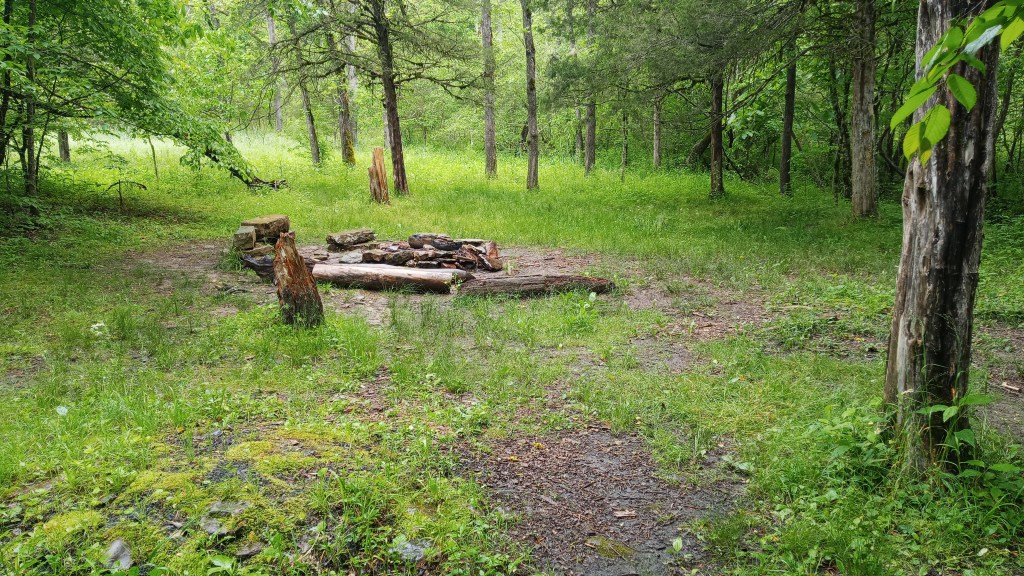
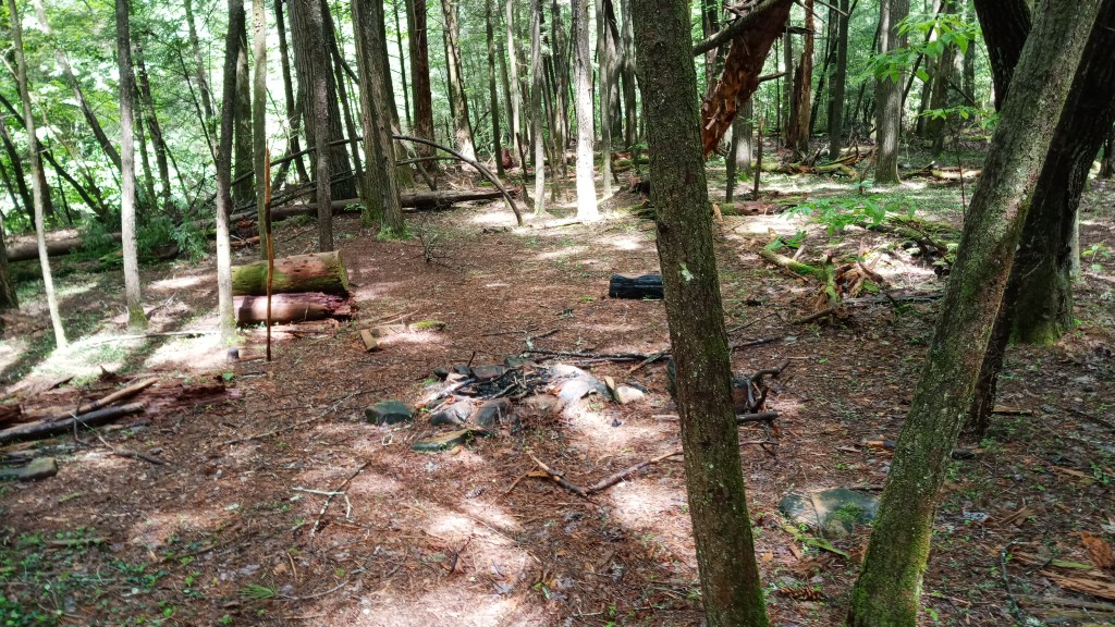
My luck ran out, though, a little further downstream, and I got caught on a rock and tipped. Braden managed to ferry me over to the bank while Dad did a “rescue” on my kayak. It was about 6:30 at this point, and after not having done a kayak trip in a while, I was worn out and not too anxious to get back in the kayak now that I was all wet. While I waited for the boys, I started exploring with the hopes of making camp for the night, and was delighted to find an amazing camping spot tucked away among some rocks and plants.
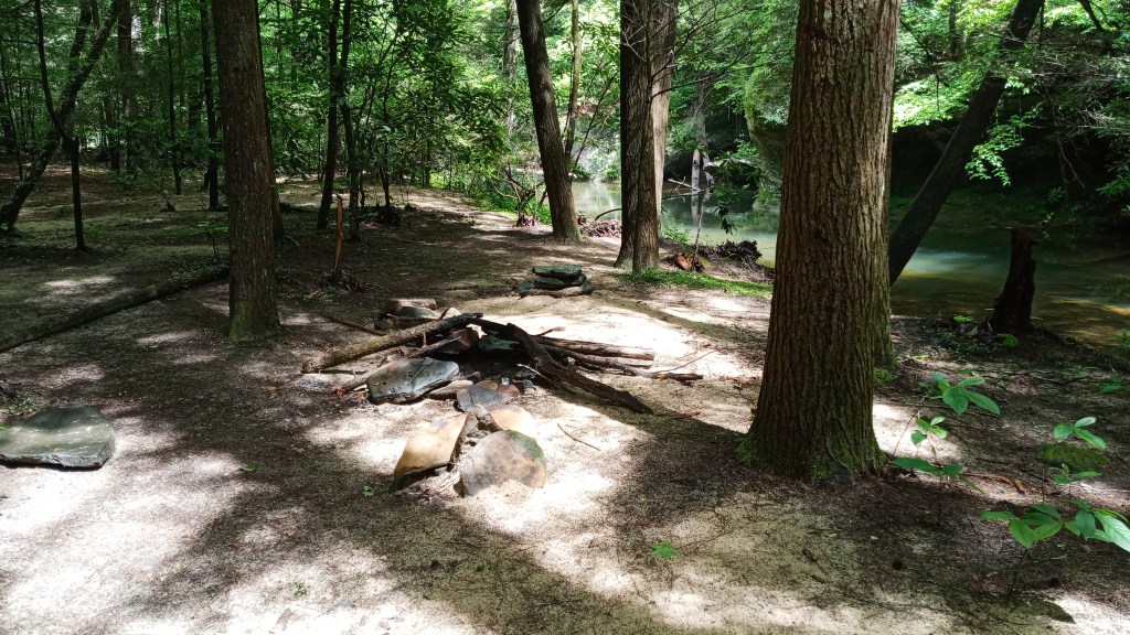
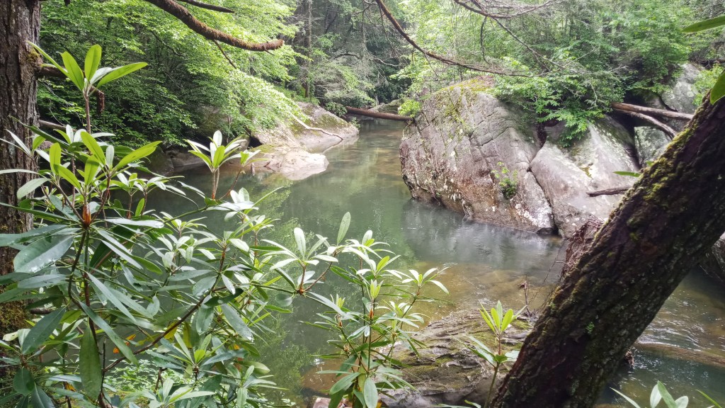
As we figured out, I just so happened to dump right next to the Gentleman’s Swimming Hole, a long established favorite with the locals. I was absolutely enthralled and quickly convinced the boys that we should break camp here.
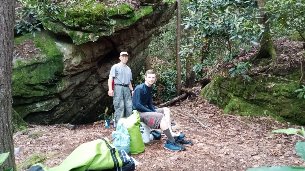
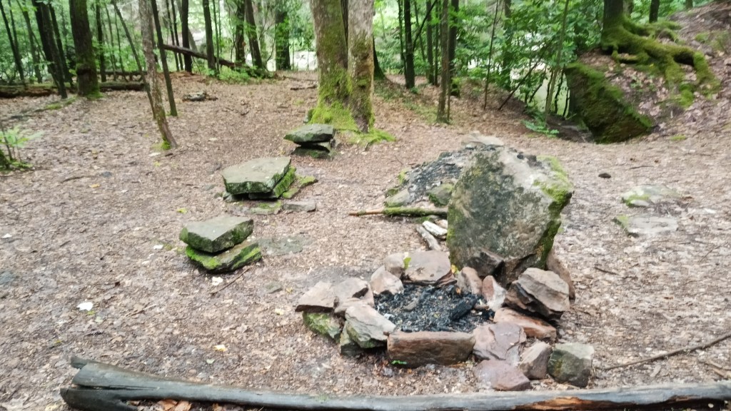
There was the perfect stump to put our lifejackets on, a boulder that we could hang our water filter from, a fire pit… I loved it.
We spent a little time exploring, then got to setting up camp. We made dinner, and Dad built a small fire, but we were pretty tired and didn’t stay up too late.
Sunday morning was a bit cloudy as we packed up and put on the water. That didn’t dampen the trip any though – this next section of water was an absolute hoot, with plenty of tricky rapids. Though I got pretty stuck at one point, I managed not to dump, which I was pretty happy about! I learned pretty quickly to let Dad take the lead and find the best way through, though I did gain more confidence by the end of the trip.
This section of water was also the first time I used a kayak skirt. I found it really tricky to put on the first time, but I got better at it over time, and it was really nice not having to empty out the boats whenever a little water got in them.
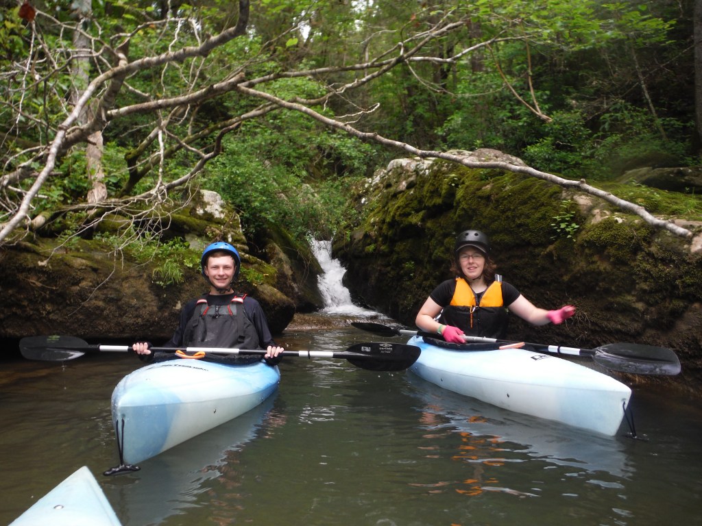
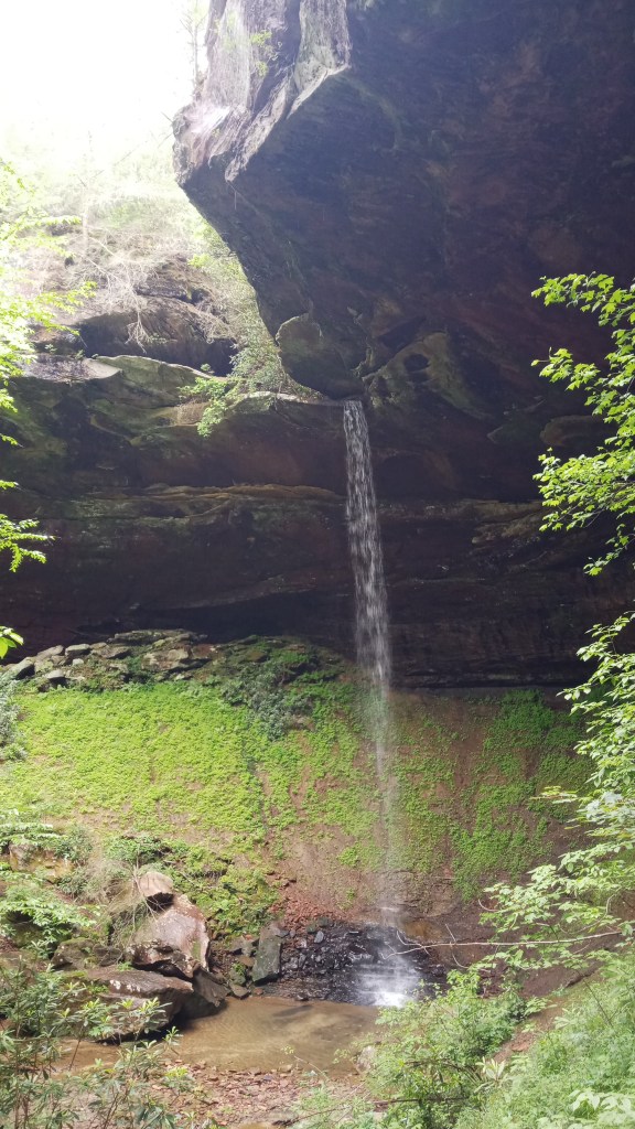
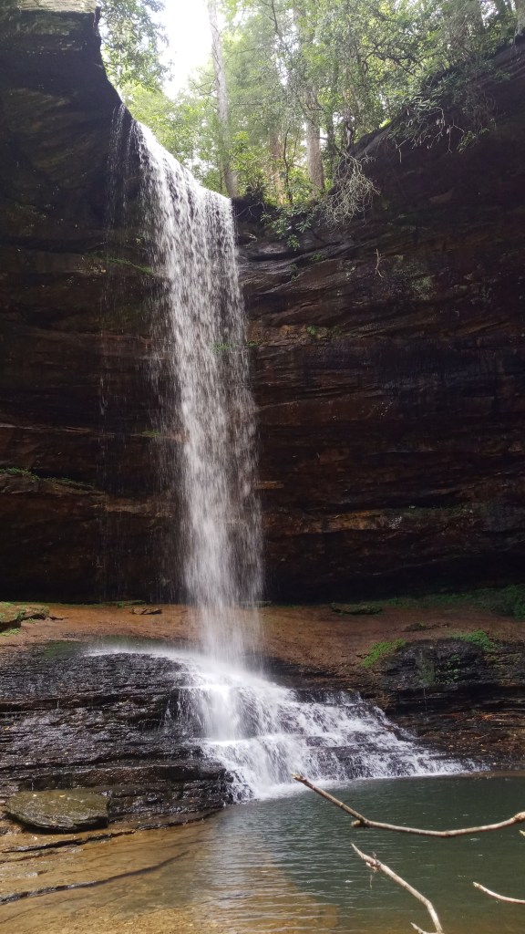
When we weren’t navigating rapids, we enjoyed the scenery, like this pretty little waterfall tucked back in a cove.
I wish I had some good pictures of the rapids here – they were really a lot of fun and seemed to come one after the other. We all decided that if we had had an extra half day, we would have come back and done that stretch again.
About noon or so, we came up on Burnt Mill Bridge, our take out point. I was sad it was over but also excited to start the next section.
Once we were off the water, Braden and I began the shuttling process while Dad got things unpacked. This took quite a while; it was fun driving those curvy back roads, but they definitely didn’t make things any shorter.
Technically we could have kept going downstream, as the Clear Fork would merge into the Big South Fork; however, several of the rapids there were Class IV, and we didn’t have the right equipment nor the skill for that extreme of kayaking. This is a very popular stretch of water for highly skilled whitewater kayakers, however, and they come from all around and will often run it multiple times in a day.
We debated for a while over where to start our next section of the trip. We narrowed it down to Pine Creek and Leatherwood Ford, the latter of which was further downstream. There were apparently really fun rapids downstream of Pine Creek, but it would add on extra mileage, and we would have had to carry the kayaks a half mile between the end of the road and the water. Ultimately we decided to put in at Leatherwood Ford, mainly because of time constraints. The take-out point was decided – the old mining community of Blue Heron – so we began the long process of shuttling vehicles.
If you look at the map below, you can see Leatherwood Ford to the south and Blue Heron at the north.
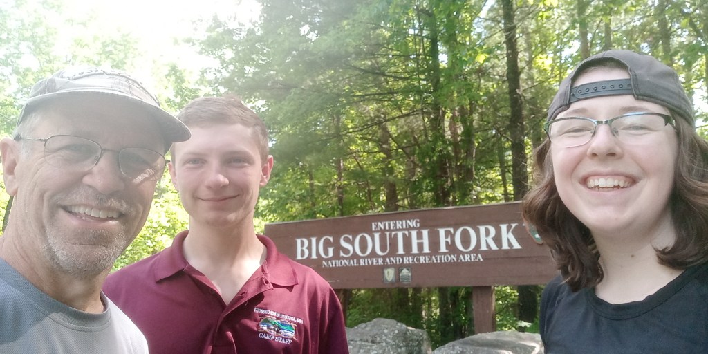
We also stopped along the way somewhere in there to get a picture of the BSF sign! What a bunch of river rats…
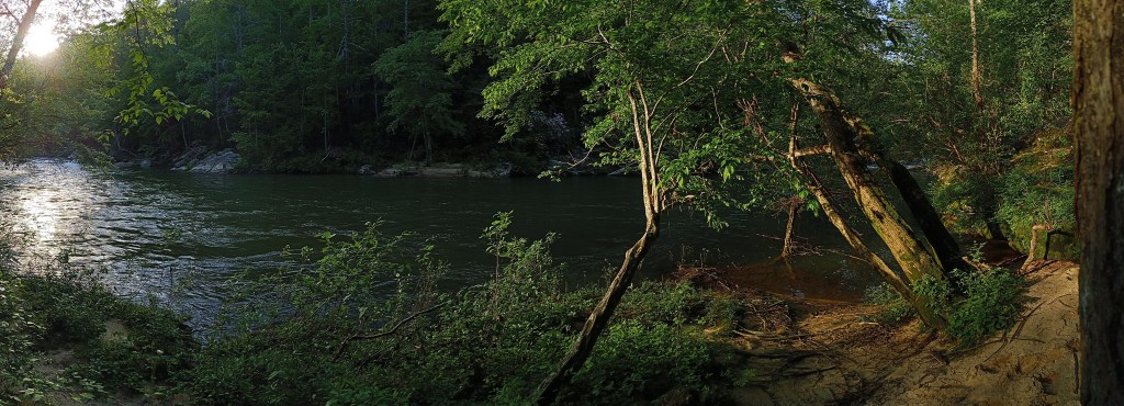
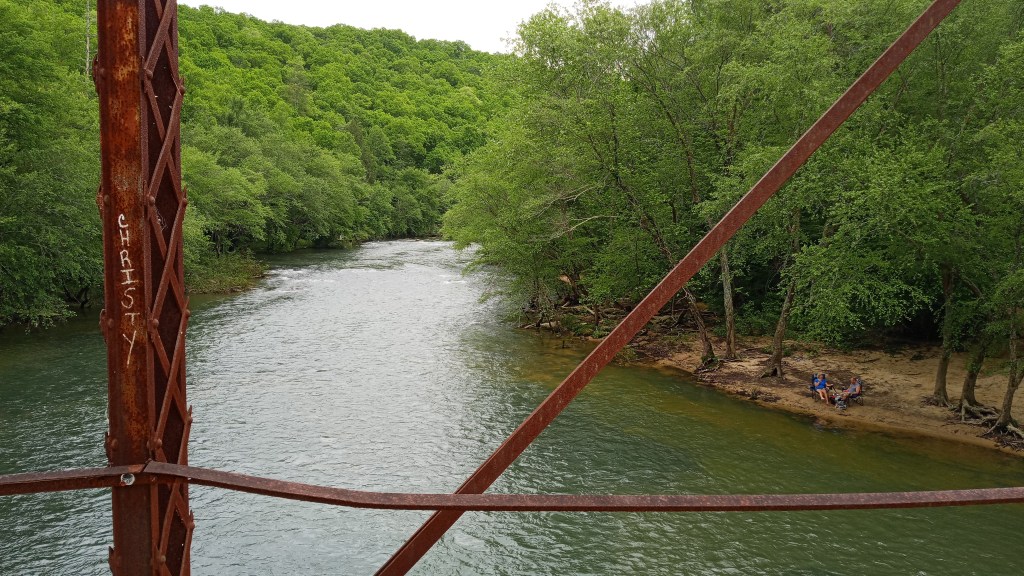
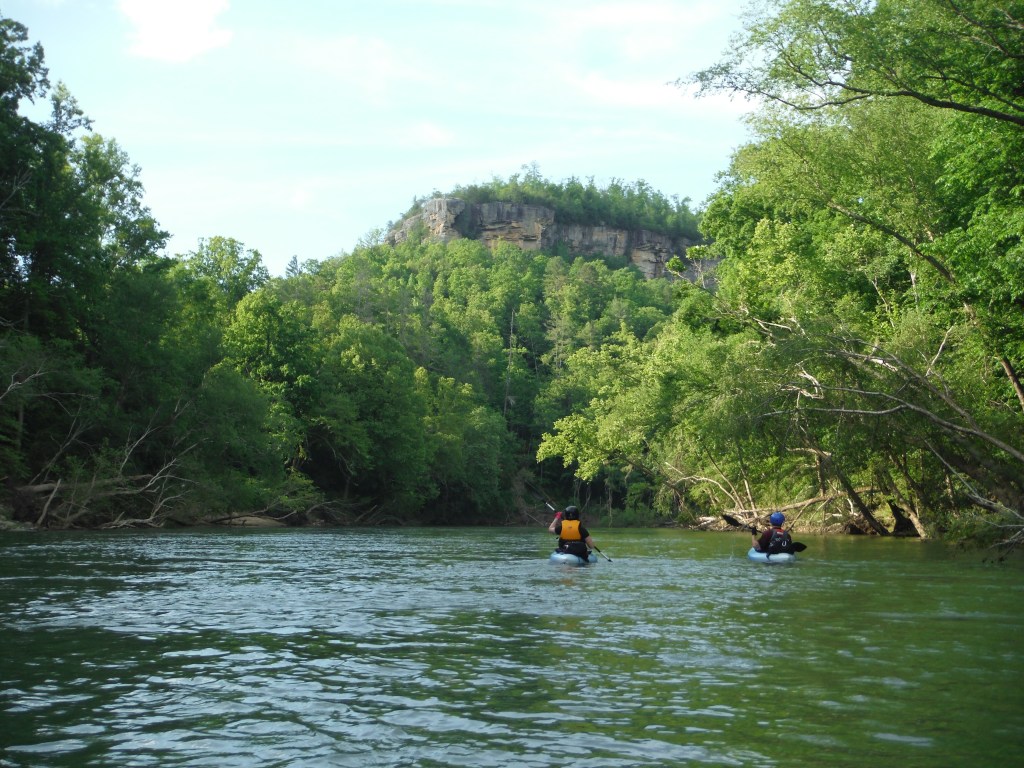
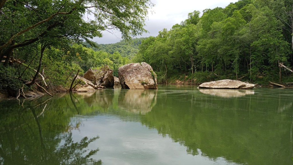
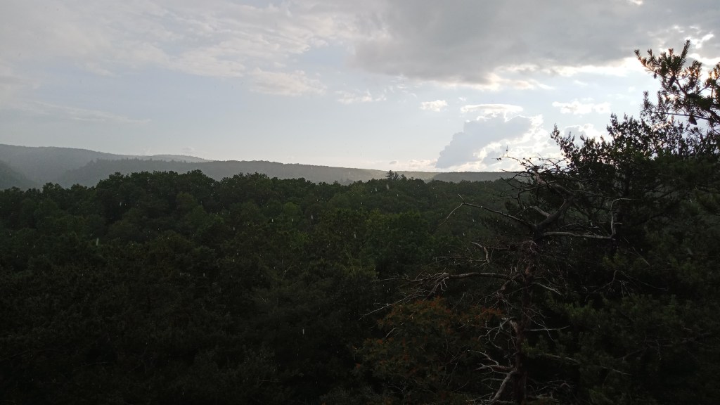
By the time we put on at Leatherwood Ford, it was probably about 5:00. Our goal was to try to spend the night at Station Camp, but we had a good ways before we got there and the water was moving pretty slowly. The Big South Fork was significantly wider than the Clear Fork, and seemed to have less of the pretty foliage, but the scenery was still neat.
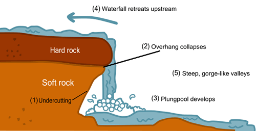
It wasn’t long before we came up on Angel Falls. IMPORTANT NOTE: If you’re planning on paddling this section of the BSF, you HAVE to portage the falls. There’s several boulders around the falls, and some of them are dangerously undercut. Also, there are no signs indicating that you’re coming up on Angel Falls!! So it’s really important that you’re paying attention and carrying a map around here.
If you’re not familiar with what ‘undercut’ means, it’s when water has eroded away a section of rock right at the surface or below the surface of the water (see the diagram below!). If the water is moving fast enough and in the right direction, it can push a kayaker into the rock, which would tip the boat, and then trap the kayaker under the water. Pretty scary stuff.
The falls were really pretty though! The portage, on the other hand… pshew.
We got the boats loaded back up and put on the water again pretty quickly, trying to make as much headway as we could before dark.
Unfortunately, things went a little south at the last rapid we did that night. We all made it through the rapid okay, but Dad and I ended up on one side of the creek and Braden the other. Dad wanted us to meet Braden at the other side of the creek – I think maybe we had decided we weren’t going to make it to Station Camp, and Dad remembered a nice camping spot there from his last trip. He decided to try to teach me an upstream ferry so we could get to the other side. I was pretty worn out, however, and I didn’t get positioned quite right, so the current soon overpowered me. I was going downstream backwards in a decently fast section – not a great situation.
I was trying to turn myself around when I hit a strainer. For those of you unfamiliar, a strainer is a downed tree extending out into the water. Strainers can be extremely dangerous, as they will capsize you, and the current can suck you under them, where you can get pinned by branches. Really scary stuff. Here’s an example of one.
Thankfully, the one I hit was much smaller, though it did capsize me and hang me up for a few seconds- it ripped a small hole in my pants. I was able to break free and grab onto my boat, and the water was shallow enough that I could stand up and dig in. Normally, you should really just grab hold of your boat and float downstream feet first until someone can rescue you, but Dad was really still hoping to grab that campsite. Unfortunately, the current was too strong, and I couldn’t stay in one place and hold onto the boat, so I ended up having to float downstream until Dad and Braden could come rescue me.
Thankfully, there were no real gear losses, and I was okay, just pretty shaken up. While I changed into dry clothes and let off a little emotion, Dad and Braden found a passable campsite. We set up camp and cooked dinner, and I went to bed right after.
Monday I woke up in better spirits, and good thing, because we had a guest!
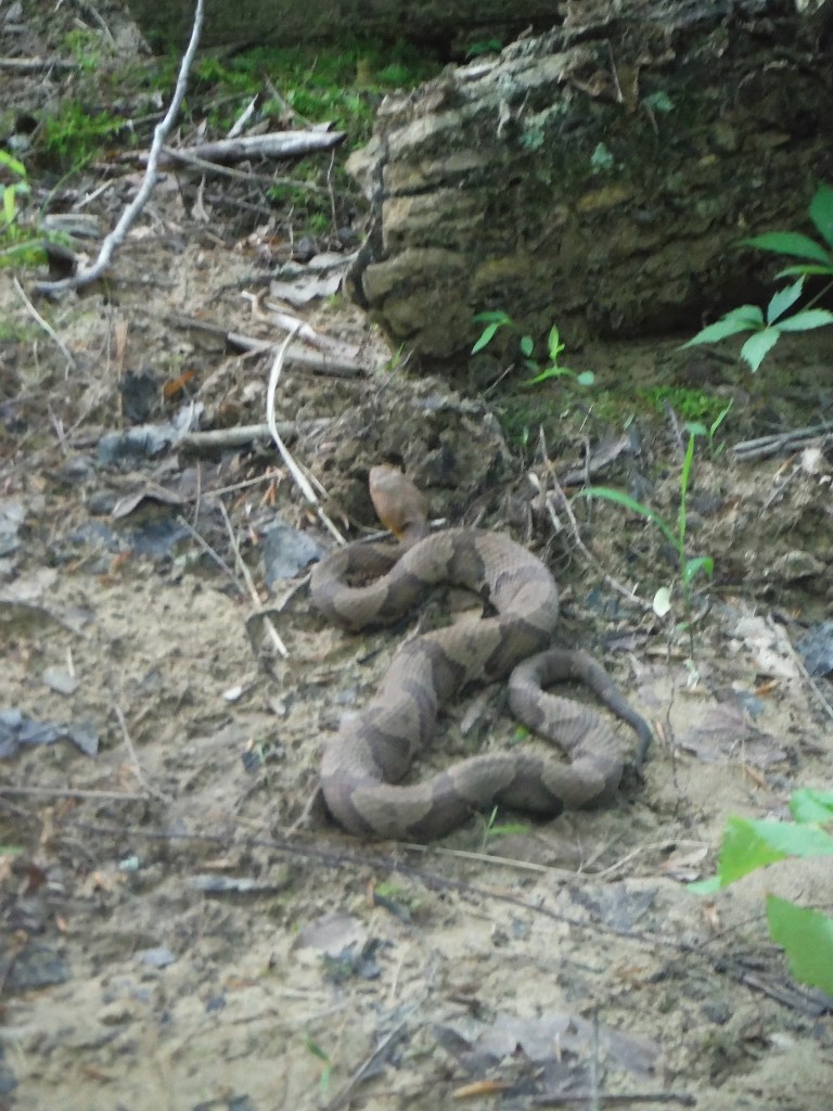
This is a bona fide Copperhead. It was actually the only one we saw the whole trip – I was okay with that though! It didn’t bother us or even really move the whole time we were there.
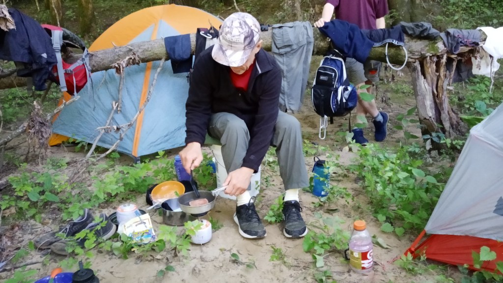
For breakfast, Dad fried up some spam – my first time! I thought it was pretty good.
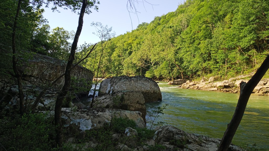
We packed up and were back on the water about 10:00. Here’s an early morning river view for ya.
This next section of water was very slow, almost lakelike. After yesterday’s action, though, that was okay with me!
We broke for a pretty early lunch at Station Camp. I quickly determined that trying to cross the Big South Fork here while backpacking was not going to be feasible.
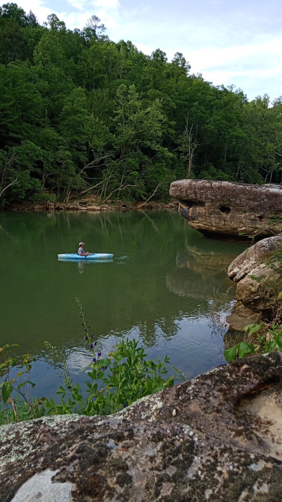
Back on the water, we began keeping our eye out for a campsite Dad had read about online. The only thing we knew was that it was close to a large mushroom-shaped rock. About 3:00 or so, we spotted it!
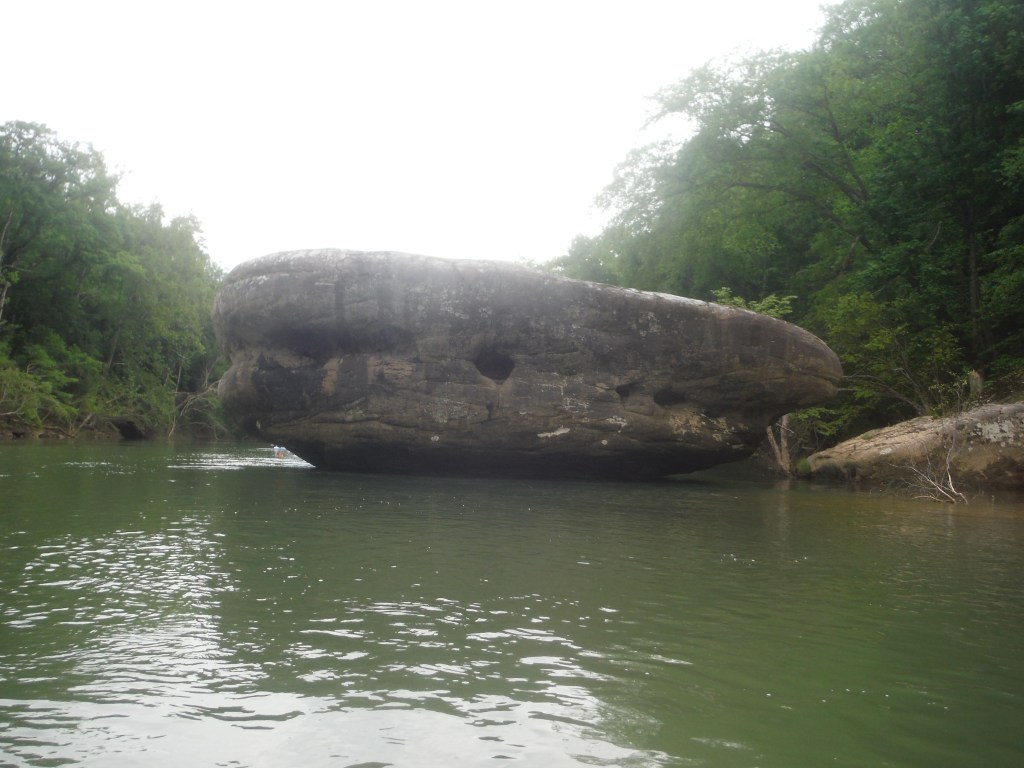
It felt pretty strange stopping so early for the day, especially when we’d gone pretty much until dark the last two days. I was really glad we did stop here, though – what a beautiful site, even if it was a climb to get up to it!
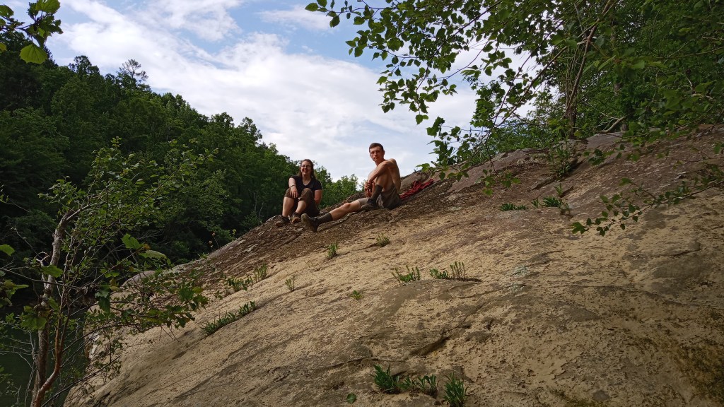
We unloaded the kayaks and lugged everything up the hill, then went back down to explore a little bit.
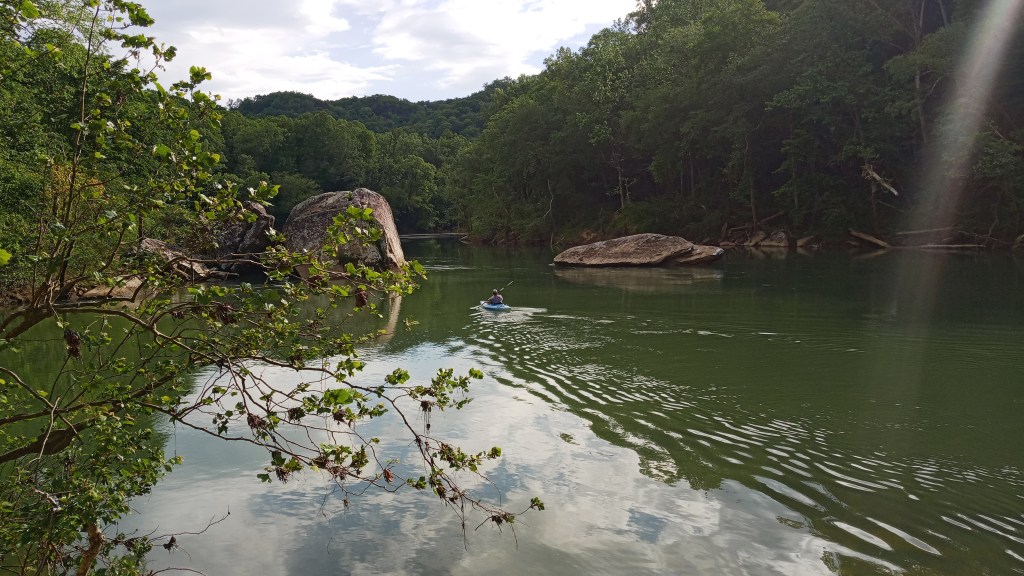
It was absolutely gorgeous. Braden and I spent some time laying out on this massive boulder, and Dad took a kayak out and paddled around a bit. It was just so relaxing.
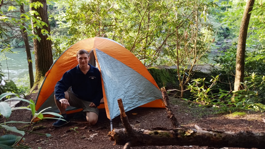
After a couple of hours, however, it started sprinkling, so we headed back up to camp. Thankfully, the boys had set up the tents already, so we just crawled in and rode out the storm with a nap.
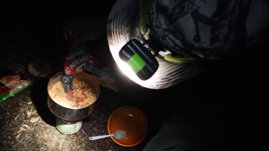
By the time we roused ourselves, it was nearly dark. We whipped up our last trail dinner as a family, chili mac with pepperoni – so good!
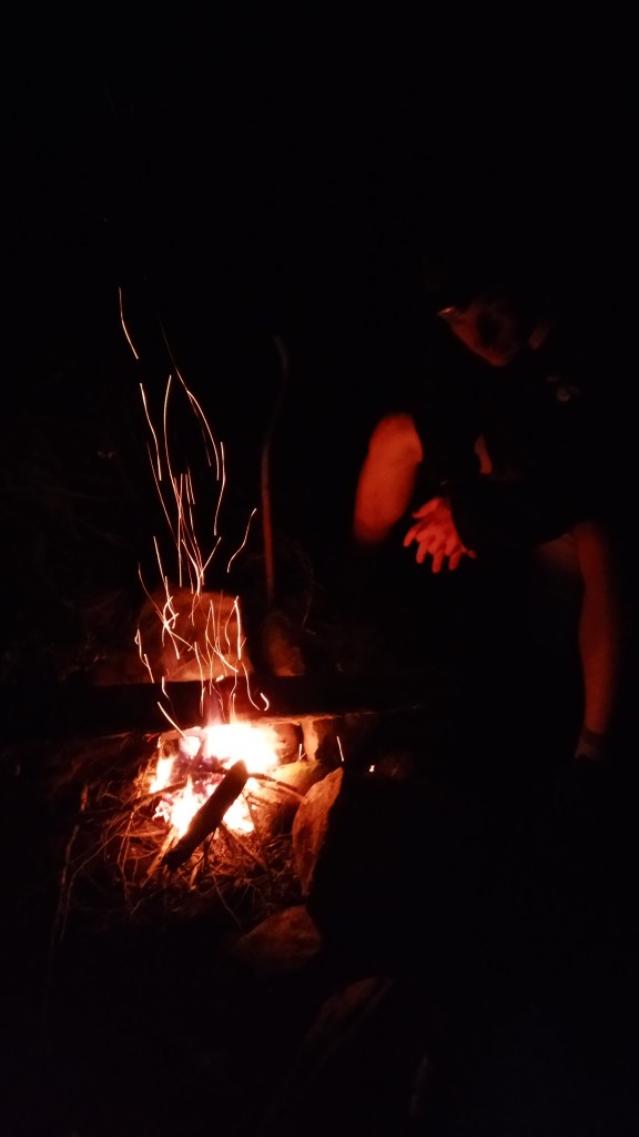
Since we hadn’t done much that day and had already gotten a good nap in, we stayed up a bit later around the fire just talking.
Tuesday morning, our final morning on the water, we packed up and put on the water again. The water picked up not too far after the campsite, and we had a good bit of fun after such a long flat stretch the day before.
Before we knew it, we were at Devil’s Jump, the last big rapid before our take out point. We were really hoping to run it, so we pulled over and scouted it out. Unfortunately, Dad decided water levels weren’t quite right and that it would probably be too dangerous since we weren’t in white water kayaks. It was still neat to see though.
Of course, that meant portaging all the gear and boats… Oh well.
Once we were back on the water, Braden decided to try a little surfing (putting the nose of the kayak upstream in a crevice). Of course, he tipped, so the trip ended with me towing him and his boat to the takeout point. He also had decided not to tie down his spray skirt since we were just going around the bend, so we lost that to the waters of the BSF. Silly boy.
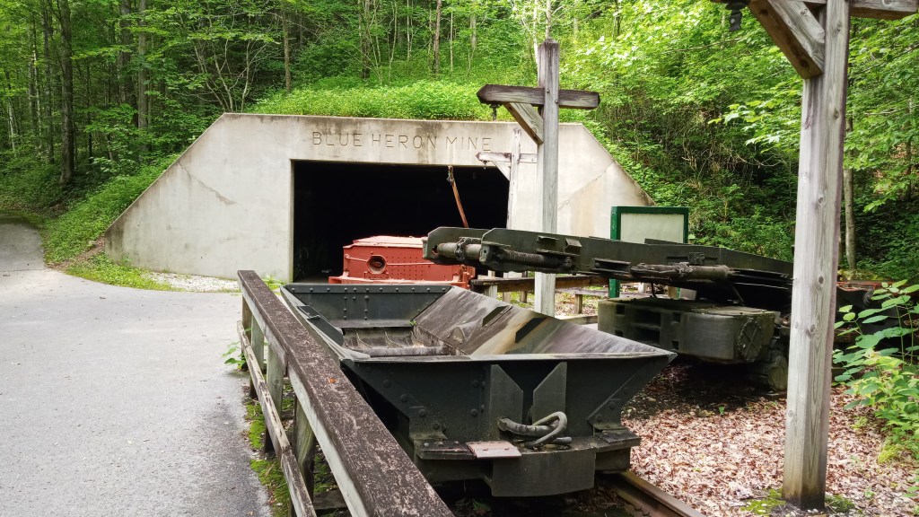
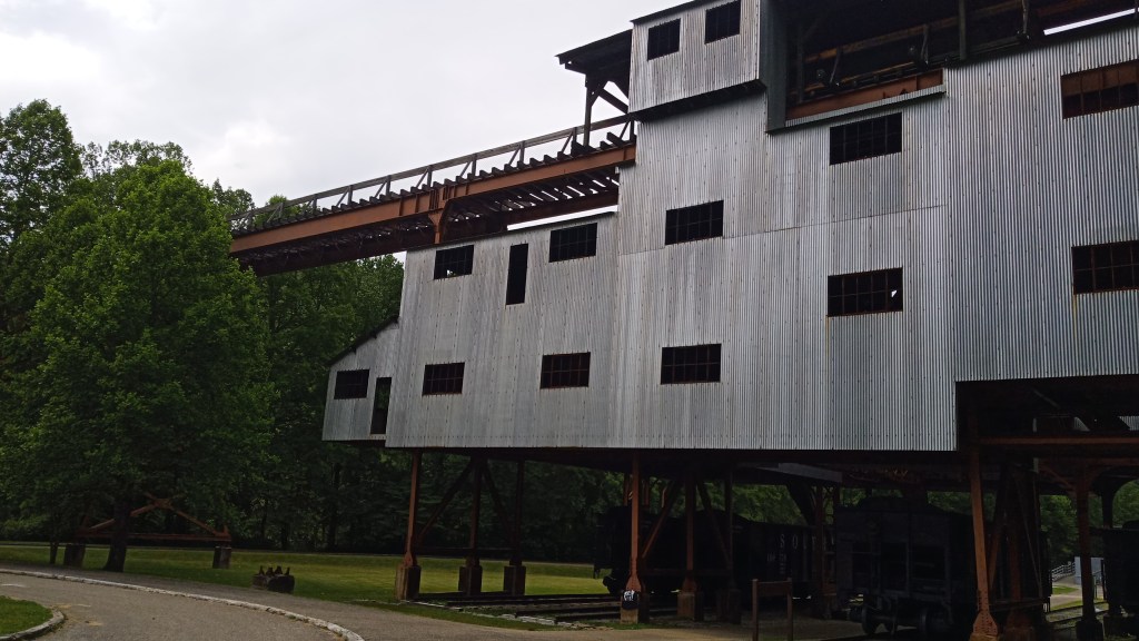
Once we got the kayaks out of the water, Braden and I went to go get the truck from Leatherwood Ford. Once we got back, Dad packed up, which allowed me to run around and explore Blue Heron.
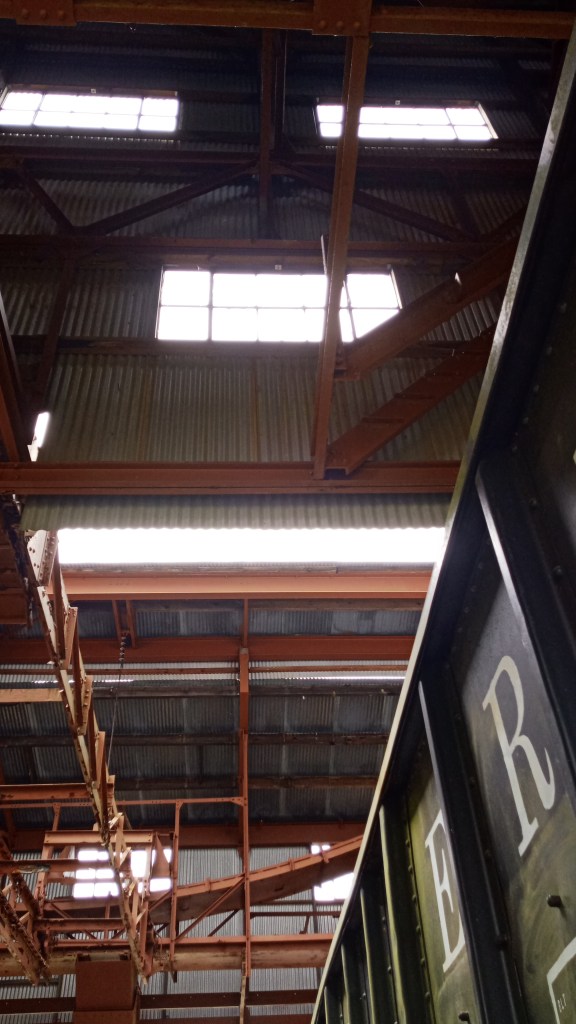
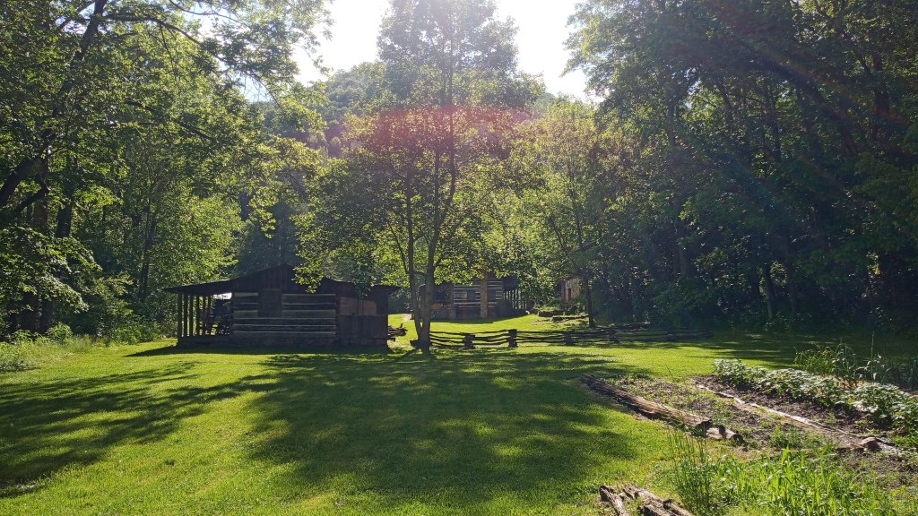
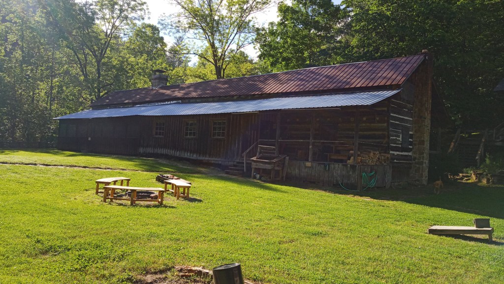
Blue Heron was really interesting. It’s an old abandoned mining town that’s been turned into an outdoor museum. It still had the tipple (building/machine that sorts coal) and a couple other buildings, though most are now just foundations. The mine ended up being not very successful, but the tipple was pretty heavily used until coal in the area dried up and the mine was closed in 1962. The history nut in me was very excited.
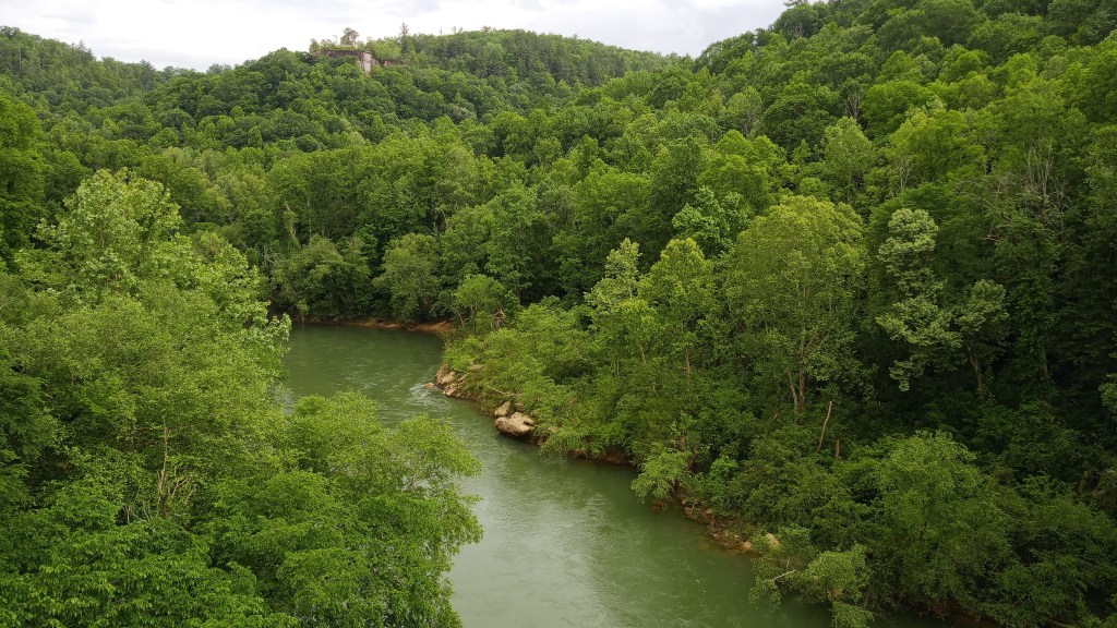
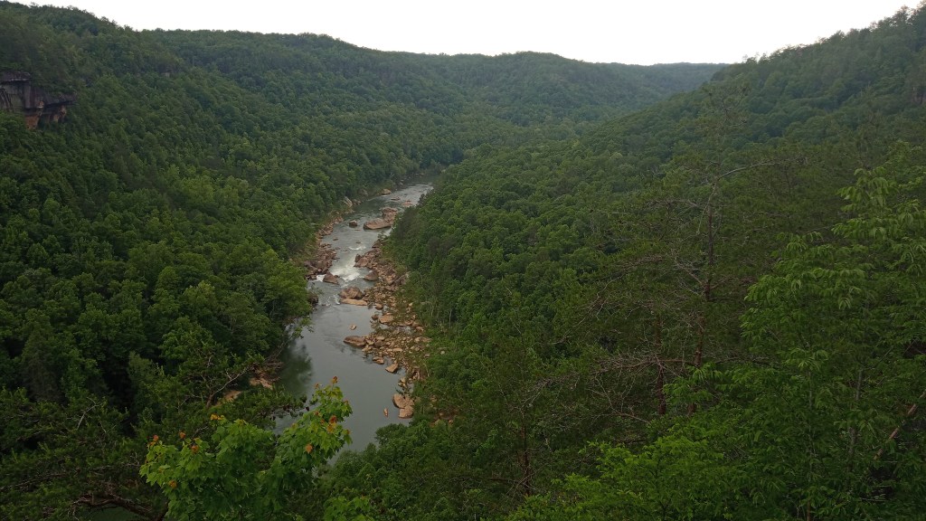
After we got packed up, we decided to drive to a lookout we had seen while we were down on the water. The views did not disappoint! This is the aerial view of Devils Jump, the rapid we had just portaged.
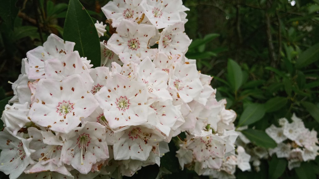
Also, I finally got to get up close to these pretty little flowers we had been seeing along the river bank! Apparently they’re called mountain laurel.
Eventually, we hit the road for Sheltowee Trace again. We got showers – oh how glorious not to be just wet but also clean and warm! – and then went out for Mexican to celebrate a successful trip before turning in for the night.
Pshew. This is going to be a long post. If you want to take a break, now is probably a good spot!
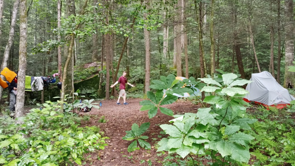
Wednesday, we packed up and parted ways. Braden had to get back for a final and Dad back to work, but I still had a few days to play. I hadn’t been backpacking since I got back from New Zealand, and I had been itching to go. This was my chance!
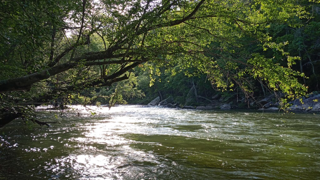
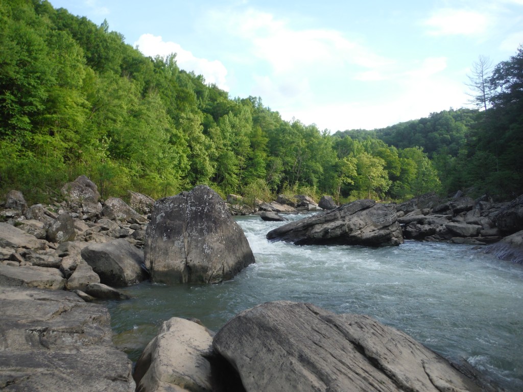
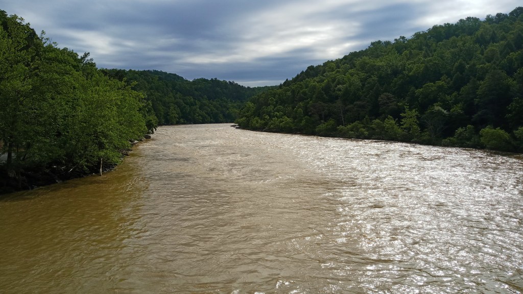
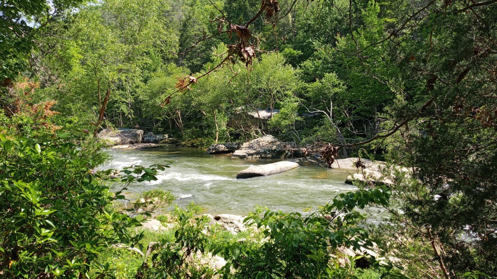
I packed up, reserved my backcountry camping permit, checked the weather one last time, and hit the road. I stopped to take this picture of a river (not sure which one, but I was glad we hadn’t been trying to paddle it!).
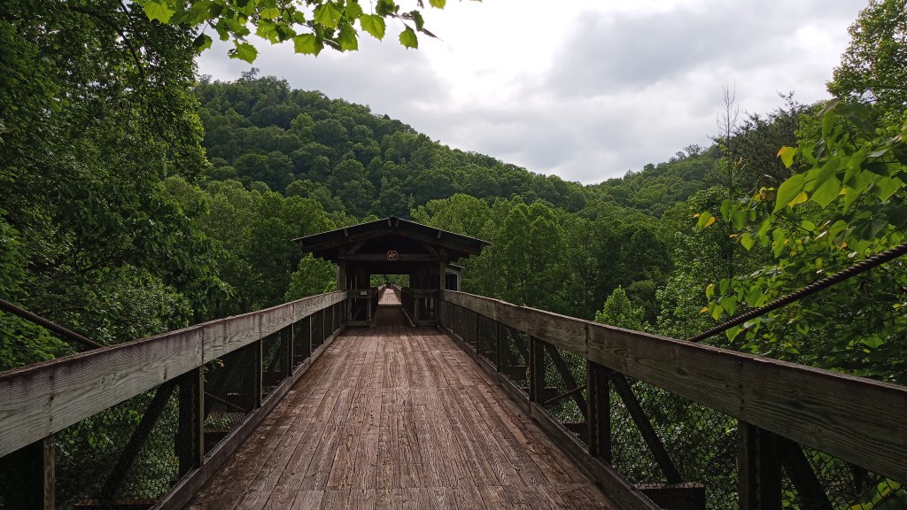
The plan was for me to spend Wednesday, Thursday, and Friday morning backpacking in the Big South Fork. I was going to start at the Twin Arches trailhead, then hike counterclockwise to the Slave Falls to Charit Creek trail and then over to Sawmill then take the Fork Ridge Road/Trail to the Laurel Fork Creek Trail, then the Station Camp Creek Trail back to the Arches loop. There’s a map below if you want to try to follow along with any of that; basically it was an approximately 20-mile loop trail.
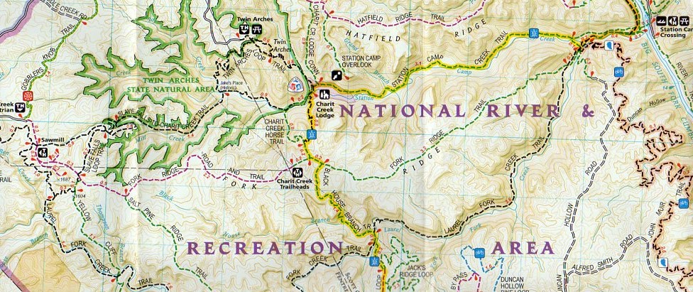
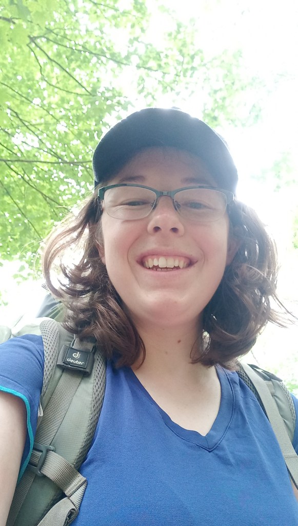
I put on the trail about 1:00 or so. There was some rain in the forecast, but I decided to go for it anyway and hoped that it would miss me. Here’s a pre-trip selfie!
I got a little confused to start off with – I knew that the Twin Arches, which are a decently popular area attraction, were along the hike I was doing, but my map made it look like I could do the first section without seeing them and save them for the end. It took me some time, but I eventually figured out that the trail actually went right underneath one of them. Oh well – this meant I got to see them twice!

Unfortunately, I didn’t get great pictures of them, but they were pretty neat. Even better, you could walk on top of them, and there was a great view from the end!
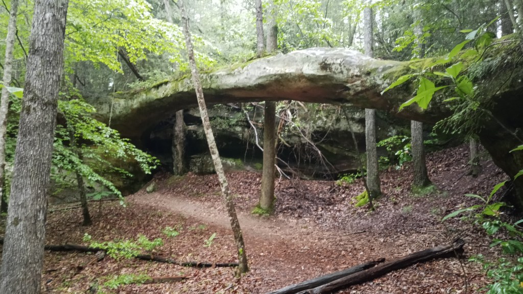
After I figured out where I was going, I started down the Twin Arches loop trail. There were a lot of neat rock formations and miniature waterfalls, especially close to the arches.
A historic “Jake’s Place’ appeared on the map right where I was supposed to hop off onto another trail, but unfortunately there wasn’t much signage, so I didn’t learn what made it historic. Nice little campsite there, though pretty soggy at the time.
The next section of trail led me right by Slave Falls, so I decided to take the little spur trail and go see it. It was a pretty little falls!
I also got the chance to refill on water here. That was one nice thing about this hike: I had several chances to refill on water. This was actually the first backpacking trip where I had had to treat/filter water – the trips I had done in New Zealand were kind of “cush”, as there was often treated water available.
There’s really two methods of making “wild” water potable – chemical treatment or filtering. There’s pros and cons to each. Filters remove everything from the water and leave it tasting normal, but they’re significantly heavier/bulkier (an ever present concern when backpacking!), take a little more work and time, and they can clog up. Chemical treatment is arguably easier, as you just have to drop a tablet in water and wait half an hour; however, the tablet does nothing to remove garbage in the water, so if your source water is full of gunk, you’re kind of stuck drinking gunky water. We had used a filter on the water portion of the trip because we weren’t worried about weight, but I decided to use the tablets here, specifically iodine. Overall, I thought the taste was pretty good! It was just a tiny bit chemical. It definitely helped that I used pH rectifying tablets alongside the iodine tablets – most of the time nowadays it seems like they are sold together.
I took two liters of water on this trip, which is the recommended amount, but I found this wasn’t quite enough for me. Even though I had several opportunities to fill up on water and felt like I was staying on top of it, I still ended up almost running out the second day. Remember, this is water is not only for drinking, but cooking and cleaning, so it can go pretty quick. A third liter just gives you a nice safety net.
Sorry to talk so much about water, but it’s really important on trips like these! I always realize when I come back how much we take clean water for granted.
The next little sight on the trail was the Needle Arch. Quite smaller than the Twin Arches, but still neat.
The clouds started looking pretty ominous, and I began looking for a place to spend the night, preferably one with shelter. I was hoping to make it over to the Sawmill trailhead, where I hoped there would be an established campsite, but I was looking elsewhere just in case.
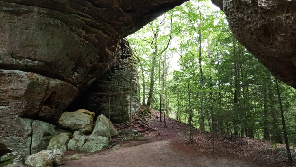
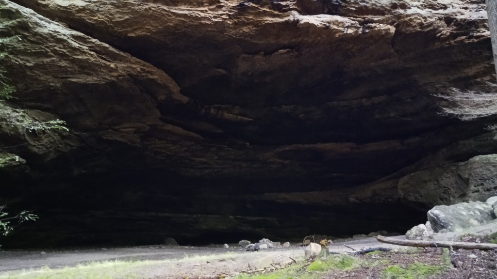
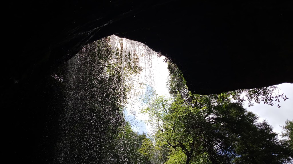
Sure enough, it started raining soon after, and I started booking it. I got to Sawmill, only to find out that there was no camping allowed at the trailhead, and the closest campsite that would keep me somewhat dry was a few miles back. Already pretty wet, I decided I might as well go down this other little loop trail and look for a campsite. I had also seen a sign for an Indian Rockhouse and thought that sounded interesting.
To my wonderful surprise, the Indian Rockhouse turned out to be the perfect place to spend the night! It was a massive cutout in a rock shelf, and I was thrilled to find the ground underneath it was DRY!
It was absolutely massive. Here’s my tent for scale.
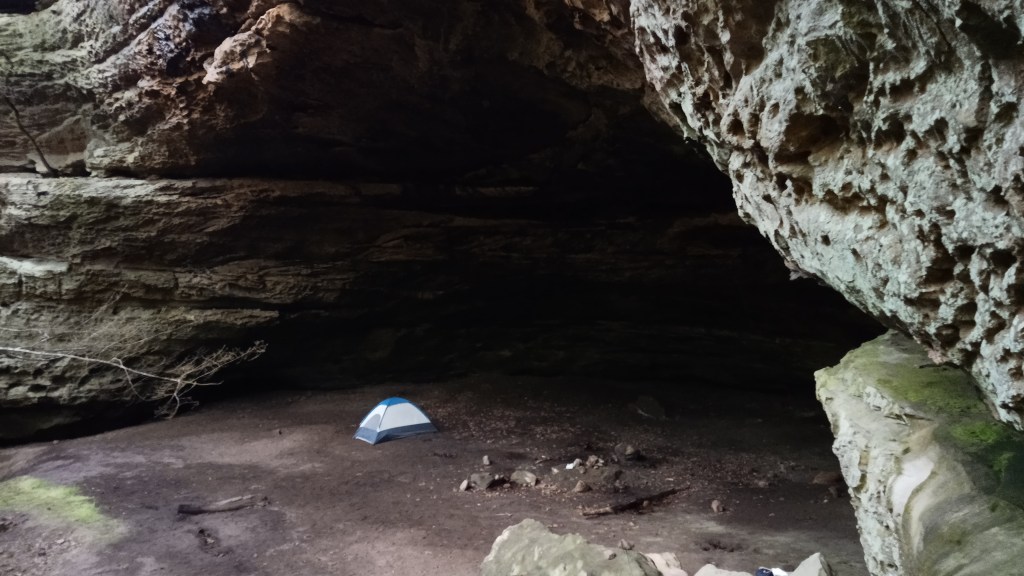
I quickly set up camp and laid some things out to dry, then it was ramen for dinner!
This was my first time backpacking solo, and I found I really liked several aspects of it: being able to move at my own pace, the quiet solitude, feeling independent, etc. At the same time, once I had set up camp and fixed dinner, I found there really wasn’t much to do. I wasn’t terribly lonely, but I could see how I might be if I hiked solo for longer. I ended up going to bed pretty early.
The next morning, I fixed my oatmeal, packed up and headed out by about 9:00. It was so nice to wake up dry… What a godsend that rockhouse was!
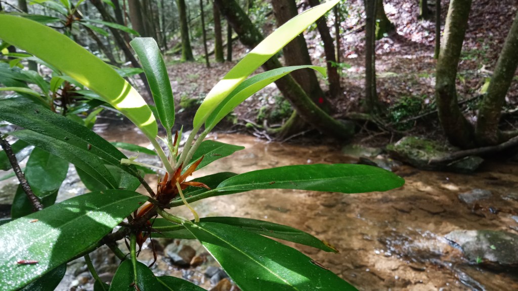
I finished out the loop the rockhouse was on and went back to the Fork Ridge Road and Trail. I was kind of disappointed to find that it was very roadlike, but it went by rather quick. Once I turned off onto the Black House Branch, things got more interesting, and even more so once it intersected with the Laurel Fork Creek Trail. There were three creek crossings pretty close together in this area; I planned my steps really carefully on the first one and was able to make it across dry, only to realize there was no way to escape getting wet on the next crossing. Oh well. At least it was pretty!
There were also two really nice campsites right around the crossings! Too early to stop though.
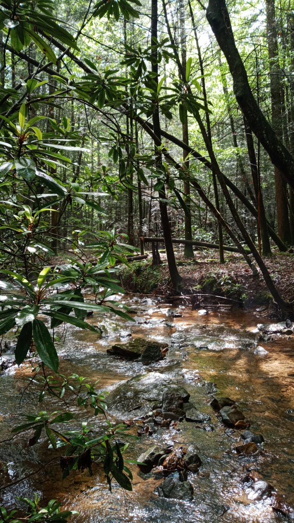
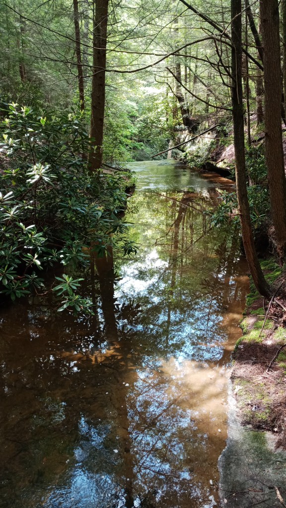
The section along Laurel Creek was probably my favorite along the whole loop. The creek was just so pretty, and the trail was nice and wind-y without being too challenging. I stopped about 1:00 for lunch at another nice little campsite.
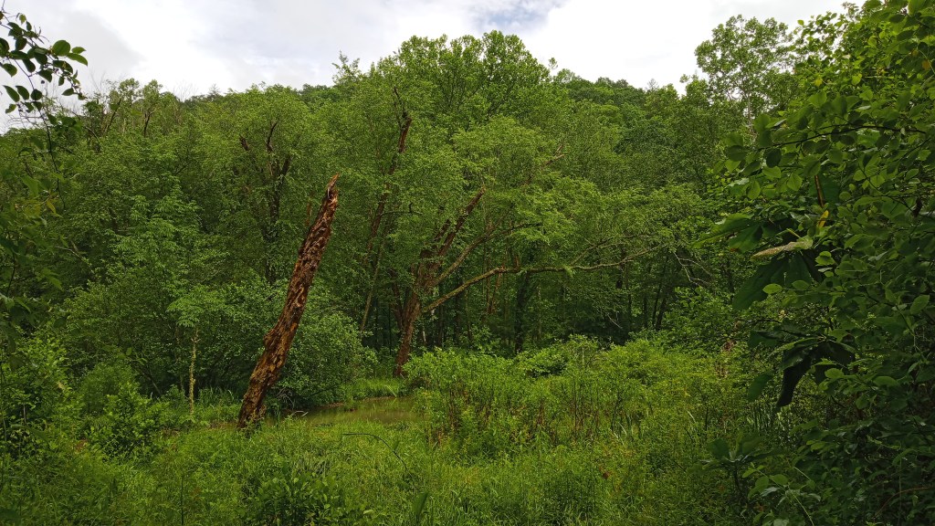
Most of the trail was wooded, though I came across this swampy clearing at the very end of the Laurel Fork trail.
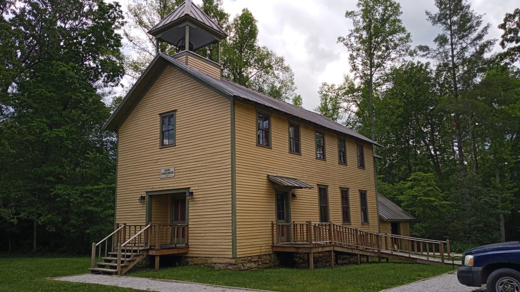
Next up, I turned onto the Station Camp Creek Trail. The trail at this point was quite a bit wider, as it was also a horse trail. Definitely pretty muddy at points. I hadn’t expected to make it this far in one day, but I was feeling pretty good and still had a lot of daylight left, so I kept going, looking for campsites along the way. I ended up going all the way to Charit Creek Lodge without finding an established site.
Unfortunately, the lodge was closed to all but employees due to COVID, but it was a neat area.
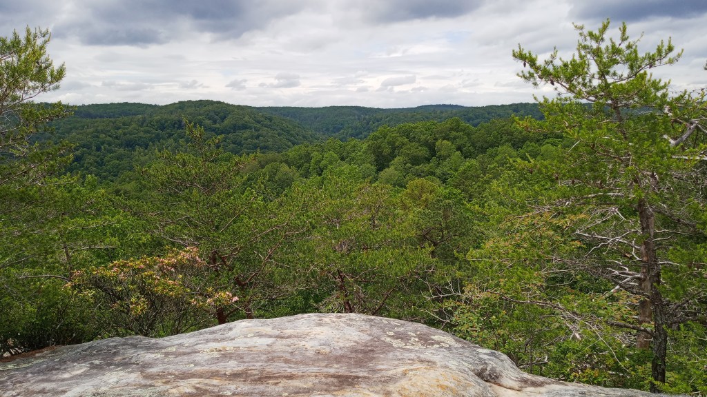
I talked briefly with a staff person, and she recommended some camping sites close by, but I was unable to find them. I was actually only a mile or so from the arches, so I decided to hike back up and camp close to there. It was quite the hike – several switchbacks, but I made it back up. I called Dad from the top of the arches to check in and get updated weather – he was quite surprised at the progress I had made.
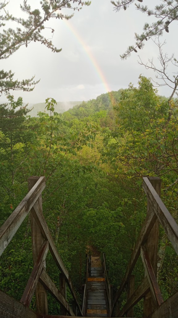
I was really tempted to try camping on top of the arches, but a sign made me a little wary. I definitely enjoyed another look at the view though. Of course, it started to rain some while I was up there, causing me to book it back to a more sheltered spot.
Of course, it didn’t last long, and when I turned around, there was a rainbow! Pretty neat way to end a 13+ mile day.
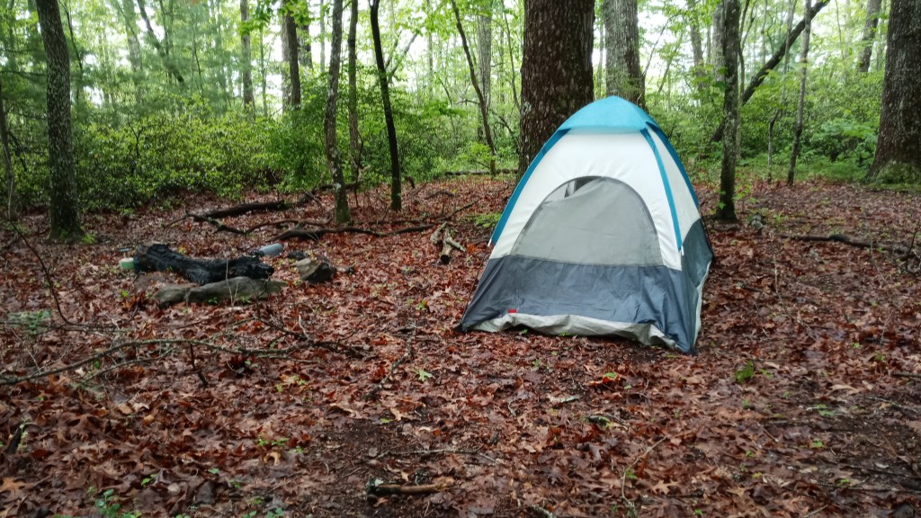
I then hiked another mile or so back to the trailhead and was really fortunate to find a campsite close by. The trip definitely went quicker than I was expecting, but it was nice to know that I had been underestimating myself.

The next morning, I made my oatmeal and packed up, excited for my travels that day. I had picked out a few letterboxes nearby, so I first set out for one at an area called Colditz Cove. It was absolutely beautiful – I felt like I was in another country, what with all the falls and wild rhodendron!
Unfortunately, I was unable to find the box, but it was still so worth it.
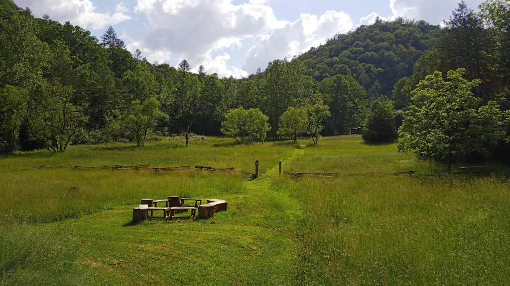
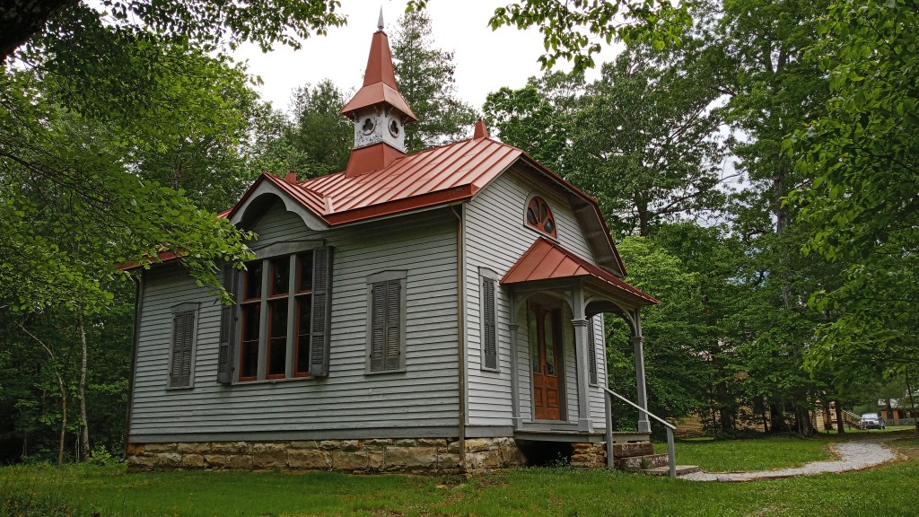
Next up, I decided to go to Rugby, which was close to where we had put in on our first trip. It was so interesting! I’ll spare you all the details, but it was this little English, very Victorian colony among the hills of Tennessee. It was essentially started as a place for second-born English gentlemen who were left little of their family’s inheritance to learn trades such as farming, etc. Overall, it wasn’t really a success – they were criticized for having a swimming hole (where we stayed at the first night!) before a working water system – and though a few people stayed on, today it is mainly a historic site. Definitely recommend stopping by here.

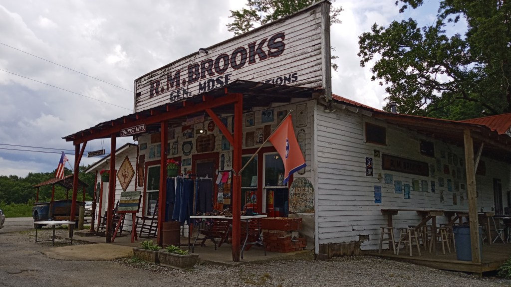
I also enjoyed stopping by a little country general store nearby and splurging on a hot lunch.
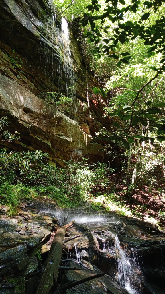
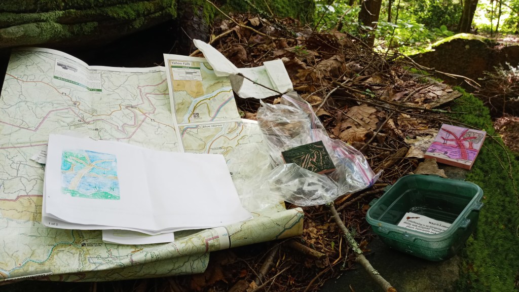
At this point, I only had really one more thing on my list: another letterbox was planted close to Burnt Mill Bridge, where we had taken out on our first river trip. It required about a 1.5 mile hike in to get to it, but there were several neat waterfalls and campsites all around.
And the best part was, the box was there! I was very happy.
After that, I hiked back out and hit the road for Indiana!
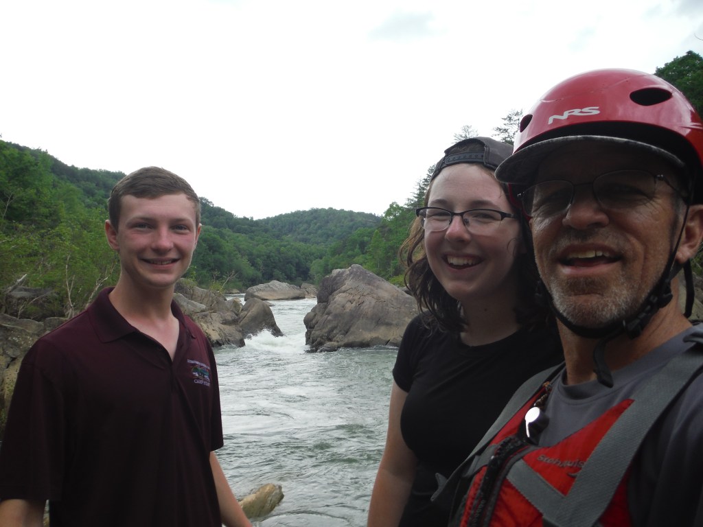
Overall, it was a really good trip, and it was really good to get out of the house and back outdoors. I was also really grateful to get to spend time with Dad and Braden and improve my kayaking skills.
Next adventure takes place in the Pacific Northwest, so stay tuned! Until then!
